Related Research Articles

The City of Banyule is a local government area in Victoria, Australia in the north-eastern suburbs of Melbourne. It was created under the Local Government Act 1989 and established in 1994 as an amalgamation of former councils. It has an area of 63 square kilometres (24.3 sq mi) and lies between 7 and 21 km from central Melbourne. In 1994 it had a population of 116,000. In June 2018 Banyule had a population of 130,237. The Yarra River runs along the City's southern border while its western border is defined by Darebin Creek.

Eltham is a suburb of Melbourne, Victoria, Australia, 20 km north-east of the Central Business District, located within the Shire of Nillumbik local government area. Eltham recorded a population of 18,847 at the 2021 census.

Heidelberg is a suburb of Melbourne, Victoria, Australia, 11 kilometres (7 mi) northeast of Melbourne's central business district, located within the City of Banyule local government area. Heidelberg recorded a population of 7,360 at the 2021 census.
Ivanhoe East is a suburb of Melbourne, Victoria, Australia, 10 km north-east from Melbourne's Central Business District, located within the City of Banyule local government area. Ivanhoe East recorded a population of 3,762 at the 2021 census.

Yarrambat is a town in Victoria, Australia, 24 km north-east of Melbourne's Central Business District, located within the Shire of Nillumbik local government area. Yarrambat recorded a population of 1,602 at the 2021 census.

La Trobe Street is a major street and thoroughfare in the Melbourne central business district, Victoria, Australia. It runs roughly east–west and forms the northern boundary of the central business district. The street was laid out as an extension of the original Hoddle Grid in 1839 and was named after Charles La Trobe. La Trobe Street extends from Victoria Street in the east to Harbour Esplanade in the west.

Bear's Castle is a small faux castle constructed in approx 1846 in Yan Yean, Victoria, Australia.

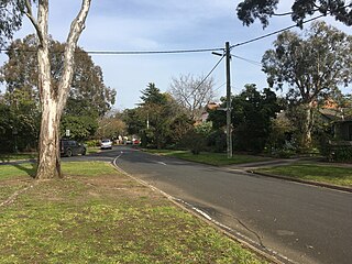
Eaglemont is an established suburb of Melbourne, Victoria, Australia, 10 km north-east of Melbourne's Central Business District, located within the City of Banyule local government area. Eaglemont recorded a population of 3,960 at the 2021 census.

Branxholme is a township in the Shire of Southern Grampians in the Western District of Victoria, Australia on the Henty Highway between Heywood and Hamilton. At the 2016 census, Branxholme and the surrounding area had a population of 351.
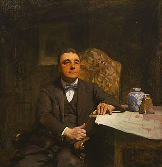
Harold Desbrowe-Annear was an influential Australian architect who was at the forefront of the development of the Arts and Crafts movement in the country. During the 1890s he was an instructor in architecture at the Working Men's College where he founded the T-Square in 1900. The club acted as a meeting point for Melbourne's architects, artists and craft workers and helped to develop a strong Arts and Crafts culture in the city. Desbrowe-Annear was also a supporter of the Victorian Arts and Crafts Society, founded in 1908.

Westgarthtown is a heritage registered precinct located within the Melbourne suburbs of Thomastown and Lalor, in Victoria, Australia.

John Beswicke (1847–1925) was an architect who practiced in Melbourne between the 1870s and 1915.

The Northcote Farm School (NFS) was a farm school built at Glenmore, near Bacchus Marsh, Victoria, in 1937.
The Rice House is a residence located at 69 Ryans Road, Eltham, Victoria, Australia, built from 1952-53. Designed by Melbourne architect Kevin Borland for a young couple, whose open mindedness and excitement for progressive/alternative ways of living allowed quite a different archetype for housing, the house is notable for its unusual construction technique and use of materials. Rice House was the first experiment of three architectural explorations in Melbourne.
Oakden, Addison and Kemp was an Australian architectural firm in Melbourne, Victoria. While it was short lived, existing from only 1887 to 1892, they designed a number of outstanding projects, and all three members designed many more notable projects in earlier and later partnerships.

The Rialto, Winfield and Olderfleet building group, in Collins Street, Melbourne, is a group of five historic buildings all built within a few years of each other in 1888-1891. They are all a similar height, width and level of detail, making up one of the most notable historic streetscapes in Melbourne, and a particularly notable Victorian streetscape in the international context. All the buildings were subject to preservation battles in the 1970s and early 1980s, ultimately saving the front portions of four of them, and the whole of one of them, the Rialto.
Pholiota was built as the home of architects Walter Burley Griffin and Marion Mahony Griffin in 1920 at 23 Glenard Drive in Eaglemont, Victoria, Australia. The house is listed on the Victorian Heritage Register.

Irymple Railway Station is a closed railway station in Irymple, on the Mildura railway line, in Victoria, Australia. It was opened in October 1903 when the railway was extended from Ouyen to Mildura and was closed when passenger services to Mildura were withdrawn in September 1993.
References
- ↑ "[Sales brochure for Glenard Estate, Mount Eagle, Victoria]". nla.gov.au. Retrieved 2020-06-01.
- ↑ "TOWN PLANNING TRIUMPH". Herald (Melbourne, Vic. : 1861 - 1954). 1916-06-08. p. 4. Retrieved 2020-06-01.
- 1 2 "Glenard Estate". Victorian Heritage Database. January 5, 2007. Retrieved 2020-06-01.
{{cite web}}: CS1 maint: url-status (link) - ↑ "Pholiota". vhd.heritagecouncil.vic.gov.au. June 26, 2007. Retrieved 2020-06-01.
{{cite web}}: CS1 maint: url-status (link) - ↑ "Lippincott House". vhd.heritagecouncil.vic.gov.au. August 21, 2006. Retrieved 2020-06-01.
{{cite web}}: CS1 maint: url-status (link)