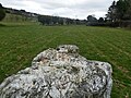
| Glencullen Standing Stone | |
|---|---|
| Native name Liagáin Ghleann Cuilinn (Irish) | |
| Queen Mab | |
 Northwest face | |
| Type | Standing stone |
| Location | Barrack Road, Glencullen, Dún Laoghaire–Rathdown, Ireland |
| Coordinates | 53°13′11″N6°13′03″W / 53.219772°N 6.217379°W |
| Height | 1.83 m (6.0 ft) |
| Built | c. 18th century BC |
| Official name | Glencullen |
| Reference no. | 276 |
 Location of Glencullen Standing Stone in County Dublin | |
Glencullen Standing Stone is a standing stone and National Monument located in Glencullen, County Dublin, Ireland. [1] [2] [3] [4] [5]