
Sutter's Fort was a 19th-century agricultural and trade colony in the Mexican Alta California province. Established in 1839, the site of the fort was originally called New Helvetia by its builder John Sutter, though construction of the fort proper would not begin until 1841. The fort was the first non-indigenous community in the California Central Valley. The fort is famous for its association with the Donner Party, the California Gold Rush, and the formation of the city of Sacramento, surrounding the fort. It is notable for its proximity to the end of the California Trail and Siskiyou Trails, which it served as a waystation.

The National Road was the first major improved highway in the United States built by the federal government. Built between 1811 and 1837, the 620-mile (1,000 km) road connected the Potomac and Ohio Rivers and was a main transport path to the West for thousands of settlers. When improved in the 1830s, it became the second U.S. road surfaced with the macadam process pioneered by Scotsman John Loudon McAdam.

The Peralta Adobe, also known as the Luis María Peralta Adobe or the Gonzales-Peralta Adobe, is the oldest building in San Jose, California. The adobe was built in 1797 by José Manuel Gonzeles, one of the founders of San Jose, and is named after Luis María Peralta, its most famous resident.

Caliente is an unincorporated community in Kern County, California. It is located 22 miles (35 km) east-southeast of Bakersfield, at an elevation of 1,312 feet (400 m).

Monterey State Historic Park is a historic state park in Monterey, California. It includes part or all of the Monterey Old Town Historic District, a historic district that includes 17 contributing buildings and was declared a National Historic Landmark in 1970. The grounds include California's first theatre, and the Monterey Custom House, where the American flag was first raised over California.

Freeman Junction, a ghost town in Kern County, California, USA, was first homesteaded in the early 1870s. Freeman S. Raymond built a stage coach station here to accommodate travelers between the desert mines and Los Angeles. A group of Native Americans who were defending their homes and families in 1909 killed off the homesteaders and burned the stage station, after which the property lay dormant for several years. It was re-homesteaded in the 1920s by Clare C. Miley, who was born in 1900, and his wife. By the 1930s their small stone cabin became a gas station/car repair and later, a restaurant and some mining activities dominated the site. In 1953 a post office was planned, but never materialized and residents had to travel seven miles to Inyokern to collect their mail. By June, 1978, the town had died once again and the remains of the town have since been removed by passersby. Today, the site has reverted to its natural state and nothing remains.

State Route 155 is a state highway in the U.S. state of California connecting State Route 99 and State Route 178, going through the southern part of the Sierra Nevada mountain range. This highway runs from west to east. Its western terminus is in Delano and its eastern terminus is in the small town of Lake Isabella. Locally it is known as the Garces Highway.
Olompali State Historic Park is a 700-acre (2.8 km2) California State Park in Marin County, California. It consists of the former Rancho Olómpali and was the site of the famed Battle of Olómpali during the Bear Flag Revolt. Rancho Olómpali was purchased by the Californian government in 1977, which turned it into a public park.

The House of the Four Winds, or La Casa de Los Vientos, is a historic adobe building located at 540 Calle Principal in Monterey, California. It was built by Thomas O. Larkin in 1834. The house acquired its named because of the weather vane on its hipped roof. The building was used as the first State of California Hall of Records. Today it is used as the clubhouse for the Monterey Civic Club. The building is listed as a California Historical Landmark #353.
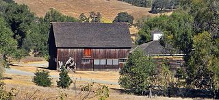
Warner's Ranch, near Warner Springs, California, was notable as a way station for large numbers of emigrants on the Southern Emigrant Trail from 1849 to 1861, as it was a stop on both the Gila River Trail and the Butterfield Overland Mail stagecoach line (1859-1861). It was also operated as a pioneering cattle ranch.

Bealville is an unincorporated community in Kern County, California. It is located on the Union Pacific Railroad 1.25 miles (2 km) south of Caliente, at an elevation of 1,811 feet (552 m). The area was named after Edward Fitzgerald Beale, who owned the adjacent Rancho El Tejon.
Woody is an unincorporated community in Kern County, California, in the United States. It is located in the foothills of the Greenhorn Mountains, 25 miles (40 km) north-northeast of Bakersfield at an elevation of 1,654 feet (504 m).
Glennville is an unincorporated community in Kern County, California.
Lavers' Crossing is a former settlement in Kern County, California. It was located 1 mile (1.6 km) west-northwest of Glennville, at the current junction of White River and Jack Ranch roads.

The Sebastian Indian Reservation (1853-1864), more commonly known as the Tejon Indian Reservation, was formerly at the southwestern corner of the San Joaquin Valley in the Tehachapi Mountains, in southern central California.
Rancho Johnson was a 22,197-acre (89.83 km2) Mexican land grant in present-day Yuba County, California, given in 1844 by Governor Manuel Micheltorena to Pablo Gutiérrez. The grant was located along the north side of Bear River, and encompassed present-day Wheatland.

Adobe Creek, historically San Antonio Creek, is a 14.2-mile-long (22.9 km) northward-flowing stream originating on Black Mountain in the Santa Cruz Mountains. It courses through the cities of Los Altos Hills, Los Altos, and Palo Alto on its way to the Palo Alto Flood Basin and thence to southwestern San Francisco Bay in Santa Clara County, California, United States. Historically, Adobe Creek was a perennial stream and hosted runs of steelhead trout entering from the Bay, but these salmonids are now blocked by numerous flood control structures, including a tidal gate at the creek's mouth and a long concretized rectangular channel culminating in an impassable drop structure at El Camino Real. The co-founders of Adobe Systems both lived on Adobe Creek.

Rancho Temescal was a farming outpost of Mission San Luis Rey de Francia, one of the 21 Franciscan missions established in California by Spain during the late 18th and early 19th centuries. The Mission was located on the coast where Oceanside, California, is today. The Rancho was settled in 1819 by Leandro Serrano, and became the first non-native settlement within the boundaries of what would become Riverside County, California.
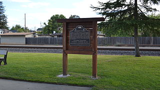
Posey Creek Station of the Butterfield Overland Mail 1st Division was located on Posey or Poso Creek, in the southeastern San Joaquin Valley, in present-day Kern County, California.
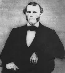
Alexis Godey also called Alec Godey and Alejandro Godey, born Alexander Godey, was a trapper, scout, and mountain man. He was an associate of Jim Bridger and was lead scout for John C. Frémont.

