Related Research Articles
Old Ottawa South is an older urban neighbourhood in Capital Ward in Ottawa, Ontario, Canada. Old Ottawa South is a relatively small and compact neighbourhood, located between the Rideau Canal and the Rideau River. The eastern boundary is Avenue Road. Bronson Avenue forms the western border of the residential neighbourhood. Carleton University is on the other (western) side of Bronson but the campus can be considered to be geographically within Old Ottawa South as the campus is also nestled between the river and the canal.

Ottawa South is a federal electoral district in Ottawa, Ontario, Canada. It is represented in the House of Commons of Canada by David McGuinty, brother of former Premier of Ontario and Ottawa South MPP Dalton McGuinty. It has been held continuously by Liberal candidates since it was first contested in 1988, and is regarded as one of the strongest Liberal ridings in Canada. Ottawa South is a suburban, generally middle class riding, notable for having the highest Arab population in Ontario.

Orléans is a federal electoral district in Ottawa, Ontario, Canada, that has been represented in the House of Commons of Canada since 1988.

Nepean—Carleton was a federal electoral district in Ontario, Canada that was represented in the House of Commons from 1979 to 1988, and again from 1997 to 2015.

Billings Bridge is a bridge over the Rideau River in Ottawa. Bank Street passes over the river by way of this bridge. The bridge was named after Braddish Billings, who settled in this area and established a farm nearby in 1812. The first bridge, originally called Farmers Bridge, was built over the river here in 1830. The current bridge was built in 1916.

Carleton is a federal electoral district in Ontario, Canada, represented in the House of Commons of Canada from 1867 to 1968 and since 2015. It was represented in the Legislative Assembly of Upper Canada from 1821 to 1840 and in the Legislative Assembly of the Province of Canada from 1841 until 1866. It has been represented by Pierre Poilievre, the current Leader of the Opposition, since its creation in 2015.
Rideau is an historic township in eastern Ontario, Canada. It is located in the rural parts of the City of Ottawa, in the extreme south. Its eastern boundary is the Rideau River, its namesake.
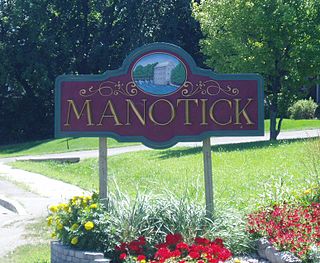
Manotick is a community in Rideau-Jock Ward in the rural south part of the City of Ottawa, Ontario, Canada. It is a suburb of the city, located on the Rideau River, immediately south of the suburbs Barrhaven and Riverside South, about 25 km (16 mi) from downtown Ottawa. It was founded by Moss Kent Dickinson in 1864. He named the village 'Manotick', after the Algonquin word for 'island'. It has been part of the City of Ottawa since amalgamation in 2001. Prior to that, it was located in Rideau Township. According to the Canada 2016 Census, Manotick had a population of 4,486.

The Rideau Falls are two 11-metre waterfalls located in Ottawa, Ontario, Canada, where the Rideau River empties into the Ottawa River. The falls are divided by Green Island, with Ottawa's Old City Hall just to the south. To the west of the falls is the headquarters of the National Research Council while to the east are the Canada and the World Pavilion and the French Embassy. Samuel de Champlain described the falls as "...a marvelous fall...it descends a height of twenty or twenty-five fathoms with such impetuosity that it makes an arch nearly four hundred paces broad." The falls were named by the early French for their resemblance to a curtain, or rideau in French. The Rideau River was later named after the falls. The Rideau Canal was constructed to bypass these falls and the Hog's Back Falls.
Ficko is a dispersed rural community in Osgoode Ward in Ottawa, Ontario, Canada. It is located in the former City of Gloucester, which was amalgamated into Ottawa in 2001. The community is located on Bowesville Road halfway between Earl Armstrong Road and Rideau Road, and includes Ficko Crescent.

Osgoode is a population centre in Osgoode Ward in the rural south end of Ottawa, Ontario, Canada. It lies surrounded by farmland, about 2 km east of the Rideau River. Until amalgamation in 2001, it was part of Osgoode Township. At the Canada 2016 Census, the population was 2,578.

North Gower Township is a former and now geographic township in eastern Ontario, Canada, now located in Ottawa. It contains the communities of Manotick and North Gower.

Rideau View is a sub-neighbourhood of Carleton Heights in River Ward, in the west-end of Ottawa, Ontario, Canada, located near the Rideau River. It is bordered by Meadowlands Drive to the south, Claymor Avenue to the west and Dynes Road to the north. Debra Avenue is the main road that runs through the neighbourhood and there is some residential housing on Eiffel Avenue. Some of parts of the neighbourhoods are east of Prince of Wales Drive and runs parallel along the Rideau River. The area is also located close to the former city of Nepean. A major feature of the neighbourhood is a low-income housing project designed and built by the Ottawa Housing corporation. There are four high-rise condominiums on Prince of Wales at the corner of Dynes and Meadowlands.
Overbrook is an urban neighbourhood situated in Rideau-Rockcliffe Ward, in the east end of Ottawa, Ontario, Canada. It is located across the Rideau River from the neighbourhood of Sandy Hill and is just to the south of Vanier. To the east of Overbrook is the former City of Gloucester. It was constituted as a police village in 1922 and was annexed by the City of Ottawa in 1950.
Leitrim is a dispersed rural community in the South Gloucester section of Ottawa, Ontario, Canada, and is named for the Irish County Leitrim. The area comprises the rapidly growing Findlay Creek suburban neighbourhood.
Kars is a village on the Rideau River within Rideau-Jock Ward in the city of Ottawa, Ontario. Prior to joining the city in 2000 it was part of Rideau Township.

Ottawa–Rideau was a short lived provincial electoral district in Ottawa, Ontario. It elected one member to the Legislative Assembly of Ontario. It was created in 1987 and was abolished in 1999 into Ottawa South, Nepean–Carleton, Ottawa West–Nepean and Ottawa Centre.
Orléans is a provincial electoral district in eastern Ontario, Canada. It elects one member to the Legislative Assembly of Ontario. Before the 2018 election, it was known as Ottawa—Orléans.

Dutchy's Hole Park or Robinson Park is a park on the Rideau River in Ottawa, Ontario, Canada. It is part of the downtown Ottawa neighbourhood of Sandy Hill. The park has a wading pool, playground, and a football field, called Robinson Field. Pathways connect the park with Strathcona Park, the Rideau Campus of the University of Ottawa and via a former train bridge with Parc Riverain/River Road Park across the Rideau River in Vanier.

Vincent Massey Park is an urban park along the Rideau River in the Confederation Heights neighbourhood of Ottawa, Ontario, Canada, accessible via Heron Road. It is extensively used in the summer for family and group picnics.
References
- ↑ "Search the Canadian Geographical Names Database (CGNDB)". Government of Canada. 2021-02-16. Retrieved 2024-12-01.
45°16′55″N75°41′45″W / 45.28194°N 75.69583°W
| | This article relating to Ottawa and to Canada's National Capital Region is a stub. You can help Wikipedia by expanding it. |