Gmina Koło

Last updated
Gmina Koło
Koło Commune
Gmina
POL gmina Kolo COA.png
Coat of arms
POL powiat kolski gmina Kolo map.svg
Coordinates(Koło): 52°12′N18°38′E / 52.200°N 18.633°E / 52.200; 18.633 Coordinates: 52°12′N18°38′E / 52.200°N 18.633°E / 52.200; 18.633
CountryFlag of Poland.svg  Poland
Voivodeship Greater Poland
County Koło
Seat Koło
Area
  Total 101.88 km2 (39.34 sq mi)
Population (2006)
  Total 6,995
  Density 69/km2 (180/sq mi)

Gmina Koło is a rural gmina (administrative district) in Koło County, Greater Poland Voivodeship, in west-central Poland. Its seat is the town of Koło, although the town is not part of the territory of the gmina.

Gmina administrative division of Poland

The gmina is the principal unit of the administrative division of Poland, similar to a municipality. As of 2010 there were 2,478 gminy throughout the country. The word gmina derives from the German word Gemeinde, meaning "community".

Koło County County in Greater Poland, Poland

Koło County is a unit of territorial administration and local government (powiat) in Greater Poland Voivodeship, west-central Poland. It came into being on January 1, 1999, as a result of the Polish local government reforms passed in 1998. Its administrative seat and largest town is Koło, which lies 119 kilometres (74 mi) east of the regional capital Poznań. The county contains three other towns: Kłodawa, 21 km (13 mi) east of Koło, Dąbie, 19 km (12 mi) south-east of Koło, and Przedecz, 21 km (13 mi) north-east of Koło.

Greater Poland Voivodeship Voivodeship in Poland

Greater Poland Voivodeship, also known as Wielkopolska Voivodeship, Wielkopolska Province, or Greater Poland Province, is a voivodeship, or province, in west-central Poland. It was created on 1 January 1999 out of the former Poznań, Kalisz, Konin, Piła and Leszno Voivodeships, pursuant to the Polish local government reforms adopted in 1998. The province is named after the region called Greater Poland or Wielkopolska(listen). The modern province includes most of this historic region, except for some south-western parts.

Contents

The gmina covers an area of 101.88 square kilometres (39.3 sq mi), and as of 2006 its total population is 6,995.

Villages

Gmina Koło contains the villages and settlements of Aleksandrówka, Borki, Chojny, Czołowo, Czołowo-Kolonia, Dąbrowa, Dzierawy, Kaczyniec, Kamień, Kiełczew Górny, Kiełczew Smużny Czwarty, Kiełczew Smużny Pierwszy, Leśnica, Lubiny, Lucjanowo, Mikołajówek, Ochle, Podlesie, Powiercie, Powiercie-Kolonia, Przybyłów, Ruchenna, Skobielice, Sokołowo, Stellutyszki, Wandynów, Wrząca Wielka and Zawadka.

Aleksandrówka is a village in the administrative district of Gmina Koło, within Koło County, Greater Poland Voivodeship, in west-central Poland.

Borki is a village in the administrative district of Gmina Koło, within Koło County, Greater Poland Voivodeship, in west-central Poland.

Chojny, Greater Poland Voivodeship Village in Greater Poland, Poland

Chojny is a village in the administrative district of Gmina Koło, within Koło County, Greater Poland Voivodeship, in west-central Poland. It lies approximately 3 kilometres (2 mi) north-east of Koło and 121 km (75 mi) east of the regional capital Poznań.

Neighbouring gminas

Gmina Koło is bordered by the town of Koło and by the gminas of Babiak, Dąbie, Grzegorzew, Kościelec, Kramsk and Osiek Mały.

Gmina Babiak Gmina in Greater Poland, Poland

Gmina Babiak is a rural gmina in Koło County, Greater Poland Voivodeship, in west-central Poland. Its seat is the village of Babiak, which lies approximately 17 kilometres (11 mi) north of Koło and 120 km (75 mi) east of the regional capital Poznań.

Gmina Dąbie, Greater Poland Voivodeship Gmina in Greater Poland, Poland

Gmina Dąbie is an urban-rural gmina in Koło County, Greater Poland Voivodeship, in west-central Poland. Its seat is the town of Dąbie, which lies approximately 19 kilometres (12 mi) south-east of Koło and 135 km (84 mi) east of the regional capital Poznań.

Gmina Grzegorzew Gmina in Greater Poland, Poland

Gmina Grzegorzew is a rural gmina in Koło County, Greater Poland Voivodeship, in west-central Poland. Its seat is the village of Grzegorzew, which lies approximately 6 kilometres (4 mi) south-east of Koło and 125 km (78 mi) east of the regional capital Poznań.

Related Research Articles

Gmina Niedźwiada Gmina in Lublin, Poland

Gmina Niedźwiada is a rural gmina in Lubartów County, Lublin Voivodeship, in eastern Poland. Its seat is the village of Niedźwiada, which lies approximately 10 kilometres (6 mi) north-east of Lubartów and 34 km (21 mi) north of the regional capital Lublin.

Gmina Radziejów is a rural gmina in Radziejów County, Kuyavian-Pomeranian Voivodeship, in north-central Poland. Its seat is the town of Radziejów, although the town is not part of the territory of the gmina.

Gmina Bychawa is an urban-rural gmina in Lublin County, Lublin Voivodeship, in eastern Poland. Its seat is the town of Bychawa, which lies approximately 26 kilometres (16 mi) south of the regional capital Lublin.

Gmina Łaziska is a rural gmina in Opole Lubelskie County, Lublin Voivodeship, in eastern Poland. Its seat is the village of Łaziska, which lies approximately 7 kilometres (4 mi) west of Opole Lubelskie and 50 km (31 mi) west of the regional capital Lublin.

Gmina Łaszczów is an urban-rural gmina in Tomaszów Lubelski County, Lublin Voivodeship, in eastern Poland. Its seat is the town of Łaszczów, which lies approximately 25 kilometres (16 mi) east of Tomaszów Lubelski and 114 km (71 mi) south-east of the regional capital Lublin.

Gmina Sulejów is an urban-rural gmina in Piotrków County, Łódź Voivodeship, in central Poland. Its seat is the town of Sulejów, which lies approximately 15 kilometres (9 mi) east of Piotrków Trybunalski and 56 km (35 mi) south-east of the regional capital Łódź.

Gmina Gniewoszów Gmina in Masovian, Poland

Gmina Gniewoszów is a rural gmina in Kozienice County, Masovian Voivodeship, in east-central Poland. Its seat is the village of Gniewoszów, which lies approximately 21 kilometres (13 mi) south-east of Kozienice and 102 km (63 mi) south-east of Warsaw.

Gmina Suchy Dąb is a rural gmina in Gdańsk County, Pomeranian Voivodeship, in northern Poland. Its seat is the village of Suchy Dąb, which lies approximately 11 kilometres (7 mi) south-east of Pruszcz Gdański and 20 km (12 mi) south-east of the regional capital Gdańsk.

Gmina Kłodawa, Greater Poland Voivodeship Gmina in Greater Poland, Poland

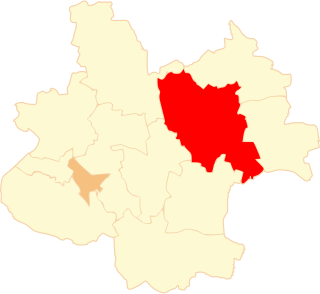
Gmina Kłodawa is an urban-rural gmina in Koło County, Greater Poland Voivodeship, in west-central Poland. Its seat is the town of Kłodawa, which lies approximately 21 kilometres (13 mi) east of Koło and 138 km (86 mi) east of the regional capital Poznań.

Gmina Osiek Mały Gmina in Greater Poland, Poland

Gmina Osiek Mały is a rural gmina in Koło County, Greater Poland Voivodeship, in west-central Poland. Its seat is the village of Osiek Mały, which lies approximately 10 kilometres (6 mi) north of Koło and 115 km (71 mi) east of the regional capital Poznań.

Gmina Przedecz Gmina in Greater Poland, Poland

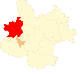
Gmina Przedecz is an urban-rural gmina in Koło County, Greater Poland Voivodeship, in west-central Poland. Its seat is the town of Przedecz, which lies approximately 21 kilometres (13 mi) north-east of Koło and 136 km (85 mi) east of the regional capital Poznań.

Gmina Pyzdry is an urban-rural gmina in Września County, Greater Poland Voivodeship, in west-central Poland. Its seat is the town of Pyzdry, which lies approximately 20 kilometres (12 mi) south of Września and 59 km (37 mi) south-east of the regional capital Poznań.

Zwierzchociny is a village in the administrative district of Gmina Babiak, within Koło County, Greater Poland Voivodeship, in west-central Poland. It is bordered to the west by Sokołowo and Podkiejsze, the north by Kiejsze and Osówie, the east by Lipie Góry and by Kiełczew Smużny Czwarty in the south.

Czołowo, Koło County Village in Greater Poland, Poland

Czołowo is a village in the administrative district of Gmina Koło, within Koło County, Greater Poland Voivodeship, in west-central Poland. It lies approximately 6 kilometres (4 mi) north of Koło and 121 km (75 mi) east of the regional capital Poznań.

Kiełczew Górny Village in Greater Poland, Poland

Kiełczew Górny is a village in the administrative district of Gmina Koło, within Koło County, Greater Poland Voivodeship, in west-central Poland. It lies approximately 9 kilometres (6 mi) north-east of Koło and 125 km (78 mi) east of the regional capital Poznań.

Kiełczew Smużny Czwarty Village in Greater Poland, Poland

Kiełczew Smużny Czwarty is a village in the administrative district of Gmina Koło, within Koło County, Greater Poland Voivodeship, in west-central Poland. It lies approximately 10 kilometres (6 mi) north-east of Koło and 124 km (77 mi) east of the regional capital Poznań.

Kiełczew Smużny Pierwszy Village in Greater Poland, Poland

Kiełczew Smużny Pierwszy is a village in the administrative district of Gmina Koło, within Koło County, Greater Poland Voivodeship, in west-central Poland. It lies approximately 11 kilometres (7 mi) north-east of Koło and 125 km (78 mi) east of the regional capital Poznań.

Powiercie Village in Greater Poland, Poland

Powiercie is a village in the administrative district of Gmina Koło, within Koło County, Greater Poland Voivodeship, in west-central Poland. It lies approximately 5 kilometres (3 mi) east of Koło and 124 km (77 mi) east of the regional capital Poznań.

References