Gmina Leszno is a rural gmina in Warsaw West County, Masovian Voivodeship, in east-central Poland. Its seat is the village of Leszno, which lies approximately 15 kilometres (9 mi) west of Ożarów Mazowiecki and 28 km (17 mi) west of Warsaw.
Gmina Lipno is a rural gmina in Leszno County, Greater Poland Voivodeship, in west-central Poland. Its seat is the village of Lipno, which lies approximately 8 kilometres (5 mi) north of Leszno and 59 km (37 mi) south-west of the regional capital Poznań.
Gmina Rydzyna is an urban-rural gmina in Leszno County, Greater Poland Voivodeship, in west-central Poland. Its seat is the town of Rydzyna, which lies approximately 9 kilometres (6 mi) south-east of Leszno and 69 km (43 mi) south of the regional capital Poznań.

Drobnin is a village in the administrative district of Gmina Krzemieniewo, within Leszno County, Greater Poland Voivodeship, in west-central Poland. It lies approximately 2 kilometres (1 mi) south-west of Krzemieniewo, 18 km (11 mi) east of Leszno, and 62 km (39 mi) south of the regional capital Poznań.
Garzyn is a village in the administrative district of Gmina Krzemieniewo, within Leszno County, Greater Poland Voivodeship, in west-central Poland. It lies approximately 4 kilometres (2 mi) west of Krzemieniewo, 16 km (10 mi) east of Leszno, and 60 km (37 mi) south of the regional capital Poznań.
Górzno is a village in the administrative district of Gmina Krzemieniewo, within Leszno County, Greater Poland Voivodeship, in west-central Poland. It lies approximately 5 kilometres (3 mi) north-west of Krzemieniewo, 16 km (10 mi) east of Leszno, and 59 km (37 mi) south of the regional capital Poznań.
Hersztupowo is a village in the administrative district of Gmina Krzemieniewo, within Leszno County, Greater Poland Voivodeship, in west-central Poland. It lies approximately 5 kilometres (3 mi) north-east of Krzemieniewo, 23 km (14 mi) east of Leszno, and 58 km (36 mi) south of the regional capital Poznań.
Karchowo is a village in the administrative district of Gmina Krzemieniewo, within Leszno County, Greater Poland Voivodeship, in west-central Poland. It lies approximately 3 kilometres (2 mi) north of Krzemieniewo, 19 km (12 mi) east of Leszno, and 58 km (36 mi) south of the regional capital Poznań.
Kociugi is a village in the administrative district of Gmina Krzemieniewo, within Leszno County, Greater Poland Voivodeship, in west-central Poland. It lies approximately 5 kilometres (3 mi) south-west of Krzemieniewo, 16 km (10 mi) east of Leszno, and 64 km (40 mi) south of the regional capital Poznań.

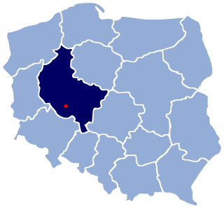
Krzemieniewo is a village in Leszno County, Greater Poland Voivodeship, in west-central Poland. It is the seat of the gmina called Gmina Krzemieniewo. It lies approximately 18 kilometres (11 mi) east of Leszno and 62 km (39 mi) south of the regional capital Poznań.
Lubonia is a village in the administrative district of Gmina Krzemieniewo, within Leszno County, Greater Poland Voivodeship, in west-central Poland. It lies approximately 4 kilometres (2 mi) south of Krzemieniewo, 17 km (11 mi) east of Leszno, and 66 km (41 mi) south of the regional capital Poznań.
Mierzejewo is a village in the administrative district of Gmina Krzemieniewo, within Leszno County, Greater Poland Voivodeship, in west-central Poland. It lies approximately 2 kilometres (1 mi) south of Krzemieniewo, 18 km (11 mi) east of Leszno, and 64 km (40 mi) south of the regional capital Poznań.
Nowy Belęcin is a village in the administrative district of Gmina Krzemieniewo, within Leszno County, Greater Poland Voivodeship, in west-central Poland. It lies approximately 4 kilometres (2 mi) north-east of Krzemieniewo, 20 km (12 mi) east of Leszno, and 58 km (36 mi) south of the regional capital Poznań.
Oporówko is a village in the administrative district of Gmina Krzemieniewo, within Leszno County, Greater Poland Voivodeship, in west-central Poland. It lies approximately 5 kilometres (3 mi) south of Krzemieniewo, 18 km (11 mi) east of Leszno, and 66 km (41 mi) south of the regional capital Poznań.
Oporowo is a village in the administrative district of Gmina Krzemieniewo, within Leszno County, Greater Poland Voivodeship, in west-central Poland. It lies approximately 7 kilometres (4 mi) south of Krzemieniewo, 20 km (12 mi) east of Leszno, and 67 km (42 mi) south of the regional capital Poznań.
Pawłowice is a village in the administrative district of Gmina Krzemieniewo, within Leszno County, Greater Poland Voivodeship, in west-central Poland. It lies approximately 7 kilometres (4 mi) south-west of Krzemieniewo, 13 km (8 mi) east of Leszno, and 65 km (40 mi) south of the regional capital Poznań.
Stary Belęcin is a village in the administrative district of Gmina Krzemieniewo, within Leszno County, Greater Poland Voivodeship, in west-central Poland. It lies approximately 4 kilometres (2 mi) north-east of Krzemieniewo, 20 km (12 mi) east of Leszno, and 58 km (36 mi) south of the regional capital Poznań.
Zbytki is a village in the administrative district of Gmina Krzemieniewo, within Leszno County, Greater Poland Voivodeship, in west-central Poland. It lies approximately 3 kilometres (2 mi) north-west of Krzemieniewo, 17 km (11 mi) east of Leszno, and 60 km (37 mi) south of the regional capital Poznań.