
Louisville is the most populous city in the Commonwealth of Kentucky, sixth-most populous city in the Southeast, and the 27th-most-populous city in the United States. By land area, it is the country's 24th-largest city, although by population density, it is the 265th most dense city. Louisville is the historical county seat and, since 2003, the nominal seat of Jefferson County, on the Indiana border.

Kingsley is a home rule-class city in Jefferson County, Kentucky, United States. The population was 381 as of the 2010 census, down from 428 at the 2000 census. It is a suburb of Louisville.

Old Louisville is a historic district and neighborhood in central Louisville, Kentucky, United States. It is the third largest such district in the United States, and the largest preservation district featuring almost entirely Victorian architecture. It is also unique in that a majority of its structures are made of brick, and the neighborhood contains the highest concentration of residential homes with stained glass windows in the U.S. Many of the buildings are in the Victorian-era styles of Romanesque, Queen Anne, Italianate, among others; and many blocks have had few or no buildings razed. There are also several 20th-century buildings from 15 to 20 stories.

Kentucky Kingdom, formerly known as Six Flags Kentucky Kingdom, is an amusement park in Louisville, Kentucky, United States. The 67-acre (27 ha) park includes a collection of amusement rides and the Hurricane Bay water park. Kentucky Kingdom is at the intersection of Interstate 65 and Interstate 264, sharing a parking lot with the Kentucky Exposition Center.
Shawnee is a neighborhood in western Louisville, Kentucky. Its boundaries are the Ohio River on the West, Bank Street and the Portland neighborhood on the North, I-264 on the East, and West Broadway on the South. Maps sometimes identify the area as Shawneeland.

Butchertown is a neighborhood just east of downtown Louisville, Kentucky, United States, bounded by I-65, Main Street, I-71, Beargrass Creek and Mellwood Avenue.
Irish Hill is a neighborhood east of downtown Louisville, Kentucky USA. It is bounded by Baxter Avenue to the west, Lexington Road to the north, the middle fork of Beargrass Creek and I-64 to the east. Cave Hill Cemetery is located directly south of Irish Hill. It is in the inner Highlands area of Louisville.

Crescent Hill is a neighborhood four miles (6 km) east of downtown Louisville, Kentucky USA. This area was originally called "Beargrass" because it sits on a ridge between two forks of Beargrass Creek. The boundaries of Crescent Hill are N Ewing Ave to the St. Matthews city limit by Brownsboro Road to Lexington Road. Frankfort Avenue generally bisects the neighborhood.

Bonnycastle is a neighborhood four miles (6 km) southeast of downtown Louisville, Kentucky USA. It is considered a part of a larger area of Louisville called The Highlands. Its boundaries are Bardstown Road, Cherokee Road, Eastern Parkway and Speed Avenue.

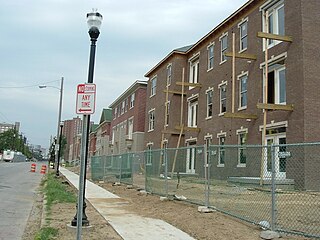
This is a list of official neighborhoods in Louisville, Kentucky. Like many older American cities, Louisville has well-defined neighborhoods, many with well over a century of history as a neighborhood.
Highland Park was a city near and eventually neighborhood in Louisville, Kentucky, United States, that was razed as a part of the expansion of Louisville International Airport. Its boundaries were roughly the CSX railroad tracks to the west, and what would become the Kentucky State Fair & Exposition Center and the airport on all other sides.
Phoenix Hill is a neighborhood of Louisville, Kentucky just east of Downtown. Its boundaries are Market Street to the North, Preston Street to the West, Broadway to the South, and Baxter Avenue to the East. The Phoenix Hill neighborhood, settled before 1850 by German immigrants, is now a rich tapestry of people and a diverse mix of business, industry and residences.
The Highlands is an area in Louisville, Kentucky which contains a high density of nightclubs, eclectic businesses, and many upscale and fast food restaurants. It is centered along a three-mile (5 km) stretch of Bardstown Road and Baxter Avenue and is so named because it sits atop a ridge between the middle and south forks of Beargrass Creek. The commercial area extends from the intersection of Bardstown Road and Taylorsville Road/Trevillian Way in the south, to the intersection of Baxter Avenue and Lexington Road in the north, a length of 3.2 miles (5.1 km). A 1⁄2-mile (800 m) section of the nearby Barret Avenue also contains many similar businesses. The residential area is separated from other adjacent areas like Germantown and Crescent Hill by the south and north forks of Beargrass Creek. The middle fork runs through Cherokee Park, and the south fork divides Germantown from Tyler Park, after flowing past several cemeteries and undeveloped forests downstream from Joe Creason Park. Due to its large collection of night clubs and restaurants, it is locally known as "Restaurant Row".
Louisville, Kentucky is home to numerous structures that are noteworthy due to their architectural characteristics or historic associations, the most noteworthy being the Old Louisville neighborhood, the third largest historic preservation district in the United States. The city also boasts the postmodern Humana Building and an expanding Waterfront Park which has served to remove the former industrial appearance of the riverfront.

Colonial Gardens is a restaurant complex and local landmark located in the Kenwood Hill neighborhood of Louisville, Kentucky, across New Cut Road from Iroquois Park. It was formerly an entertainment complex, and in its earliest existence, a part of Senning's Park, the site of the first zoo in Louisville.

The parkway system of Louisville, Kentucky, also known as the Olmsted Park System, was designed by the firm of preeminent 19th century landscape architect Frederick Law Olmsted. The 26-mile (42 km) system was built from the early 1890s through the 1930s, and initially owned by a state-level parks commission, which passed control to the city of Louisville in 1942.

The Cherokee Triangle is a historic neighborhood in Louisville, Kentucky, USA, known for its large homes displaying an eclectic mix of architectural styles. Its boundaries are Bardstown Road to the southwest, Cherokee Park and Eastern Parkway to the southeast, and Cave Hill Cemetery to the north, and is considered a part of a larger area of Louisville called The Highlands. It is named for nearby Cherokee Park, a 409 acres (1.7 km2) park designed by Frederick Law Olmsted, the designer of New York's Central Park.
Warwick Village is a neighborhood located in Louisville, Kentucky. Warwick Village is just outside the Watterson Expressway and part of the City of St. Matthews, Its boundaries are roughly New La Grange Rd, Washburn Ave, and Columbia Ave. Many of Warwick Village's streets are surrounded by Warwick Park also known as Warwick-Villa Park Playground.
Little Haifa or New Preston St. are the two nicknames for a large Jewish neighborhood on Dutchman's Lane stretching from Abigail Drive through Almara Circle, Vivian Lane, and Woodluck Avenue.

Lynn Family Stadium is a soccer-specific stadium in the Butchertown neighborhood of Louisville, Kentucky, U.S. The field is home to Louisville City FC of the USL Championship (USLC) since its opening in 2020, along with the National Women's Soccer League (NWSL) side Racing Louisville FC since 2021. With a capacity of 11,700, the design allows expansion up to 15,304 spectators. Breaking ground in 2018, naming-rights were acquired by local business leader Mark Lynn shortly after.

