Related Research Articles

Botswana, officially the Republic of Botswana, is a landlocked country in Southern Africa. Botswana is topographically flat, with approximately 70 per cent of its territory part of the Kalahari Desert. It is bordered by South Africa to the south and southeast, Namibia to the west and north, Zambia to the north and Zimbabwe to the northeast. With a population of slightly over 2.4 million people and a comparable land area to France, Botswana is one of the most sparsely populated countries in the world. It is essentially the nation-state of the Tswana people, who constitute nearly 80 per cent of the population.

The geography of France consists of a terrain that is mostly flat plains or gently rolling hills in the north and the west and mountainous in the south and the east. Metropolitan France has a total size of 551,695 km2 (213,011 sq mi). It is the third-largest country in Europe by area and the largest in Western Europe.

Panaji is the capital of the Indian state of Goa and the headquarters of North Goa district. Previously, it was the territorial capital of the former Portuguese India. It lies on the banks of the Mandovi river estuary in the Tiswadi sub-district (taluka). With a population of 114,759 in the metropolitan area, Panaji is Goa's largest urban agglomeration, ahead of Margao and Mormugao.
This article lists extreme locations on Earth that hold geographical records or are otherwise known for their geophysical or meteorological superlatives. All of these locations are Earth-wide extremes; extremes of individual continents or countries are not listed.
Goa is a state in India.

Francistown is the second-largest city in Botswana, with a population of about 103,417 and 147,122 inhabitants for its agglomeration at the 2022 census. It is located in eastern Botswana, about 400 kilometres (250 mi) north-northeast from the capital, Gaborone. Francistown is located at the confluence of the Tati and Ntshe rivers, and near the Shashe River and 90 kilometres (56 mi) from the international border with Zimbabwe.
The Aviator Glacier is a major valley glacier in Antarctica that is over 60 nautical miles long and 5 nautical miles wide, descending generally southward from the plateau of Victoria Land along the west side of Mountaineer Range, and entering Lady Newnes Bay between Cape Sibbald and Hayes Head where it forms a floating tongue.

Mogtédo, also spelt Mogtedo or Moktedo, is a town located in the province of Ganzourgou in Burkina Faso. The population of Mogtédo is 25,699, and it is the capital of Mogtédo Department.

Tūpai, also called Motu Iti, is a low-lying atoll in Society Islands, French Polynesia. It lies 19 km to the north of Bora Bora and belongs to the western Leeward Islands. This small atoll is only 11 km2 in size. Its broad coral reef encloses a shallow sandy lagoon. There are almost continuous long wooded motus on Tūpai's reef. Tūpai has no permanent residents apart from some workers in its coconut plantations. A private airfield was inaugurated on Tūpai in 2001, and its use is restricted.
Antsangasanga is a town and commune in Madagascar. It belongs to the district of Ambatondrazaka, which is a part of Alaotra-Mangoro Region. The population of the commune was estimated to be approximately 7,000 in 2001 commune census.

The Adare Peninsula, is a high ice-covered peninsula, 40 nautical miles long, in the northeast part of Victoria Land, extending south from Cape Adare to Cape Roget. The peninsula was named by the New Zealand Antarctic Place-Names Committee (NZ-APC) for Cape Adare. The peninsula is considered the southernmost point of the Borchgrevink Coast, named for Carsten Borchgrevink (1864-1934).

Otjombinde Constituency is an electoral constituency in the Omaheke Region of Namibia. It had 6,378 inhabitants in 2004 and 4,879 registered voters in 2020. The district capital of the constituency is the settlement of Otjombinde, and its main economic hub is Talismanus. The constituency forms part of the border between Namibia and Botswana. It contains the settlements of Eiseb, Helena, and Rietfontein.
Trollkjelen Crevasse Field is a crevasse field about 12 nautical miles (22 km) long in the Fimbul Ice Shelf, lying immediately off the northeast side of Trollkjelneset Headland in Queen Maud Land. Mapped by Norwegian cartographers from surveys and air photos by Norwegian-British-Swedish Antarctic Expedition (NBSAE) (1949–52) and air photos by the Norwegian expedition (1958–59) and named Trollkjelen.
Mount Twigg is a large rock outcrop bisected by a north-trending glacier, standing 16 nautical miles (30 km) southeast of Mount Maguire near the head of Lambert Glacier. Mapped from ANARE air photos and surveys, 1956–58. Named by Antarctic Names Committee of Australia (ANCA) for D.R. Twigg, radio supervisor at Mawson Station, 1958.
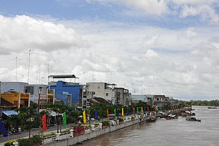
Hồng Ngự is a provincial city in Đồng Tháp Province in the Mekong Delta region of Vietnam. It was separated from Hồng Ngự District in 2008.

INS Hansa, is an Indian naval air station located near Dabolim in Goa, India. It is India's biggest naval airbase. The military air base has a civil enclave, that operates as Dabolim Airport.
Gobojango, locally known as Gobas, is a village in the Central District, Botswana; more specifically in the Bobirwa Sub-District.

Goa is a state on the southwestern coast of India within the Konkan region, geographically separated from the Deccan highlands by the Western Ghats. It is bound by the Indian states of Maharashtra to the north, and Karnataka to the east and south, with the Arabian Sea in the west. It is India's smallest state by area and fourth-smallest by population. Goa has the highest GDP per capita among all Indian states, two and a half times as high as the GDP per capita of the country as a whole. The Eleventh Finance Commission of India named Goa the best-placed state because of its infrastructure, and India's National Commission on Population rated it as having the best quality of life in India. It is the second-highest ranking among Indian states in the human development index.
Mogonye is a village in the Southern District of Botswana. In the 2011 census, it had a population of 577.
References
18°17′S21°50′E / 18.283°S 21.833°E
| | This Botswana location article is a stub. You can help Wikipedia by expanding it. |