Related Research Articles

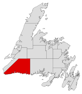
Burgeo-La Poile is a provincial electoral district for the House of Assembly of Newfoundland and Labrador, Canada. As of 2011, there are 7,527 eligible voters living within the district. The district was first created when Newfoundland joined confederation in 1949 as Burgeo and La Poile, and existed until 1975. It was recreated in 1995 following a reduction in the number of seats in the House of Assembly from 52 to 48, forming from the amalgamation of the former districts of La Poile and Burgeo-Bay D'Espoir.
Aviron Bay is natural bay on the island of Newfoundland in the province of Newfoundland and Labrador, Canada. The Friar, a castellated rock, is located between Aviron Bay and Cul-de-sac bay.
Facheux Bay was the location of a small fishing settlement of the same name. In 1901 it had a population of 47. The community was also called Fachier, Facheaux, and Fouche. Facheux Bay is a deep fjord that separates Eastern Head and Western Head of Hermitage Bay, Newfoundland, Canada. Facheux bay is 2.25 miles (3.62 km) west of Mosquito Cove. The entrance is between two steep falls in high hills. The bay runs in 6.5 miles (10.5 km), with an average width of 0.75 miles (1.21 km), and has deep water throughout. On the west side are three coves with anchorage in 20 to 10 fathoms.

La Poile Bay is a natural bay in Newfoundland, Canada, in the southwestern area of the island, off the south coast. It subdivides into Northeast Arm and North Bay. The settlement of La Poile is located on the bay.

Mortier Bay is a natural bay on the Burin Peninsula on the south coast of the island of Newfoundland in the province of Newfoundland and Labrador, Canada. It is entered through a channel 1.5 miles (2.4 km) long and 0.5 miles (0.80 km)wide, at the north end of which the bay opens nearly 2 miles (3.2 km) in diameter with deep water and no anchorage, except in the harbors off it. The settlement of Marystown is located on the bay.
Chaleur Bay is natural bay on the island of Newfoundland in the province of Newfoundland and Labrador, Canada. Its features include cliffs, ravines and waterfalls.
La Hune Bay is natural bay on the island of Newfoundland in the province of Newfoundland and Labrador, Canada. It is by Cape La Hune.
Cinq Cerf Bay is a natural bay on the island of Newfoundland in the province of Newfoundland and Labrador, Canada.
Garia Bay is natural bay on the island of Newfoundland in the province of Newfoundland and Labrador, Canada.
Bay Le Moine is a natural bay on the island of Newfoundland in the province of Newfoundland and Labrador, Canada.
Coney Bay is a natural bay on the island of Newfoundland in the province of Newfoundland and Labrador, Canada. It is east of Otter Bay.
Otter Bay is a natural bay on the island of Newfoundland in the province of Newfoundland and Labrador, Canada. Coney Bay is east of it.
Isthmus Bay is a natural bay on the island of Newfoundland in the province of Newfoundland and Labrador, Canada. It is a sub-bay of St. George's Bay and flanked by the town of Port-au-Port. It is separated from Port au Port Bay by two narrow gravel isthmi.
West Bay is a natural bay on the island of Newfoundland in the province of Newfoundland and Labrador, Canada.
Médée Bay is a natural bay off the island of Newfoundland in the province of Newfoundland and Labrador, Canada. It faces the modern village and archeological site of L'Anse aux Meadows.
Witless Bay is a natural bay off of the island of Newfoundland in the province of Newfoundland and Labrador, Canada. It is located on the eastern coast of the Avalon Peninsula, south of Bay Bulls and north of La Manche Provincial Park.
Carbonear Bay is a natural bay off the island of Newfoundland, located in the province of Newfoundland and Labrador, Canada. The bay is also home to Carbonear Island.

Spaniard's Bay is a natural bay off the island of Newfoundland in the province of Newfoundland and Labrador, Canada. It extends from Conception Bay into the northern section of the Avalon Peninsula.
Bay Bulls is a natural bay off the island of Newfoundland in the province of Newfoundland and Labrador, Canada.

Division No. 1, Subdivision G is an unorganized subdivision on the Avalon Peninsula in Newfoundland and Labrador, Canada. It is in Division 1 and contains the unincorporated communities of Baccalieu Island, Besom Cove, Bradley's Cove, Burnt Point, Caplin Cove, Daniel's Cove, Grates Cove, Gull Island, Job's Cove, Kingston, Long Beach, Lower Island Cove, Low Point, Northern Bay, Ochre Pit Cove, Red Head Cove, Riverhead, Smooth Cove and Western Bay.
References
- ↑ United States Hydrographic Office; Davenport, Richard G. (1884). Newfoundland and Labrador: The coast and banks of Newfoundland and the coast of Labrador, from Grand Point to the Koksoak River, with the adjacent islands and banks (Public domain ed.). Govt. print. off. pp. 180–. Retrieved 20 November 2011.