Related Research Articles

Nepal measures about 880 kilometers (547 mi) along its Himalayan axis by 150 to 250 kilometers across. It has an area of 147,516 km2 (56,956 sq mi).

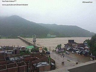
The Bagmati River flows through the Kathmandu valley of Nepal, separating the cities of Kathmandu and Patan, before flowing through Madesh Province of southern Nepal and joining the Kamla River in the Indian state of Bihar. It is considered holy by both Hindus and Buddhists. A number of Hindu temples are located on its banks.

The Thakali are an ethnolinguistic Tibeto-Burman ethnic group of Nepal. The traditional area of the Thakali community is called Thak-sat-se or the Thak Khola region and lies in the Kali Gandaki River valley in the Mustang District, Gandaki Province in western Nepal. According to the 2001 census, the Thakali population of around 12,973 constituted only 0.06% of Nepal's population. By the 2011 Nepal census, there were 13,215 Thakali people in Nepal.

Pokhara is a metropolitan city in central Nepal, which serves as the capital of Gandaki Province and the tourism capital of Nepal. It is the second most populous city of Nepal after Kathmandu, with 599,504 inhabitants living in 120,594 households in 2021. It is the country's largest metropolitan city in terms of area. The city also serves as the headquarters of Kaski District. Pokhara is located 200 kilometres west of the capital, Kathmandu. The city is on the shore of Phewa Lake, and sits at an elevation of approximately 822 m. The Annapurna Range, with three out of the ten highest peaks in the world—Dhaulagiri, Annapurna I and Manaslu—is within 15–35 mi (24–56 km) of the valley.

The Ghaghara River, also known as the Karnali River in Nepal, Mapcha Tsangpo in Tibet, and the lower Ghaghara in Awadh is known as the Sarayu River, is a perennial trans-boundary river that originates in the northern slopes of the Himalayas in the Tibetan Plateau, cuts through the Himalayas in Nepal and joins the Sharda River at Brahmaghat in India. Together they form the Ghaghara River, a major left-bank tributary of the Ganges. With a length of 507 km (315 mi), it is the longest river in Nepal. The total length of the Ghaghara up to its confluence with the Ganges at Revelganj in Bihar is 1,080 km (670 mi). It is the largest tributary of the Ganges by volume and the second largest by length after Yamuna.

The Kali Gandaki Gorge or Andha Galchi is the gorge of the Kali Gandaki in the Himalayas in Nepal. By some sources, it may be one of the deepest gorges in the world.

The Gandaki River, also known as the Narayani and Gandak, is one of the major rivers in Nepal and a left-bank tributary of the Ganges in India. Its total catchment area is 46,300 km2 (17,900 sq mi), most of it in Nepal. In the Nepal Himalayas, the Gandaki is notable for its deep canyon. The basin also contains three mountains over 8,000 m (26,000 ft), namely Dhaulagiri, Manaslu and Annapurna Massif. Dhaulagiri is the highest point of the Gandaki basin.

Baglung District, a part of Gandaki Province, is one of the seventy-seven districts of Nepal. The district, with Baglung as its district headquarters, covers an area of 1,784 km2 (689 sq mi) and has a population (2011) of 268,613.

Mustang District is one of the eleven districts of Gandaki Province and one of seventy-seven districts of Nepal which was a Kingdom of Lo-Manthang that joined the Federation of Nepal in 2008 after abolition of the Shah dynasty. The district covers an area of 3,573 km2 (1,380 sq mi) and in 2011 had a population of 13,452. The headquarters is located at Jomsom. Mustang is the fifth largest district of Nepal in terms of area.

Palpa District (Nepali: पाल्पा जिल्ला, a part of Lumbini Province, is one of the seventy-seven districts of Nepal, a landlocked country of South Asia. The district, with Tansen as its headquarters, covers an area of 1,373 km2 and has a population of 261,180.
Dhorpatan is a municipality in Nepal's Baglung District, 3,900 meters elevation in an east–west valley south of the Dhaulagiri mountain range in the Himalayas. It is the headquarters of Dhorpatan Hunting Reserve. There is a small community of indigenous Kham Magar people as well as Tibetan refugees.

The Bheri River is a major tributary of the Karnali River draining the western Dhaulagiri range in western Nepal. It has three important upper tributaries. Sani Bheri River drains southern slopes of this range while Thuli Bheri River drains northern slopes. Another tributary Uttar Ganga drains Dhorpatan Valley to the south of the Dhaulagiris. Downstream, the Bheri flows through Surkhet Valley before joining the Karnali River in the Mahabharat Range or Lesser Himalaya.
The West Rapti, also known as the Kuwano, is a river which drains Rapti Zone in Mid-Western Region, Nepal, then Awadh and Bhojpur-Purvanchal regions of Uttar Pradesh state, and finally India before joining the Ghaghara. It is a major left bank tributary of the Ganges, and is also known as the Karnali in Nepal.
The Kalapani territory is an area under Indian administration as part of Pithoragarh district in the Kumaon Division of the Uttarakhand state, but it is also claimed by Nepal since 1997. According to Nepal's claim, it lies in Darchula district, Sudurpashchim Province. The territory represents part of the basin of the Kalapani river, one of the headwaters of the Kali River in the Himalayas at an altitude of 3600–5200 meters. The valley of Kalapani, with the Lipulekh Pass at the top, forms the Indian route to Kailash–Manasarovar, an ancient pilgrimage site. It is also the traditional trading route to Tibet for the Bhotiyas of Kumaon and the Tinkar valley of Nepal.

The Seti Gandaki River, also known as the Seti River or the Milk River, is a river of western Nepal, a left tributary of the Trishuli River. It gorges around Pokhara and is a major attraction for tourists worldwide.

Gandaki Province ), is one of the seven federal provinces established by the current constitution of Nepal which was promulgated on 20 September 2015. Pokhara is the province's capital city. It borders the Tibet Autonomous Region in Southwest China to the north, Bagmati Province to the east, Karnali Province to the west, and Lumbini Province and Bihar of India to the south. The total area of the province is 21,504 km2 - constituting 14.57% of Nepal's total area. According to the latest census, the population of the province was 2,479,745. The newly elected Provincial Assembly adopted Gandaki Province as the permanent name by replacing its initial name Province No. 4 on 27 April 2023. Surendra Raj Pandey is the present chief minister of Gandaki Province.

Karnali Province is one of the seven federal provinces of Nepal formed by the new constitution, which was adopted on 20 September 2015. The total area of the province is 27,984 square kilometres (10,805 sq mi), making it the largest province in Nepal with 18.97% of the country's area. According to the 2011 Nepal census, the population of the province was 1,570,418, making it the least populous province in Nepal. The province borders the Tibet Autonomous Region of China to the north, Gandaki Province to the east, Sudurpashchim Province to the west, and Lumbini Province to the south. Birendranagar with a population of 154,886 is both the province's capital and largest city.

The Tibet–Nepal salt trade route is an ancient salt trading route running between the Tibetan Plateau and the Middle Hills of Nepal and further on to India. After the annexation of Tibet by China in 1950 and the Sino-Indian War in 1962, patterns of trade changed and the use of the old trading route between India and Tibet dwindled and the salt-carrying caravans became redundant.
References
- ↑ Nuggets, Rare Gold (2015-09-14). "Gold Mining in Nepal: Himilayan Gold Deposits". RareGoldNuggets.com. Retrieved 2021-04-11.
- 1 2 Sedhai, Roshan. "Dying community of gold miners struggles for survival (With video)". My Republica. Retrieved 2021-04-11.
- ↑ "Enter the dragon along the Himalayan border". Times of India Blog. 2020-12-26. Retrieved 2021-04-11.
- 1 2 "नेपालमा सुनखानी : तीनपटक अध्ययन, उत्खनन् शून्य" . Retrieved 2021-04-11.
- ↑ "A vanishing way of life" . Retrieved 2021-04-11.
- ↑ Rijal, Prahlad (2018-04-05). "Chinese team begins mining excavation in search of gold deposits". The Himalayan Times. Retrieved 2021-04-11.
| | This Nepal-related article is a stub. You can help Wikipedia by expanding it. |
| | This article about mining is a stub. You can help Wikipedia by expanding it. |