Bheri River

Last updated
Bheri River
Bheri river from rukum.jpg
Location
Country Nepal
Physical characteristics
Mouth Karnali River
  coordinates
28°44′31″N81°15′36″E / 28.742°N 81.260°E / 28.742; 81.260 Coordinates: 28°44′31″N81°15′36″E / 28.742°N 81.260°E / 28.742; 81.260
Basin features
River system Karnali River

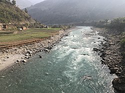
The Bheri River is a major tributary of the Karnali River draining the western Dhaulagiri range in western Nepal. It has three important upper tributaries. Sani Bheri River drains southern slopes of this range while Thuli Bheri River drains northern slopes. Another tributary Uttar Ganga drains Dhorpatan Valley to the south of the Dhaulagiris. Downstream, the Bheri flows through Surkhet Valley before joining the Karnali River in the Mahabharat Range or Lesser Himalaya . [1] [2] [3] [4] [5] [6] [7] [8] [9]

Contents

On December 25, 2007, a suspension bridge collapsed along the river in Chhinchu (Mehelkuna) village. "Scores" of people crossed the 500m steel bridge to get to a local Christmas Day fair. At least 15 people were killed and at least 22 were injured. Most of the killed were women and children. The river supposedly had strong currents. [10]

See also

Related Research Articles

Geography of Nepal Geographical features of Nepal

Nepal measures about 880 kilometers (547 mi) along its Himalayan axis by 150 to 250 kilometers across. It has an area of 147,516 km2 (56,956 sq mi).

Himalayas Mountain range in Asia

The Himalayas, or Himalaya, are a mountain range in Asia separating the plains of the South Asia from the Tibetan Plateau. The range has some of the planet's highest peaks, including the highest, Mount Everest. Over 100 peaks exceeding 7,200 m (23,600 ft) in elevation lie in the Himalayas. By contrast, the highest peak outside Asia is 6,961 m (22,838 ft) tall.

Rapti Zone Zone in Nepal

Rapti Zone was one of the fourteen zones, located in the Mid-Western Development Region of Nepal. It was named after the West Rapti River which drains Rolpa, Pyuthan and part of Dang districts. The remainder of Dang and part of Salyan district are drained by the Babai. The remainder of Salyan and all of Rukum districts are drained by the Bheri.

Ghaghara Asian river and tributary of the Ganges

Ghaghara, also called Karnali is a perennial trans-boundary river originating on the Tibetan Plateau near Lake Manasarovar. The Karnali cuts through the Himalayas in Nepal and joins the Sharda River at Brahmaghat in India. Together they form the Ghaghara River, a major left bank tributary of the Ganges. With a length of 507 kilometres (315 mi) it is the longest river in Nepal. The total length of Ghaghara River up to its confluence with the Ganges at Revelganj in Bihar is 1,080 kilometres (670 mi). It is the largest tributary of the Ganges by volume and the second longest tributary of the Ganges by length after Yamuna.

Rukum District Former District in Nepal

Rukum District was a "hill" and "mountain" district some 280 km (170 mi) west of Kathmandu partially belonging to Lumbini Province and partially to Karnali Province before split into two districts Western Rukum and Eastern Rukum after the state's reconstruction of administrative divisions in 2017. Rukum covers an area of 2,877 km2 (1,111 sq mi) with population of 207,290 in 2011 Nepal census. Musikot was the district's administrative center.

Salyan District, Nepal District in Karnali Province, Nepal

Salyan District, a part of Karnali Province, is one of the seventy-seven districts of Nepal. Salyan covers an area of 1,462 km2 (564 sq mi) with a population of 213,500 in 2001 and 241,716 in 2011. The district's administrative center is named Salyan or Salyan Khalanga, today it is part of Shaarada Municipality.

Surkhet District District of Nepal in Karnali Province

Surkhet District is a district in Karnali Province of mid-western Nepal. Surkhet is the one of the ten districts of Karnali located about 600 kilometres (373 mi) west of the national capital Kathmandu. The district's area is 2,489 square kilometres (961 sq mi). It had 288,527 population in 2001 and 350,804 in 2011 which male comprised 169,461 and female 181,381. Its district headquarters, Birendranagar, is also the capital of Karnali Province.

Tons River River in India

The Tons is the largest tributary of the Yamuna and flows through Garhwal region in Uttarakhand, touching Himachal Pradesh. The Tons thrust is named after this river.

Kham is the name of a set of languages in the Sino-Tibetan Family. The people call themselves Kham Magar or Western Magar, or simply Magar by outsiders. The name ‘Magar,’ may derive from the same etyma as the Old Tibetan mgar-ba, meaning ‘smith.’ The language was previously sometimes called "Western magar" but Kham Magar and Magar are now known to be quite different languages. Kham Magar communities live in the Middle Hills of mid-western Nepal, in the districts of Rukum, Rolpa, and Baglung. Scattered communities also live in Jajarkot, Dailekh, Kalikot, Achham, and Doti districts.

Thuli Bheri River River in Nepal

Thuli Bheri River, a tributary of Bheri River which in turn is the tributary of the Karnali River. It starts in the Chharka region of Dolpa District where it is known as the Bhargung Khola (river).

Dhorpatan Municipality in Gandaki Province, Nepal

Dhorpatan is a village in Nepal's Baglung District, 3,900 meters elevation in an east-west valley south of the Dhaulagiri mountain range in the Himalayas. It is the headquarters of Dhorpatan Hunting Reserve. There is a small community of indigenous Kham Magar people as well as Tibetan refugees.

The Inner Terai Valleys of Nepal comprise several elongated river valleys in the southern lowland Terai part of the country. These tropical valleys are enclosed by the Himalayan foothills, viz the Mahabharat Range and the Sivalik Hills farther south.

West Rapti River River in Nepal

West Rapti drains Rapti Zone in Mid-Western Region, Nepal, then Awadh and Purvanchal regions of Uttar Pradesh state, India before joining the Ghaghara—a major left bank tributary of the Ganges known as the Karnali inside Nepal.

Babai River River in South Asia

The Babai River originates in and completely drains Inner Terai Dang Valley of Mid-Western Nepal. Dang is an oval valley between the Mahabharat Range and Siwalik Hills in its eponymous district. Dang was anciently home to indigenous Tharu people and came to be ruled from India by the House of Tulsipur who also counted as one of the Baise Rajya —a confederation of 22 petty kingdoms in the Karnali (Ghagra) region. About 1760 AD all these kingdoms were annexed by the Shah Dynasty during the unification of Nepal, except Tulsipur lands south of the Siwalik Hills were not taken. Since Dang Valley was somewhat higher, cooler, better-drained and therefore less malarial than most of the country's Inner Terai, it was settled to some extent by Shah and Rana courtiers and other Paharis long before DDT was introduced to control the disease-bearing Anopheles mosquito.

Karnali Province Province of Nepal

Karnali Province is one of the seven federal provinces of Nepal formed by the new constitution which was adopted on 20 September 2015. The total area of the province is 27,984 square kilometres (10,805 sq mi) covering 18.97% of the country, making it the largest province in Nepal. According to the 2011 Nepal census, the population of the province was 1,570,418, making it the least populous province in Nepal. It borders the Tibet Autonomous Region of China to the north, Gandaki Province to the east, Sudurpashchim Province to the west, and Lumbini Province to the south. Birendranagar with a population of 47,914 is both the province's capital and largest city.

Eastern Rukum District District in Province No. 5, Nepal

Eastern Rukum is a mountain district of Lumbini Province of Nepal situated along the Dhaulagiri mountain range. It is also the only mountain district of the province with its tallest mountain Putha Hiunchuli situated in the west end of Dhaulagiri II mountain chain, at an elevation of 7,246 meters. The drainage source of ancient Airavati river, one of the five sacred rivers of Buddhism, lies in the lesser Himalayas of the district. With a Dhaulagiri mountain range, lakes, rich Magar culture and its political history, Eastern Rukum has been among the top travel destinations of Nepal as designated by the Government of Nepal.

Sani Bheri River, a tributary of the Karnali River, starts from the southern slopes of Dhaulagiri range. Sani Bheri River and Thuli Bheri River join at Rimnaghat to form the main Bheri River.

National Pride Projects are a set of infrastructure projects by the government of Nepal based on the proposal by the National Planning Commission.

Bheri Babai Diversion Multipurpose Project (BBDMP) is a multi-basin irrigation cum hydropower project lying in Surkhet District of Karnali Province in Mid-West Nepal. The water is diverted from the Bheri River and discharged to Babai River. The project aims to irrigate 51,000 ha of land in Banke and Bardiya District throughout the year. The elevation difference between the intake and irrigation area provided an opportunity to install 46.8 MW firm electricity. The project has a tunnel 12208 meters long that was constructed using a tunnel boring machine (TBM) for the first time in Nepal. The project is owned by the Ministry of Energy, Water Resources and Irrigation. Construction of the project commenced in 2015 and is expected to complete in 2023. The project is estimated to cost NPR 30,00,000,0000.

References

  1. "Mission Hospital gets its water from Bheri River". The Himalayan Times. 24 March 2016. Retrieved 10 January 2019.
  2. "Bheri river". kathmandupost.ekantipur.com. Retrieved 10 January 2019.
  3. www.nepalriverrunner.com, Nepal River Runner. "Bheri White Water Rafting and Kayaking Expedition – 6 Days | Nepal River Runner". Nepalriverrunner.com. Retrieved 10 January 2019.
  4. "Bheri River Rafting". nepalmtlovers.com. Retrieved 10 January 2019.
  5. "Bheri River Rafting – Rafting in Bheri River – Nepal Mother House Treks". Nepalmotherhousetreks.com. Retrieved 10 January 2019.
  6. "Bheri River Rafting". nestadventure.com. Retrieved 10 January 2019.
  7. "Bheri River Rafting | Bheri river rafting in Nepal with Himalayan River Fun". nepalraft.com. Retrieved 10 January 2019.
  8. "Bheri River Rafting - Rafting in Bheri - White Water River Rafting - Nepal River Rafting". nepal-rafting.com. Retrieved 10 January 2019.
  9. Project, Bheri Babai Diversion Multipurpose. "Bheri Babai Diversion Multipurpose Project - BBDMP". bbdmp.gov.np. Retrieved 10 January 2019.
  10. Scores missing from Nepal bridge BBC News