Related Research Articles

Mongolia is a landlocked country in Central Asia and East Asia, located between China and Russia. The terrain is one of mountains and rolling plateaus, with a high degree of relief. The total land area of Mongolia is 1,564,116 square kilometres. Overall, the land slopes from the high Altai Mountains of the west and the north to plains and depressions in the east and the south. The Khüiten Peak in extreme western Mongolia on the Chinese border is the highest point. The lowest point is at 560 m (1,840 ft), is the Hoh Nuur or lake Huh. The country has an average elevation of 1,580 m (5,180 ft).
The Global 200 is the list of ecoregions identified by WWF, the global conservation organization, as priorities for conservation. According to WWF, an ecoregion is defined as a "relatively large unit of land or water containing a characteristic set of natural communities that share a large majority of their species dynamics, and environmental conditions". So, for example, based on their levels of endemism, Madagascar gets multiple listings, ancient Lake Baikal gets one, and the North American Great Lakes get none.

Manaslu is the eighth-highest mountain in the world at 8,163 metres (26,781 ft) above sea level. It is in the Mansiri Himal, part of the Nepalese Himalayas, in the west-central part of Nepal. The name Manaslu means "mountain of the spirit" and is derived from the Sanskrit word manasa, meaning "intellect" or "soul". Manaslu was first climbed on May 9, 1956, by Toshio Imanishi and Gyalzen Norbu, members of a Japanese expedition. It is said that, given the many unsuccessful attempts by the British to climb Everest before New Zealander Edmund Hillary, "just as the British consider Everest their mountain, Manaslu has always been a Japanese mountain".
Arghakhanchi is one of the districts of Lumbini Province in Nepal. The district headquarter is Sandhikharka. The district covers an area of 1,193 km2 (461 sq mi) and has a population (2011) of 197,632. Its neighboring districts are Palpa in the east, Gulmi in the north, Kapilvastu District in the south and Pyuthan in the west.
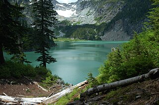
The Henry M. Jackson Wilderness is a 103,297-acre (41,803 ha) designated wilderness area in the state of Washington, United States. The area lies adjacent to the southwest corner of the Glacier Peak Wilderness, northwest of Stevens Pass on U.S. Highway 2 and northeast of the town of Skykomish, Washington. Wild Sky Wilderness is located immediately southwest of the Henry M. Jackson Wilderness. While the wilderness straddles the Cascade Mountain Range, most of it is in the westside ecotype. The wilderness lies in parts of Snoqualmie, Mount Baker, and Wenatchee national forests.

The Gandaki River, also known as the Narayani and the Gandak, is one of the major rivers in Nepal and a left bank tributary of the Ganges in India. Its total catchment area amounts to 46,300 km2 (17,900 sq mi), most of it in Nepal. In the Nepal Himalayas, it is notable for its deep canyon. The basin also contains three mountains over 8,000 m (26,000 ft), namely Dhaulagiri, Manaslu and Annapurna I. Dhaulagiri is the highest point of the Gandaki basin.

Mustang District is one of the eleven districts of Gandaki Province and one of seventy-seven districts of Nepal. It covers an area of 3,573 km2 (1,380 sq mi) and has a population (2011) of 13,452. The headquarters is located at Jomsom. Mustang is the 5th largest district of Nepal.

Palpa District (Nepali: पाल्पा जिल्लाListen , a part of Lumbini Province, is one of the seventy-seven districts of Nepal, a landlocked country of South Asia. The district, with Tansen as its headquarters, covers an area of 1,373 km2 and has a population of 261,180.

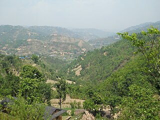
Parbat District (Nepali: पर्वत जिल्ला[pʌɾbʌt], is a hilly area of Nepal. It is a part of Gandaki Province and one of the seventy-seven districts of Nepal. The district, with Kusma as its district headquarters, covers an area of 494 km2 and has a population of 157,826. It is the fourth smallest district of Nepal with 47 VDCs currently. It is mainly known for the Gupteshwar Cave, which is visited by thousands of pilgrims during Shivaratri. Patheshwari Temple a notable temple in Kushma located at Katuwa Chaupari of Kushma-09. Patheshwori Mandir has many sub-temples inside like Ram Janaki Mandir, Bhagwati, Devi, Hanuman, and others. Alapeshwar cave is a cave in this district. It is also noted for the Dahere Deurali Temple, which is visited by thousands of pilgrims during Balachaturdanshai. Kamadhenu Mandir is another temple of Parbat district which is located in Khurkot development committee. Recently the Modi hydro project of 10 M.W. has been constructed in this district. Parbat's biggest playground lies in Phalewas village named Majhi Chour and Indra Chour.
Gossaigaon is one of the major and a developing town in the Bodoland region of Assam, India. This is a sub-divisional headquarter of Kokrajhar district. It shares its boundaries with the neighboring state West Bengal in the west and Dhubri district to the south. It is Also a proposed district. Gossaigaon is well connected by Ground transportation and rails. The town serves a direct route by road to the newly operated Rupsi Airport in the district. It has small rivers Madati and Sankosh, and forested areas which include such saleable trees as Shorea robusta (sal), Tectona grandis (teak). This place practices organic farming, also modern agriculture following recent scientific developments.
Lipulekh is a Himalayan pass on the border between India's Uttarakhand state and the Tibet region of China, near their trijunction with Nepal. Nepal has ongoing claims to the southern side of the pass, called Kalapani territory, which is controlled by India. The pass is near the Chinese trading town of Taklakot (Purang) in Tibet and used since ancient times by traders, mendicants and pilgrims transiting between India and Tibet. It is also used by pilgrims to Kailas and Manasarovar.
Flora of Azerbaijan or Vegetation of Azerbaijan refers to the plants, trees, flowers which can be found in Azerbaijan.
The Kalapani territory is an area under Indian administration as part of Pithoragarh district in the Kumaon Division of the Uttarakhand state, but it is also claimed by Nepal since 1997. According to Nepal's claim, it lies in Darchula district, Sudurpashchim Province. The territory represents part of the basin of the Kalapani river, one of the headwaters of the Kali River in the Himalayas at an altitude of 3600–5200 meters. The valley of Kalapani, with the Lipulekh Pass at the top, forms the Indian route to Kailash–Manasarovar, an ancient pilgrimage site. It is also the traditional trading route to Tibet for the Bhotiyas of Kumaon and the Tinkar valley of Nepal.
The Little Yalmy River is a perennial river of the Snowy River catchment, located in the Alpine region of the Australian state of Victoria.
Jhargram is a district in the state of West Bengal, India.The district lies between the Kangsabati River in the north and the Subarnarekha in the south. Jhargram has one of the lowest population densities among the districts of West Bengal, with almost all its population living in rural areas. It is a popular tourist destination known for its sal forests, elephants, ancient temples and royal palaces. The district was formed on 4 April 2017, after bifurcation from the Paschim Medinipur district as the 22nd district of West Bengal. The district has its headquarters at Jhargram.
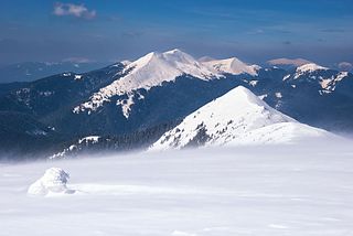
Gorgany Nature Reserve is a strict nature reserve of Ukraine that covers a part of the Gorgany mountain range of the Outer Eastern Carpatians in southwest Ukraine. The reserve is 46% old-growth forest, one of the last and largest such stands in Europe. The reserve was originally created in 1996 to protect relic stands of Stone pine trees. The reserve is administratively in the Nadvirna District of Ivano-Frankivsk Oblast.
Tinkar is a village in the Byans Rural Municipality of Darchula District in the Sudurpashchim province of Nepal. It is named after the Tinkar Khola river, a tributary of the Mahakali River, which it joins near the village of Chhangru.

Modi River or Modi Khola is a tributary of Gandaki River in Parbat district of Nepal. It is a snow-fed perennial river originating from Annapurna Mountains and has a catchment area of 675 km2. It meets the Kali Gandaki River at Modi Beni of Parbat District. The total length of the river is approximately 50km. The main tributaries of Modi river are Bhurangdi Khola, Rati Khola, Pati Khola, Malyangdi Khola, Ghandruk Khola and Ambote Khola. The mean annual precipitation in the basin is approximately 2700mm and 80% of the total annual rainfall occurs during the monsoon.
Pakyong district is a district in the Indian state of Sikkim, administered from Pakyong. Pakyong District was officially created from East Sikkim in December 2021 by the Sikkim Legislative Assembly's Reorganization of Districts Act 2021,hence becoming the fifth district of Sikkim. Pakyong District comprises three subdivisions: Pakyong Subdivision, Rangpo Subdivision and Rongli Subdivision. The district is surrounded by the Kalimpong district of West Bengal, Bhutan, China, Gangtok District and Namchi District of Sikkim.
References
| | This article related to a river in Nepal is a stub. You can help Wikipedia by expanding it. |