Related Research Articles

Nepal measures about 880 kilometers (547 mi) along its Himalayan axis by 150 to 250 kilometers across. It has an area of 147,516 km2 (56,956 sq mi).

Ghaghara, also called Karnali is a perennial trans-boundary river originating on the Tibetan Plateau near Lake Manasarovar. It cuts through the Himalayas in Nepal and joins the Sharda River at Brahmaghat in India. Together they form the Ghaghara River, a major left bank tributary of the Ganges. With a length of 507 kilometres (315 mi) it is the longest river in Nepal. The total length of Ghaghara River up to its confluence with the Ganges at Revelganj in Bihar is 1,080 kilometres (670 mi). It is the largest tributary of the Ganges by volume and the second longest tributary of the Ganges by length after Yamuna.

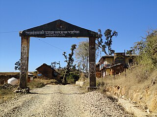
Dolpo is a high-altitude culturally Tibetan region in the upper part of the Dolpa District of western Nepal, bordered in the north by China. Part of the region lies in Shey Phoksundo National Park. The sparse, agro-pastoral population, known as Dolpo in standard Tibetan and Dhol-wa in the local dialect, is connected to the rest of Nepal via Jufal airport, which can be reached in three days by horse. There are no precise population numbers for the region, with estimates including less than 5,000 and 18,000
Dailekh District a part of Karnali Province, is one of the 77 districts of Nepal. The district, with Dailekh as its district headquarters, covers an area of 1,502 km2 (580 sq mi) and had a population of 225,201 in 2001 and 261,770 in 2011.

Dolpa District, is a district, located in Karnali Province of Nepal, It is one of the seventy-seven districts of Nepal and one of ten district of Karnali. The district, with Dunai as its district headquarters, covers an area of 7,889 km2 (3,046 sq mi) and has a population (2011) of 36,700. Dolpa is the largest district of Nepal.

Humla District (Nepali: हुम्ला जिल्ला, a part of Karnali Pradesh, is one of the seventy-seven districts of Nepal. The district, with Simikot as its district headquarters, covers an area of 5,655 km2 and has population of 50,858 as per the census of 2011. Humla is the 2nd largest district of Nepal. The Southern part and middle of Humla District is inhabited by Khas people, originating from Sinja valley, whereas the North border is mostly inhabited by Tibetans. Northern part of this district is administered by China since border skirmishes with India in 2020.
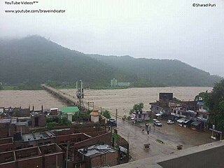
Surkhet District is the province capital of Karnali province.Surkhet is the one of the ten districts of Karnali located about 600 kilometres (373 mi) west of the national capital Kathmandu. The district's area is 2,488.64 square kilometres (960.87 sq mi)which is longest in Nepal. It had 288,527 population in 2001 and 350,804 in 2011 which male comprised 169,461 and female 181,381. It is the district headquarters of surkhet and commercial hub of the Karnali state of the new federal republic.

Karnali Zone was one of the fourteen zones located in the Mid-Western Development Region of Nepal. The headquarters of Karnali Zone was Jumla.

The Seti River is an important tributary of the Karnali system that drains western Nepal.

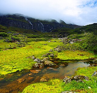
Shey Phoksundo National Park is the largest and only trans-Himalayan national park in Nepal. It was established in 1984 and covers an area of 3,555 km2 (1,373 sq mi) in the districts of Dolpa and Mugu in the Mid-Western Region, Nepal. The protected area ranges in elevation from 2,130 to 6,885 m. Phoksundo Lake is the park's prominent feature, located at an elevation of 3,612 m (11,850 ft).
Phoksundo Lake, (Nepali: फोक्सुण्डो ताल, NLK Phoksuṇḍo tāl[pʰoksuɳɖo]), is an alpine fresh water oligotrophic lake in Nepal's Shey Phoksundo National Park, located at an elevation of 3,611.5 m (11,849 ft) above sea level in the Dolpa District. Phoksundo Lake is 494 ha (1.91 sq mi) in size with a water volume of 409,000,000 m3 (1.44×10¹⁰ cu ft) and a discharge of 3.715 m3/s (131.2 cu ft/s). In 2004, a survey by the Department of Hydrology and Meteorology measured the maximum depth of the lake at 145 m (476 ft). In 2019, another detailed survey was carried out by the Department of Hydrology and Meteorology, which measured the maximum depth of the lake at 136.20 m (446.9 ft).

The following outline is provided as an overview of and topical guide to Nepal:

Saldang is a village in Dolpa District in the Karnali Zone of north-western Nepal. Saldang lies at an altitude of 3,620 metres (11,880 ft) in the Nankhang Valley, in the historic Tibetan region of Dolpo. At the time of the 1991 Nepal census, Saldang had a population of 1,714 in 386 individual households, and as of 2011 it has a population of 2,103 people.
The Barun River is a tributary of the Arun River and is part of the Kosi river system in Nepal.
West Rapti drains Rapti Zone in Mid-Western Region, Nepal, then Awadh and Purvanchal regions of Uttar Pradesh state, India before joining the Ghaghara—a major left bank tributary of the Ganges known as the Karnali inside Nepal.
The Kanjiroba Himal is an isolated part of the Himalaya range within Nepal, adjacent to the Tibetan border.

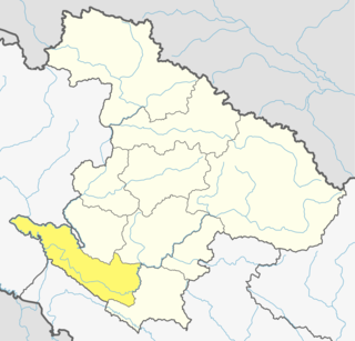
Karnali Province is one of the seven federal provinces of Nepal formed by the new constitution which was adopted on 20 September 2015. The total area of the province is 27,984 square kilometres (10,805 sq mi) covering 18.97% of the country, making it the largest province in Nepal. According to the 2011 Nepal census, the population of the province was 1,570,418, making it the least populous province in Nepal. It borders the Tibet Autonomous Region of China to the north, Gandaki Province to the east, Sudurpashchim Province to the west, and Lumbini Province to the south. Birendranagar with a population of 47,914 is both the province's capital and largest city.

The Shey Gompa is a Buddhist monastery located in the She Phoksundo rural municipality of the Dolpa district in Nepal at an elevation of 4200m. Shey Gompa means the Crystal Monastery in Tibetan. It was established in the 11th century. The monastery is considered to be the spiritual heart of Upper Dolpa.
References
- 1 2 Negi, Sharad Singh (1991). Himalayan rivers, lakes and glaciers. p. 108. ISBN 9788185182612 . Retrieved 2010-05-29.
- ↑ "Shey Phoksundo National Park". Archived from the original on 2010-05-03. Retrieved 2010-05-29.
Hydrography of Nepal | ||||||||||||
|---|---|---|---|---|---|---|---|---|---|---|---|---|
| Rivers |
| |||||||||||
| Lakes | ||||||||||||
| Glaciers | ||||||||||||
| Icefalls | ||||||||||||
| Dams, barrages | ||||||||||||
| Related topics | ||||||||||||
| Hydrography of surrounding areas | ||||||||||||
| | This article related to a river in Nepal is a stub. You can help Wikipedia by expanding it. |