
Princess Dorothea of Denmark was the Duchess of Brunswick-Lüneburg from 1561 until 1592 as the consort of Duke William the Younger. She was regent for her son George from 1592 to 1596.

Bad Colberg-Heldburg is a former municipality in the region Heldburger Land in the district of Hildburghausen, in Thuringia, Germany. It is situated 16 km south of Hildburghausen, and 18 km west of Coburg. It was created in 1993 by the merger of the former municipalities of Bad Colberg, Gellershausen, Heldburg, Holzhausen, Lindenau and Völkershausen. Since 1 January 2019, it is part of the town Heldburg.

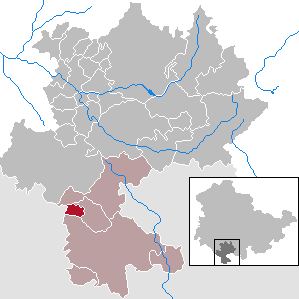
Ummerstadt is a town in the region Heldburger Land in district of Hildburghausen, in Thuringia, Germany. It is situated 19 km south of Hildburghausen, and 11 km west of Coburg.

John Casimir of Saxe-Coburg was the Duke of Saxe-Coburg. He was the descendant of the Ernestine branch of the House of Wettin. Under his rule, the residence town of Coburg prospered with many Renaissance buildings being erected that still remain today.

Westhausen is a municipality in the region Heldburger Land in the district of Hildburghausen, in Thuringia, Germany.
Hellingen is a village and a former municipality in the region Heldburger Land in the district of Hildburghausen, in Thuringia, Germany. Since 1 January 2019, it is part of the town Heldburg. It was the southernmost municipality in Thuringia, and the second-southernmost in what was formerly East Germany.
Schlechtsart is a municipality in the region Heldburger Land in the district of Hildburghausen, in Thuringia, Germany.

Schweickershausen is a municipality in the region Heldburger Land in the district of Hildburghausen, in Thuringia, Germany.
Heldburger Unterland is a Verwaltungsgemeinschaft in the district of Hildburghausen, in Thuringia, Germany. The seat of the Verwaltungsgemeinschaft is in Heldburg.

Regina von Habsburg, also known by the traditional royal title of Archduchess Regina of Austria, was a German-born Austrian social worker. She was a member of the House of Wettin by birth and married to Otto von Habsburg, the last heir of the Austro-Hungarian Empire.

Ellen Franz, also known as Helene, Baroness von Heldburg was a German pianist and actress.

Billmuthausen was a village in Germany, founded in 1340. It was destroyed by East German authorities in 1978 as it stood too close to the Inner German border, the border between the post-war states of East and West Germany. It lay in the extreme south of Thuringia in the Heldburger Land in the district of Hildburghausen, only five hundred metres away from the Thuringian-Bavarian border. In January 1965, the authorities destroyed the small village church. In September 1978, the last family left the village, after which all the buildings in the village were demolished and the land leveled.

The Heldburger Land was the historical, Saxon, administrative district (Amtsbezirk) of Heldburg and is today the southernmost part of the Free State of Thuringia and the district of Hildburghausen, between the towns of Coburg, Hildburghausen and Bad Königshofen. The region known now as the Heldburger Land is referred to administratively as the Heldburger Unterland, and sometimes in the vernacular as the Heldburger Zipfel.
The German Castle Museum is a history museum at Heldburg Fortress in the region of Heldburger Land and in the county of Hildburghausen in the German state of Thuringia.
Heldburg Fortress is a high medieval hilltop castle. In the 16th century it was rebuilt into a renaissance castle. It rises on a 405-metre-high former volcanic cone, a part of the 'Heldburger Gangschar' volcanic region, 113 metres above the town of Heldburg in the Heldburger Land, the southern tip of the district Hildburghausen in Thuringia. The Veste Heldburg, once a secondary residence and hunting lodge of the Dukes of Coburg, dominates the little town of Heldburg on the Thuringian border with Bavaria. From it can be seen across the Thuringian border the sister-castle Veste Coburg,, once the residence of the Dukes of Coburg, now located in Bavaria.

Nikolaus Gromann was an architect of the German Renaissance who served at the court of John Frederick I, Elector of Saxony. He also worked for John Frederick's descendants residing in the cities of Weimar, Gotha and Altenburg, thus spending more than 30 years in the service of the House of Wettin.
The Heldburger Gangschar is a Cenozoic volcanic system in the Franconian parts of southern Thuringia and northern Bavaria. The term Gangschar refers to the fact that few of the volcanoes have retained their characteristic topographical shape, rather their former activity can be detected by filled fissures known as Gänge. These veins are mostly oriented in south-southwest direction, their cross-section is often less than one metre wide. The Heldburger Gangschar' is named after the small settlement of Heldburg, part of the borough of Bad Colberg-Heldburg. The surrounding area, the Heldburger Land, belongs entirely to the northern part of the volcanic zone. The most impressive of the surviving volcanic cones by far are the twin peaks of the Gleichberge, 641 metres and 679 metres high, in nearby Heldburger Land.
The term Beilager, as well as the related terms Bettleite and Bettsetzung all refer to a ceremonial part of marriage as performed in Germany from the High Middle Ages to about the 19th century.

Anna of Saxony, was a Duchess of Saxe-Coburg-Eisenach by marriage to John Casimir, Duke of Saxe-Coburg-Eisenach.

Heldburg is a town and a municipality in the district of Hildburghausen, in Thuringia, in central Germany. The municipality was created with effect from 1 January 2019 by the merger of the former municipalities of Bad Colberg-Heldburg, Gompertshausen and Hellingen. It is situated 16 km south of Hildburghausen, and 18 km west of Coburg.


