
Twillingate is a town of 2,121 people located on the Twillingate Islands ("Toulinquet") in Notre Dame Bay, off the north eastern shore of the island of Newfoundland in the province of Newfoundland and Labrador, Canada. The town is about 100 kilometres (62 mi) north of Lewisporte and Gander.

Trinity North was a provincial electoral district for the House of Assembly of Newfoundland and Labrador, Canada. As of 2011, there were 8,278 eligible voters living within the district.

Grates Cove is a local service district and designated place in the Canadian province of Newfoundland and Labrador. It is the most northerly community on the Avalon Peninsula, located on the tip of the Bay de Verde Peninsula on the island of Newfoundland. Called "the Grates" by John Guy as early as 1612, the origin of the name is unknown.

Caplin Cove is a small community on the north shore of Conception Bay, Newfoundland and Labrador, Canada. It is surrounded on the north by Low Point near the end of the Bay de Verde Peninsula, and on the south by Lower Island Cove. Caplin Cove was probably named for the large body of capelin in its waters.
New Chelsea-New Melbourne-Brownsdale-Sibley's Cove-Lead Cove is a local service district and designated place in the Canadian province of Newfoundland and Labrador.
Piccadilly Slant-Abraham's Cove is a local service district and designated place in the Canadian province of Newfoundland and Labrador. It is located on the island of Newfoundland, along St. George's Bay, on the Port au Port Peninsula. The DPL consists of the fishing villages of Abraham's Cove and Piccadilly.

St. Alban's is a town of approximately 1,200 located in the Bay d'Espoir estuary on the south coast of Newfoundland, Canada. St. Alban's is the largest community in Bay d'Espoir. The town is 180 kilometres (110 mi) south of Grand Falls-Windsor.

Southport is a community in the Canadian province of Newfoundland and Labrador. It is located on the southern side of the entrance to Trinity Bay's Southwest Arm, about 41 km southeast of Clarenville. It is part of the local service district and designated place of Caplin Cove-Southport.
Keels is a small town in the Canadian province of Newfoundland and Labrador, located about 3 kilometres from Duntara. The population of this municipality in the 2016 Canadian National Census was 51. This is down from 61 in 2011 and 73 in 2006. The earlier population figures show it had 85 in 2001, 101 in 1996, 128 in 1991, 115 in 1986, 206 in 1956 and 372 in 1940.
Maberly is a tiny coastal hamlet at the end of route 238-II on the Bonavista Peninsula on the island of Newfoundland with a permanent year-round population of about 20. In the 1921 census, there were 83 inhabitants. It has long been associated with nearby Elliston, being about 3 km from Elliston Centre by road, and was officially annexed by that town in the 1960s. Driving from Elliston Centre to Maberly, you pass through Sandy Cove and the Neck.
Bay de Verde is an incorporated town in Conception Bay on the northern tip of the Bay de Verde Peninsula of Newfoundland and Labrador, Canada. The first recorded inhabitants at Bay de Verde arrived in 1662. Bay de Verde became an incorporated town in 1950.
Smith Sound is a zigzag 24 kilometre inner region of Trinity Bay. This sound is one of the longest portions of inshore waterways in Newfoundland, located on its north-eastern coast in the Canadian province of Newfoundland and Labrador. Bonavista Peninsula is to the north of the sound, while Random Island is to the south. The waters that make up the sound is a continuous channel that encircles Random Island, broken only by a narrow channel located at Clarenville where a causeway was built to provide access to the communities on Random Island. The channel on the south side of Random Island is North West Arm.
Savage Cove is a community located on the Great Northern Peninsula, north of Flower's Cove on the coast of the Strait of Belle Isle. Savage Cove is the most northerly sheltered harbour in the straits on the island of Newfoundland. In 1996, Savage Cove and nearby Sandy Cove were officially consolidated into the Town of Savage Cove - Sandy Cove.

Coachman's Cove is a town in the Canadian province of Newfoundland and Labrador. The town had a population of 111 in the Canada 2021 Census.
Trinity Bay North is a town in the Canadian province of Newfoundland and Labrador. It is located at the northern tip of Trinity Bay. It was established on January 1, 2005, through the amalgamation of several smaller communities, including Catalina, Port Union, Melrose, and Little Catalina. The town is known for its strong ties to Newfoundland's fishing heritage and its scenic coastal landscapes.

Cod fisheries are fisheries for cod. Cod is the common name for fish of the genus Gadus, belonging to the family Gadidae, and this article is confined to three species that belong to this genus: the Atlantic cod, the Pacific cod and the Greenland cod. Although there is a fourth species of the cod genus Gadus, Alaska pollock, it is commonly not called cod and therefore currently not covered here.
Southwest Arm is an inlet of Random Sound, Trinity Bay, in Newfoundland and Labrador.

Division No. 1, Subdivision G is an unorganized subdivision on the Avalon Peninsula in Newfoundland and Labrador, Canada. It is in Division 1 and contains the unincorporated communities of Baccalieu Island, Besom Cove, Bradley's Cove, Burnt Point, Caplin Cove, Daniel's Cove, Grates Cove, Gull Island, Job's Cove, Kingston, Long Beach, Lower Island Cove, Low Point, Northern Bay, Ochre Pit Cove, Red Head Cove, Riverhead, Smooth Cove and Western Bay.
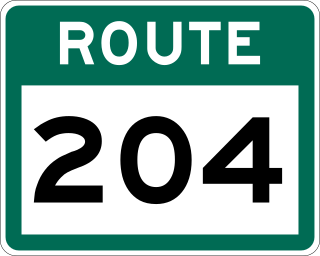
Route 204, also known as Southwest Arm Road, is a 30.5-kilometre-long (19.0 mi) east–west highway on the island of Newfoundland in the province of Newfoundland and Labrador. It connects the communities along the southern shore of the Southwest Arm of Trinity Bay with the Trans-Canada Highway at North West Brook. It is a very curvy two-lane highway traversing very hilly terrain for its entire length.
Caplin Cove-Southport is a local service district and designated place in Trinity Bay in the Canadian province of Newfoundland and Labrador. Caplin Cove-Southport is approximately 50 km from Clarenville.
