
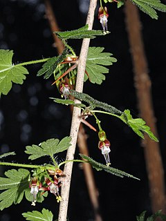
The gooseberry, with scientific names Ribes uva-crispa, is a species of Ribes.
Ribes is a genus of about 150 known species of flowering plants native throughout the temperate regions of the Northern Hemisphere. It is usually treated as the only genus in the family Grossulariaceae, but a few taxonomists place the gooseberry species in a separate genus of Grossularia. Sometimes Ribes is instead included in the family Saxifragaceae.

Gooseberry Falls State Park is a state park of Minnesota, United States, on the North Shore of Lake Superior. The park is located in Silver Creek Township, about 13 miles (21 km) northeast of Two Harbors, Minnesota in Lake County on scenic Minnesota Highway 61. The park surrounds the mouth of the Gooseberry River and includes Upper, Middle and Lower Gooseberry Falls.

Franklin Creek State Natural Area is an Illinois state park on 664 acres (269 ha) in Lee County, Illinois, United States. Franklin Creek State Natural Area was dedicated in 1982, making it the 24th nature preserve in Illinois.

Coyote Creek is a principal tributary of the San Gabriel River in northwest Orange County, southeast Los Angeles County, and southwest Riverside County, California. It drains a land area of roughly 41.3 square miles (107 km2) covering five major cities, including Brea, Buena Park, Fullerton, La Habra, and La Palma. Some major tributaries of the creek in the highly urbanized watershed include Brea Creek, Fullerton Creek, and Carbon Creek. The mostly flat creek basin is separated by a series of low mountains, and is bounded by several small mountain ranges, including the Chino Hills, Puente Hills and West Coyote Hills.
Skunk Creek is a 12.3-mile-long (19.8 km) stream in Lake County, Minnesota, United States. It is a tributary of the Gooseberry River.
Wyoming Highway 431 is a 30.19-mile (48.6 km) Wyoming state road in western Washakie County and a small part of northern Hot Springs County. Highway 431 is locally named Gooseberry Creek Road for Gooseberry Creek which it follows for most of its routing.

Gooseberry River is a 23-mile stream in Lake County, Minnesota, USA, draining into Lake Superior. It is known for its waterfalls, near its mouth in Gooseberry Falls State Park. The Gooseberry, like many of its neighboring streams, has an irregular discharge highly dependent on runoff from rain and snow melt. The region around the river was heavily forested and much logging took place during the early 20th century. The forest has since regrown and the falls and mouth of the river are now a thriving tourist destination.
The Canajoharie Creek flows into the Mohawk River in the village of Canajoharie, New York. The name "Canajoharie" is said to be a Mohawk language term meaning "the pot that washes itself," referring to the "Canajoharie Boiling Pot," a circular gorge in the Canajoharie Creek, just south of the village of Canajoharie, New York.
The Nowadaga Creek basin drains portions of the towns of Danube, Stark, and Little Falls, as well as a small portion of the town of Warren, in southern Herkimer County before converging with the Mohawk River in Indian Castle, New York. The drainage basin is approximately 49 percent forested. The creek has an average slope of 1.7 percent over its entire stream length of 10.0 miles. On a 1790 land patent map it is spelled "Inchanando Creek".
Moyer Creek starts at Wheelock Pond near Jerusalem Hill, New York. Past Gulph, New York Moyer Creek follows a deep ravine, the Frankfort Gorge, south towards Frankfort, New York before converging with the Mohawk River in Frankfort, New York. The headwaters of Moyer Creek rise within a half mile of the source of the Unadilla River which is the most northerly headwater source of the Susquehanna and the closest to the Mohawk River.
The Caroga Creek starts at the East Caroga Lake and flows south passing through Rockwood Lake before converging with the Mohawk River in Palatine Church, New York.
The Cobleskill Creek starts at the mouth of the Schenevus Creek in Richmondville, New York. It flows through Cobleskill, New York before converging with the Schoharie Creek in Central Bridge, New York.

The Schenevus Creek is a river located in southern Otsego County, New York. The creek flows through Worcester and Schenevus before converging with the Susquehanna River in Colliersville, New York.
Panther Mountain is a mountain located in Central New York of New York near Fly Creek, New York and Schuyler Lake, New York. The east side of Panther Mountain drains into Fly Creek and the west side drains into Oaks Creek and Canadarago Lake.
Gifford Hill is a small mountain chain in the Central New York Region of New York. It is located northeast of Oneonta, New York. It is made of three main peaks the highest being 1928 feet. Gifford Hill is named for the Gifford Family who moved to the area in 1803 and settled along the Oneonta Creek on what is now called Gifford Hill.
