
North Brabant, also unofficially called Brabant, is a province in the south of the Netherlands. It borders the provinces of South Holland and Gelderland to the north, Limburg to the east, Zeeland to the west, and the Flemish provinces of Antwerp and Limburg to the south. The northern border follows the Meuse westward to its mouth in the Hollands Diep strait, part of the Rhine–Meuse–Scheldt delta. North Brabant had a population of about 2,626,000 as of January 2023. Major cities in North Brabant are Eindhoven, Tilburg, Breda, its provincial capital 's-Hertogenbosch, and Helmond

The geography of France consists of a terrain that is mostly flat plains or gently rolling hills in the north and west and mountainous in the south and the east. Metropolitan France has a total size of 551,695 km2 (213,011 sq mi). It is the third largest country in Europe by area and the largest in Western Europe.

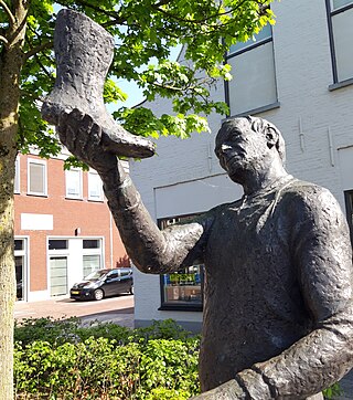
Hilvarenbeek is a municipality and a town in the south of the Netherlands, along the border with Belgium.

Orvon Grover "Gene" Autry, nicknamed the Singing Cowboy, was an American actor, musician, singer, composer, rodeo performer, and baseball team owner, who largely gained fame by singing in a crooning style on radio, in films, and on television for more than three decades, beginning in the early 1930s. During that time, he personified the straight-shooting hero — honest, brave, and true.
This is a list of the extreme points of the United Kingdom: the points that are farther north, south, east or west than any other location. Traditionally the extent of the island of Great Britain has stretched "from Land's End to John o' Groats".

This is a list of the extreme points of Ireland – the points that are furthest north, south, east or west in Ireland. It includes the Republic of Ireland and Northern Ireland.

The Taff Trail is a walking and cycle path that runs for 55 miles (89 km) between Cardiff Bay and Brecon in Wales. It is so named because it follows the course of the River Taff. Along much of its length, it follows the National Cycle Network Route 8 that continues to Holyhead, and is substantially off-road.

Johannes Goropius Becanus, born Jan Gerartsen, was a Dutch physician, linguist, and humanist.
Berezovo or Beryozovo (Берёзово) is the name of several inhabited localities in Russia. The name is derived from the Russian береза (bereza), "birch."

Ochagavía or Otsagabia is a town and municipality in the province and autonomous community of Navarre, northern Spain. It is situated in the north of the Valley of Salazar, near the Irati Forest and not far from the border with France.
Sesma is a town and municipality located in the province and autonomous community of Navarre, northern Spain. It was the scene of action between Liberals under Narciso Lopez, and Carlists under Mendiry, during the First Carlist War, on 5th. November 1834 following the Carlist victory at Vitoria.
Adventure is a village located in the Pomeroon-Supenaam Region of Guyana, on the Atlantic coast, at sea level, one mile south of Onderneeming.

For other towns with a similar name see Dąbrowica (disambiguation)

Center Parcs UK and Ireland is a short-break holiday company that operates six holiday villages in the United Kingdom and Republic of Ireland, with each covering about 400 acres (1.6 km2) of woodland. The company's first village opened at Sherwood Forest, Nottinghamshire, in 1987 and its sixth, at Longford Forest, Ireland, opened in 2019.
Kaatsheuvel is a town in the province of North Brabant, Netherlands situated along highways N261 and N628. With a population of roughly 16,600, it is the largest town in and the capital of the municipality of Loon op Zand, which also consists of the villages of De Moer and Loon op Zand.

Torrecilla de la Abadesa is a municipality located in the province of Valladolid, Castile and León, Spain. According to the 2004 census (INE), the municipality has a population of 326 inhabitants.
Sadad is a coastal village situated on the western shore of Bahrain. It is situated to the south of Malkiya and to the west of Hamad Town, in the Northern Governorate administrative region of the country.
Chelapur is a village and gram panchayat in Chandpur tehsil, Bijnor District, in the Indian state of Uttar Pradesh.

The Vadagam State was a 5th Class princely state belonging to the Mahi Kantha Agency of the Bombay Presidency during the era of the British Raj. It had its capital in Vadgam taluk, Banaskantha district of present-day Gujarat State. Wadagam State's last ruler signed the accession to join the Indian Union in 1948.