The land of Goshen is the Hebrew name of an area in the Nile delta in Ancient Egypt.

Emery County is a county in east-central Utah, United States. As of the 2010 United States Census, the population was 10,976. Its county seat is Castle Dale, and the largest city is Huntington.

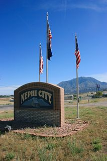
Juab County is a county in western Utah, United States. As of the 2010 United States Census, the population was 10,246. Its county seat and largest city is Nephi.

Millard County is a county in the U.S. state of Utah. As of the 2010 United States Census, the population was 12,503. Its county seat is Fillmore, and the largest city is Delta.
Piute County is a county in south-central Utah, United States. As of the 2010 United States Census, the population was 1,556, making it the second-least populous county in Utah. The county seat is Junction, and the largest town is Circleville.
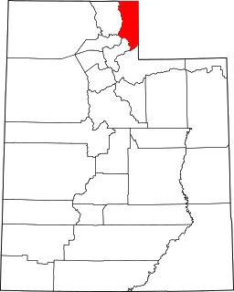
Rich County is a county in the U.S. state of Utah. As of the 2010 United States Census, the population was 2,264, making it the third-least populous county in Utah. Its county seat is Randolph, and the largest town is Garden City. The county was created in 1864. It was named for an early LDS apostle, Charles C. Rich.

Summit County is a county in the U.S. state of Utah, occupying a rugged and mountainous area. As of the 2010 United States Census, the population was 36,324. Its county seat is Coalville, and the largest city is Park City.

Elberta is a census-designated place (CDP) in Utah County, Utah, United States. It is part of the Provo–Orem Metropolitan Statistical Area. The population was 256 at the 2010 census. It was founded as Mt. Nebo. After the water failed in 1901 most of the early settlers moved away. It was purchased by Matthew B. Whitney, a native of New York, on November 7, 1907, and he renamed it "Elberta" after the peach cultivar.
Goshen is a town in Utah County, Utah, United States. It is part of the Provo–Orem Metropolitan Statistical Area. The population was 921 at the 2010 census.

John Williams Gunnison was an American military officer and explorer.

Utah Valley is a valley in North Central Utah located in Utah County, and is considered part of the Wasatch Front. It contains the cities of Provo, Orem, and their suburbs, including Alpine, American Fork, Cedar Hills, Elberta, Elk Ridge, Genola, Goshen, Highland, Lehi, Lindon, Mapleton, Payson, Pleasant Grove, Salem, Santaquin, Saratoga Springs, Spanish Fork, Springville, Vineyard and Woodland Hills. It is known colloquially as "Happy Valley".

Jordanelle Reservoir is a reservoir in Wasatch County, Utah, United States, just north of Heber City.

The Price River is a river in eastern Utah, United States.
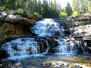
The Provo River is located in Utah County and Wasatch County, Utah, in the United States. It rises in the Uinta Mountains at Wall Lake and flows about 71 miles (114 km) southwest to Utah Lake at the city of Provo, Utah.
The Phillips-Williams Fork Reservoir site (5GA1955) is a Paleoindian site located on the shore of the Williams Fork Reservoir, about 20 kilometers (12 mi) southeast of Kremmling at an elevation of 2400 m (7874 ft.) in Grand County, Colorado, near the center of Middle Park.
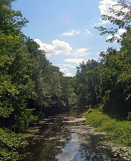
Otter Kill is a 16.0-mile-long (25.7 km) tributary of Moodna Creek that flows through central Orange County, New York, in the United States. Via the Moodna, which it forms at a confluence with Cromline Creek north of the village of Washingtonville, its waters eventually reach the Hudson River.

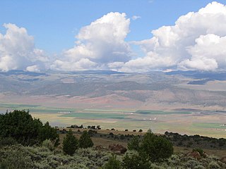
The Goshen Valley is a 17-mile-long (27 km) valley located in southern Utah County, Utah, and the valley forms part of its southeast border with the Wasatch Front, and parts of the Wasatch Range. The valley is an extension southwesterly of the Utah Valley.
The Juab Valley is a 40-mile (64 km) long valley located on the eastern edge of Juab County, Utah, United States.

Currant Creek is a stream in eastern Juab County and southern Utah County in northern Utah, United States.

