The Ore Mountains lie along the Czech–German border, separating the historical regions of Bohemia in the Czech Republic and Saxony in Germany. The highest peaks are the Klínovec in the Czech Republic at 1,244 metres (4,081 ft) above sea level and the Fichtelberg in Germany at 1,215 metres (3,986 ft).

Chatterley Whitfield Colliery is a disused coal mine on the outskirts of Chell, Staffordshire in Stoke on Trent, England. It was the largest mine working the North Staffordshire Coalfield and was the first colliery in the UK to produce one million tons of saleable coal in a year.

The Upper Harz Water Regale is a system of dams, reservoirs, ditches and other structures, much of which was built from the 16th to 19th centuries to divert and store the water that drove the water wheels of the mines in the Upper Harz region of Germany. The term regale, here, refers to the granting of royal privileges or rights in this case to permit the use of water for mining operations in the Harz mountains of Germany.

Mining in the Upper Harz region of central Germany was a major industry for several centuries, especially for the production of silver, lead, copper, and, latterly, zinc as well. Great wealth was accumulated from the mining of silver from the 16th to the 19th centuries, as well as from important technical inventions. The centre of the mining industry was the group of seven Upper Harz mining towns of Clausthal, Zellerfeld, Sankt Andreasberg, Wildemann, Grund, Lautenthal und Altenau.
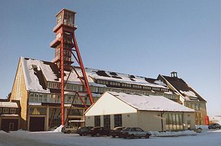
The Samson Pit or Samson Mine is an historic silver mine in Sankt Andreasberg in the Upper Harz region of central Germany.

A Kunstteich is an historic German term for a man-made lake or pond associated with the mining industry and its technology. These ponds were created by the construction of barriers, typically dams and embankments, and were used to supply hydropower and water to the mines. Water stored in the reservoir was used for a variety of purposes. It was used to turn water wheels that in turn drove the various mechanical devices used in mining in earlier centuries, such as man engines. It was also used to produce power and drain the mines, or in the processing of ore. In principle, all Kunstteiche are small dam and reservoir installations. The oldest working dams in Germany are Kunstteiche.

A Kunstgraben is a type of man-made water channel that was once used by mines to drive the water wheels needed for power, mine drainage and a host of other purposes. The term is German. Similar ditches supplying water mills in England are called leats.

Within the Lower Harz region are still many traces of the historical water management facilities used by the mining industry. In addition to water-carrying ditches and ponds, there are also long-abandoned ditches and dry pond beds. The Lower Harz Pond and Ditch System, which forms the major part of these old water management facilities, lies in the central Lower Harz, almost entirely within the borough of the present-day town of Harzgerode.
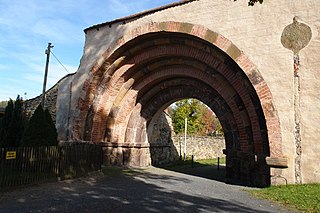
The Revierwasserlaufanstalt Freiberg or RWA Freiberg, was a historical water management system that delivered driving water to the Freiberg mines in the time of the German Electorate and later Kingdom of Saxony. Today the system is used to supply drinking and industrial water and is operated by the Saxony State Reservoir Office.
The Ore Mountain Mining Region is an industrial heritage landscape, over 800 years old, in the border region of the Ore Mountains between the German state of Saxony and North Bohemia in the Czech Republic. It is characterised by a plethora of historic, largely original, monuments to technology, as well as numerous individual monuments and collections related to the historic mining industry of the region. On 6 July 2019, the Erzgebirge/Krušnohoří Mining Region was inscribed as a UNESCO World Heritage Site, because of its exceptional testimony to the advancement of mining technology over the past 800 years.
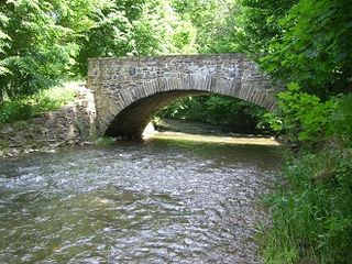
The Bobritzsch is a river of Saxony, Germany. It is a right tributary of the Freiberger Mulde with a length of about 38 km (24 mi). Its Gewässerkennzahl is 5422.
Altzella Abbey, also Altzelle Abbey, is a former Cistercian monastery near Nossen in Saxony, Germany. The former abbey contains the tombs of the Wettin margraves of Meissen from 1190 to 1381.
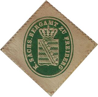
The Saxon Mining Office is the executive authority for mining rights in the German state of Saxony. It is also responsible for all non-metallic mineral resources on the terrain of the former East Germany.
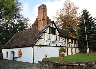
The Freibergsdorf Hammer Mill is an old hammer works that was used for metalworking in the village of Freibergsdorf in the German Ore Mountains. The site represents an important witness to proto-industrial development in the Ore Mountains. Of the once-numerous hammer mills, only three others remain working in Saxony: the Frohnauer Hammer, the Dorfchemnitz Iron Hammer Mill, and the Grünthal Copper Hammer Mill.
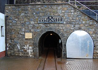
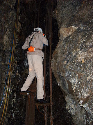
Drei Kronen & Ehrt is a former mine in the Harz Mountains of central Germany. It is located in the parish of Elbingerode in the county of Harz (Saxony-Anhalt). The mine extracted pyrite. Since 1992 it has been used, albeit not continuously, as a visitor mine.

The Maaßener Gaipel is a pub catering for day trippers on the northeastern hillside of the Kranichsberg at a height of 420 m above NN, situated above the mining town of Lautenthal in the Harz Mountains of central Germany. The name goes back to the above-ground workings of the Maaßener Treibschacht or Maaßen Hoisting Shaft 51°51′49″N10°17′25″E, which was located immediately east of the inn. Gaipel is a common expression in the Upper Harz for a headframe and goes back to the use of a horse whim which in German is a Pferdegöpel. Whims were used to transport men and materiel up and down mineshafts, for example using man engines, and also to operate water management equipment. Maaßen is shorthand for the name of the local pit which was the Grube Zweite, Dritte, Vierte, Fünfte und Sechste Maß nach der Sachsenzeche. Maaß, also variously spelt Maaß, Maas or Mas, is a unit of length for a pit field (Grubenfeld) and in mining in the Upper Harz measured 28 Lachter or 53.8 metres. The pub was built in 1924 on the initiative of the Harz Club on the terrain of the old mine shaft. But decades before the area had already become a popular destination with walkers due to its views of the mining town and the valley of the Laute.

Siebenlehn is a district of the town Großschirma in Landkreis Mittelsachsen. Until 2003 it was a separate town. Upon fusion with the neighbouring rural municipality Großschirma on 1 September 2003, the town privileges were transferred to the joint municipality.

Reinsberg Castle is a castle in the village Reinsberg in Mittelsachsen district of Saxony.

August von Herder was a German geologist and mineralogist. From 1813 he served in a succession of increasingly senior posts in the Saxon government mines service, ending up in 1826 as government mining director ("Berghauptmann"). He was an energetic and highly effective moderniser of the Saxon mining industry.

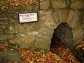
The Dorothea-Stolln, also known as Himmlisch Heer Fundgrube Dorothea, is a former underground mine in Cunersdorf near Annaberg-Buchholz in Germany. Today, it is a visitor mine with a length of 53 km and a constant temperature of 8 °C. The Upper Saxon word Stolln means an adit, the German word Fundgrube was used to describe the pit that was the first to be awarded on a newly discovered field.