Wolica is a village in Poland located in Lesser Poland Voivodeship, in Bochnia County, in Gmina Łapanów. It had a population of 230 in 2005. It lies approximately 3 kilometres (2 mi) west of Łapanów, 19 km (12 mi) south-west of Bochnia, and 33 km (21 mi) south-east of the regional capital Kraków.
Gierczyce is a village in the administrative district of Gmina Bochnia, within Bochnia County, Lesser Poland Voivodeship, in southern Poland. It lies approximately 7 kilometres (4 mi) west of Bochnia and 32 km (20 mi) east of the regional capital Kraków.

Boczów is a village in the administrative district of Gmina Łapanów, within Bochnia County, Lesser Poland Voivodeship, in southern Poland. It lies approximately 2 kilometres (1 mi) south of Łapanów, 18 km (11 mi) south-west of Bochnia, and 35 km (22 mi) south-east of the regional capital Kraków.
Brzezowa is a village in the administrative district of Gmina Łapanów, within Bochnia County, Lesser Poland Voivodeship, in southern Poland. It lies approximately 17 kilometres (11 mi) south-west of Bochnia and 34 km (21 mi) south-east of the regional capital Kraków.
Chrostowa is a village in the administrative district of Gmina Łapanów, within Bochnia County, Lesser Poland Voivodeship, in southern Poland. It lies approximately 6 kilometres (4 mi) north of Łapanów, 12 km (7 mi) south-west of Bochnia, and 32 km (20 mi) south-east of the regional capital Kraków.
Cichawka is a village in the administrative district of Gmina Łapanów, within Bochnia County, Lesser Poland Voivodeship, in southern Poland. It lies approximately 6 kilometres (4 mi) east of Łapanów, 13 km (8 mi) south-west of Bochnia, and 37 km (23 mi) south-east of the regional capital Kraków.
Kamyk is a village in the administrative district of Gmina Łapanów, within Bochnia County, Lesser Poland Voivodeship, in southern Poland. It lies approximately 4 kilometres (2 mi) north of Łapanów, 13 km (8 mi) south-west of Bochnia, and 33 km (21 mi) south-east of the regional capital Kraków.

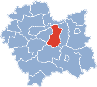
Łapanów is a village in Bochnia County, Lesser Poland Voivodeship, in southern Poland. It is the seat of the gmina called Gmina Łapanów. It lies approximately 17 kilometres (11 mi) south-west of Bochnia and 34 km (21 mi) south-east of the regional capital Kraków.
Lubomierz is a village in the administrative district of Gmina Łapanów, within Bochnia County, Lesser Poland Voivodeship, in southern Poland. It lies approximately 3 kilometres (2 mi) west of Łapanów, 18 km (11 mi) south-west of Bochnia, and 32 km (20 mi) south-east of the regional capital Kraków.

Sobolów is a village in the administrative district of Gmina Łapanów, within Bochnia County, Lesser Poland Voivodeship, in southern Poland. It lies approximately 7 kilometres (4 mi) north-east of Łapanów, 10 km (6 mi) south-west of Bochnia, and 34 km (21 mi) south-east of the regional capital Kraków.
Tarnawa is a village in the administrative district of Gmina Łapanów, within Bochnia County, Lesser Poland Voivodeship, in southern Poland. It lies approximately 4 kilometres (2 mi) south of Łapanów, 20 km (12 mi) south-west of Bochnia, and 37 km (23 mi) south-east of the regional capital Kraków. The village is also 62 km (39 mi) south-west away from the Tarnów City. Tarnawa had previously been in the Tarnów Voivodeship (1975–1998).
Ubrzeż is a village in the administrative district of Gmina Łapanów, within Bochnia County, Lesser Poland Voivodeship, in southern Poland. It lies approximately 3 kilometres (2 mi) east of Łapanów, 15 km (9 mi) south-west of Bochnia, and 36 km (22 mi) south-east of the regional capital Kraków.

Wieruszyce is a village in the administrative district of Gmina Łapanów, within Bochnia County, Lesser Poland Voivodeship, in southern Poland. It lies approximately 3 kilometres (2 mi) south-east of Łapanów, 17 km (11 mi) south-west of Bochnia, and 36 km (22 mi) south-east of the regional capital Kraków.
Wola Wieruszycka is a village in the administrative district of Gmina Łapanów, within Bochnia County, Lesser Poland Voivodeship, in southern Poland. It lies approximately 3 kilometres (2 mi) north-east of Łapanów, 14 km (9 mi) south-west of Bochnia, and 34 km (21 mi) south-east of the regional capital Kraków.
Zbydniów is a village in the administrative district of Gmina Łapanów, within Bochnia County, Lesser Poland Voivodeship, in southern Poland. It lies approximately 4 kilometres (2 mi) south of Łapanów, 19 km (12 mi) south-west of Bochnia, and 38 km (24 mi) south-east of the regional capital Kraków.
Majdan Sitaniecki is a village in the administrative district of Gmina Stary Zamość, within Zamość County, Lublin Voivodeship, in eastern Poland. It lies approximately 9 kilometres (6 mi) north-east of Stary Zamość, 15 km (9 mi) north of Zamość, and 66 km (41 mi) south-east of the regional capital Lublin.
Niskie Wielkie is a village in the administrative district of Gmina Chorzele, within Przasnysz County, Masovian Voivodeship, in east-central Poland. It lies approximately 4 kilometres (2 mi) north-west of Chorzele, 28 km (17 mi) north of Przasnysz, and 117 km (73 mi) north of Warsaw.
Morawin is a village in the administrative district of Gmina Ceków-Kolonia, within Kalisz County, Greater Poland Voivodeship, in west-central Poland. It lies approximately 5 kilometres (3 mi) south-west of Ceków-Kolonia, 17 km (11 mi) north-east of Kalisz, and 111 km (69 mi) south-east of the regional capital Poznań.
Krosno is a village in the administrative district of Gmina Wągrowiec, within Wągrowiec County, Greater Poland Voivodeship, in west-central Poland. It lies approximately 8 kilometres (5 mi) north-east of Wągrowiec and 56 km (35 mi) north-east of the regional capital Poznań.