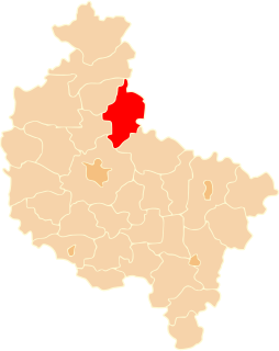
Wąbnice is a village in the administrative district of Gmina Krośnice, within Milicz County, Lower Silesian Voivodeship, in south-western Poland. Prior to 1945 it was in Germany. It lies approximately 5 kilometres (3 mi) north-west of Krośnice, 6 km (4 mi) south-east of Milicz, and 47 km (29 mi) north-east of the regional capital Wrocław.

Będzitówek is a village in the administrative district of Gmina Złotniki Kujawskie, within Inowrocław County, Kuyavian-Pomeranian Voivodeship, in north-central Poland. It lies approximately 7 kilometres (4 mi) west of Złotniki Kujawskie, 21 km (13 mi) north-west of Inowrocław, and 22 km (14 mi) south of Bydgoszcz.

Żurawia is a village in the administrative district of Gmina Kcynia, within Nakło County, Kuyavian-Pomeranian Voivodeship, in north-central Poland. It lies approximately 3 kilometres (2 mi) south-east of Kcynia, 20 km (12 mi) south of Nakło nad Notecią, and 38 km (24 mi) south-west of Bydgoszcz.

Malina is a village in the administrative district of Gmina Piotrków Kujawski, within Radziejów County, Kuyavian-Pomeranian Voivodeship, in north-central Poland. It lies approximately 7 kilometres (4 mi) south-east of Piotrków Kujawski, 16 km (10 mi) south of Radziejów, and 60 km (37 mi) south of Toruń.
Pałecznica-Kolonia is a village in the administrative district of Gmina Niedźwiada, within Lubartów County, Lublin Voivodeship, in eastern Poland.

Łyszkowice-Kolonia is a village in the administrative district of Gmina Łyszkowice, within Łowicz County, Łódź Voivodeship, in central Poland. It lies approximately 15 kilometres (9 mi) south of Łowicz and 38 km (24 mi) north-east of the regional capital Łódź.
Klimowice is a village in the administrative district of Gmina Tomaszów Lubelski, within Tomaszów Lubelski County, Lublin Voivodeship, in eastern Poland.

Zielone is a village in the administrative district of Gmina Krasnobród, within Zamość County, Lublin Voivodeship, in eastern Poland. It lies approximately 9 kilometres (6 mi) south-east of Krasnobród, 25 km (16 mi) south of Zamość, and 98 km (61 mi) south-east of the regional capital Lublin.

Szczypiorno is a village in the administrative district of Gmina Pomiechówek, within Nowy Dwór Mazowiecki County, Masovian Voivodeship, in east-central Poland. It lies approximately 8 kilometres (5 mi) north of Nowy Dwór Mazowiecki and 39 km (24 mi) north-west of Warsaw.
Natolin is a village in the administrative district of Gmina Osieck, within Otwock County, Masovian Voivodeship, in east-central Poland.

Strzyże is a village in the administrative district of Gmina Mszczonów, within Żyrardów County, Masovian Voivodeship, in east-central Poland. It lies approximately 7 kilometres (4 mi) south-east of Mszczonów, 17 km (11 mi) south-east of Żyrardów, and 45 km (28 mi) south-west of Warsaw.

Łomnica-Folwark is a settlement in the administrative district of Gmina Trzcianka, within Czarnków-Trzcianka County, Greater Poland Voivodeship, in west-central Poland. It lies approximately 7 kilometres (4 mi) north of Trzcianka, 24 km (15 mi) north of Czarnków, and 84 km (52 mi) north of the regional capital Poznań.
Czarny Las is a settlement in the administrative district of Gmina Krzemieniewo, within Leszno County, Greater Poland Voivodeship, in west-central Poland.

Papiernia is a village in the administrative district of Gmina Włoszakowice, within Leszno County, Greater Poland Voivodeship, in west-central Poland. It lies approximately 6 kilometres (4 mi) west of Włoszakowice, 21 km (13 mi) west of Leszno, and 69 km (43 mi) south-west of the regional capital Poznań.

Lipienica is a village in the administrative district of Gmina Ośno Lubuskie, within Słubice County, Lubusz Voivodeship, in western Poland. It lies approximately 5 kilometres (3 mi) north of Ośno Lubuskie, 27 km (17 mi) north-east of Słubice, and 37 km (23 mi) south-west of Gorzów Wielkopolski.

Piaseczno is a village in the administrative district of Gmina Potęgowo, within Słupsk County, Pomeranian Voivodeship, in northern Poland. It lies approximately 7 kilometres (4 mi) west of Potęgowo, 24 km (15 mi) east of Słupsk, and 82 km (51 mi) west of the regional capital Gdańsk.

Grąsino is a village in the administrative district of Gmina Słupsk, within Słupsk County, Pomeranian Voivodeship, in northern Poland. It lies approximately 9 kilometres (6 mi) north-east of Słupsk (Stolp) and 98 km (61 mi) west of the regional capital Gdańsk (Danzig).
Kadzie is a village in the administrative district of Gmina Małdyty, within Ostróda County, Warmian-Masurian Voivodeship, in northern Poland.

Nawino is a village in the administrative district of Gmina Białogard, within Białogard County, West Pomeranian Voivodeship, in north-western Poland. It lies approximately 9 kilometres (6 mi) south of Białogard and 108 km (67 mi) north-east of the regional capital Szczecin.
Kleszcze is a village in the administrative district of Gmina Ińsko, within Stargard County, West Pomeranian Voivodeship, in north-western Poland.


