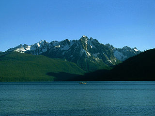
Grand Arc | |
---|---|
Le Grand Arc | |
Highest point | |
Elevation | 2,484 m (8,150 ft) |
Prominence | 693 m (2,274 ft) [1] |
Coordinates | 45°33′59″N06°21′53″E / 45.56639°N 6.36472°E Coordinates: 45°33′59″N06°21′53″E / 45.56639°N 6.36472°E |
Geography | |
Location | Savoie, France |
Parent range | Vanoise Massif |
Grand Arc is a mountain of Savoie, France. It lies in the Massif de la Vanoise range. It has an elevation of 2,484 metres above sea level.
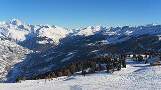
Savoie is a department in the Auvergne-Rhône-Alpes region of France. Its prefecture is Chambéry; it is located in the French Alps. In 2016, it had a population of 429,681.
France, officially the French Republic, is a sovereign state whose territory consists of metropolitan France in Western Europe and several overseas regions and territories. The metropolitan area of France extends from the Mediterranean Sea to the English Channel and the North Sea, and from the Rhine to the Atlantic Ocean. It is bordered by Belgium, Luxembourg and Germany to the northeast, Switzerland and Italy to the east, and Andorra and Spain to the south. The overseas territories include French Guiana in South America and several islands in the Atlantic, Pacific and Indian oceans. The country's 18 integral regions span a combined area of 643,801 square kilometres (248,573 sq mi) and a total population of 67.0 million. France is a unitary semi-presidential republic with its capital in Paris, the country's largest city and main cultural and commercial centre. Other major urban areas include Lyon, Marseille, Toulouse, Bordeaux, Lille and Nice.
Arc Dome is the highest mountain of the Toiyabe Range in northwestern Nye County, Nevada, United States. It is the thirteenth-highest mountain in the state. Arc Dome also ranks as the second-most topographically prominent peak in Nye County and the eighth-most prominent peak in the state. The peak is located about 53 miles (85 km) north of the community of Tonopah, within the Arc Dome Wilderness of the Humboldt-Toiyabe National Forest.
Cloudveil Dome is located in the Teton Range, Grand Teton National Park, Wyoming, immediately southeast of Grand Teton. The peak is in the central portions of the range, immediately east of South Teton and is sometimes considered to be part of what is collectively known as the Cathedral Group. Cloudveil Dome rises to the south of Garnet Canyon. The peak has a variety of mountaineering routes but since it is near to more popular climbing zones, it is often overlooked.
Nez Perce Peak is located in the Teton Range, Grand Teton National Park, Wyoming, immediately southeast of Grand Teton. The peak is in the central portions of the range, immediately east of Cloudveil Dome and is sometimes considered to be part of what is collectively known as the Cathedral Group. Nez Perce rises to the south of Garnet Canyon and is a dramatic peak that dominates the skyline to the west of Bradley and Taggart Lakes. When viewed from the western section of Jackson Hole, Nez Perce often obscures the view of Cloudveil Dome as well as South Teton, even though both summits are higher.
The Wall is located in the Teton Range in the U.S. state of Wyoming, running for more than 4 miles (6.4 km) along the western border of Grand Teton National Park. The peak is on the border of Grand Teton National Park and the Jedediah Smith Wilderness of Caribou-Targhee National Forest. This high point, near the northern terminus of the cliff, is 1 mile (1.6 km) WSW of South Teton and overlooks Snowdrift Lake.
Shadow Peak is located in the Teton Range, within Grand Teton National Park, U.S. state of Wyoming. Shadow Peak is just southeast of Nez Perce Peak and rises to the north above Avalanche Canyon.
Veiled Peak is located in the Teton Range, within Grand Teton National Park, U.S. state of Wyoming. Veiled Peak is west of Mount Wister and rises to the south above Snowdrift Lake.
Prospectors Mountain is located in the Teton Range, Grand Teton National Park in the U.S. state of Wyoming. Prospectors Mountain rises to the south above Rimrock Lake and Death Canyon.
The Grand Mogul, at 9,733 feet (2,967 m) above sea level is a peak in the Sawtooth Range of Idaho. The peak is located in the Sawtooth Wilderness of Sawtooth National Recreation Area in Custer County. The peak is located 0.95 mi (1.53 km) north-northwest of Little Decker, its line parent. The Grand Mogul is at the southwest end of Redfish Lake and 1.7 mi (2.7 km) southeast of Mount Heyburn.
This Savoie geographical article is a stub. You can help Wikipedia by expanding it. |