
This article provides a breakdown of the transportation options available in Cameroon. These options are available to citizens and tourists such as railways, roadways, waterways, pipelines, and airlines. These avenues of transport are used by citizens for personal transportation, of goods, and by tourists for both accessing the country and traveling.

Modes of transport in the Central African Republic include road, water, and air. Most of the country is connected to the road network, but not all of it. Some roads in the country do not connect to the rest of the national road network and may become impassable, especially during heavy monsoon rain. Many remote areas that not connected to the country's road network, especially in the eastern part of the country outside of the major cities and towns, can only be reached by light aircraft, boat or on foot. Most roads are unpaved, and which centres on the routes nationales identified as RN1 to RN11. Bangui serves as a seaport, and 900 km of inland waterways are navigable, the main route being the Oubangui river. There is one international airport at Bangui-Mpoko, two other paved airports, and over 40 with unpaved runways.
Modes of transport in Gabon include rail, road, water and air. The one rail link, the Trans-Gabon Railway, connects the port of Owendo with the inland town of Franceville. While most of the country is connected by roads, not all areas are accessible. Much of the road network remains unpaved, and it primarily revolves around seven "national routes" labeled N1 through N7. The largest seaports are Port-Gentil and the newer Owendo, and 1,600 km of inland waterways are navigable. There are three international airports, eight other paved airports, and over 40 with unpaved runways. Nearly 300 km of pipelines carry petroleum products, mainly crude oil.

The Welland Canal is a ship canal in Ontario, Canada, and part of the St. Lawrence Seaway and Great Lakes Waterway. The canal traverses the Niagara Peninsula between Port Weller on Lake Ontario, and Port Colborne on Lake Erie, and was erected because the Niagara River—the only natural waterway connecting the lakes—was unnavigable due to Niagara Falls. The Welland Canal enables ships to ascend and descend the Niagara Escarpment, and has followed four different routes since it opened.

The Shropshire Union Canal, sometimes nicknamed the "Shroppie", is a navigable canal in England. The Llangollen and Montgomery canals are the modern names of branches of the Shropshire Union (SU) system and lie partially in Wales.
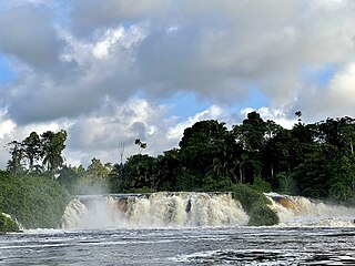
Makokou is the regional capital of the Ogooué-Ivindo province in Gabon. Its coordinates are 0°34′N12°52′E. Its altitude is 308 m. Its population in 2004 is around 16,600.
This article lists extreme locations on Earth that hold geographical records or are otherwise known for their geophysical or meteorological superlatives. All of these locations are Earth-wide extremes; extremes of individual continents or countries are not listed.

The A417 is a main road in England, running from Streatley, Berkshire to Hope under Dinmore, Herefordshire. It is best known for its section between Cirencester and Gloucester where it has primary status and forms part of the link between the major settlements of Swindon and Gloucester.

The Trans-Australian Railway, opened in 1917, runs from Port Augusta in South Australia to Kalgoorlie in Western Australia, crossing the Nullarbor Plain in the process. As the only rail freight corridor between Western Australia and the eastern states, the line is economically and strategically important. The railway includes the world's longest section of completely straight track.
Mbalam is a place in Cameroon near the southern border with the Republic of the Congo where there are significant deposits of iron ore. The mining company is Sundance Resources Limited.

Rail transport in Cameroon is primarily operated by Camrail, a subsidiary of Bolloré Africa Logistics.
Lolabé is a small coastal town in Cameroon. It lies on the Atlantic Ocean, about halfway between Kribi and the border with Equatorial Guinea.

The Grand Crimean Central Railway was a military railway built in 1855 during the Crimean War by the United Kingdom. Its purpose was to supply ammunition and provisions to Allied soldiers engaged in the Siege of Sevastopol who were stationed on a plateau between Balaklava and Sevastopol. It also carried the world's first hospital train.

The list of railway stations in Cameroon includes:
Quantm is a software package, marketed as Trimble Quantm, that is used to design road alignments and railway alignments. The program performs an otherwise tedious and laborious task where an immense amount of data are involved and choices have to be made between a considerable number of options. The Quantm software takes the data and constraints into account and generates a prioritised list of optimised alignments that the user can choose between.
Up to 2012 Chad had no rail system. Two lines are planned to Sudan and Cameroon from the capital, with construction expected to start in February 2016 and be complete in 4 years.
The Monts Avima are a mountain range in the Republic of the Congo near Gabon border to the west, and the Cameroon border to the north. The highest peak is the Mt. Avima in a 40 km west to east oriented ridge with several other top points which exceed 900 m above sea level. These mounts have a significant deposit of iron ore and few small gold placer deposits. The mountain is covered by rain-forest. The forest is inhabited by a small local tribe of native people who live on from hunting and from alluvial gold mining. Between March and September 2009 it was an access road built from Cameroon border to Mt. Avima for a mining exploration program arriving to the top of the mountain. After the exploration program, the road was covered by the rain forest blocking the access by vehicles to the mountain. Due to the significant quantities and qualities of iron ore discovered, it is expected that mining activities will start in the future.

Sundance Resources Limited is an Australian mining company, based in Perth, Western Australia, whose main assets are iron ore leases in Cameroon near Mbalam, and across the border in the Republic of Congo. Following the loss of the Congo mining licence in 2020, Sundance Resources delisted from the Australian Securities Exchange and sued Congo to acquire $8.76 billion in compensation.

The history of rail transport in Cameroon began at around the turn of the twentieth century.


