
The Eleven Point River is a 138-mile-long (222 km) river in southern Missouri and northern Arkansas, United States.
Treloar is an unincorporated community in southern Warren County, Missouri, United States. It is located on the north edge of the Missouri River floodplain and Kochs Creek enters the floodplain just west of the community. Route 94 passes just south of the community and Warrenton is twelve miles to the north.
Avery is an extinct town in eastern Crawford County, in the U.S. state of Missouri. The townsite lies above Avery Hollow about two miles west of Onondaga Cave State Park. Missouri Route MM is adjacent to the site and the Avery cemetery lies between route MM and Avery Hollow.
Fulkerson is an unincorporated community in Johnson County, in the U.S. state of Missouri.
Rover is an unincorporated community in western Oregon County, in the U.S. state of Missouri. The community lies approximately eleven miles west of Alton and is on Missouri Route M, 1.5 miles south of U.S. Route 160.
McFarland is an extinct town in Taney County, in the U.S. state of Missouri. The community was on Swan Creek approximately two miles north of Forsyth.
Bernheimer is an unincorporated community in Warren County, in the U.S. state of Missouri.
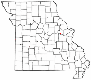
Charrette Creek is a stream in Warren County in the U.S. state of Missouri. It is a tributary of the Missouri River. The headwaters of the stream are at 38°43′54″N91°00′29″W and the confluence with the Missouri is at 38°33′36″N90°59′59″W. The stream enters the Missouri River floodplain two miles west of Marthasville and joins the Missouri about four miles to the east just north of Washington.
Gore is an unincorporated community in southwest Warren County, in the U.S. state of Missouri. The community lies on the north edge of the Missouri River Valley. Missouri Route 94 passes just north of the community and the Katy Trail passes the location. The Loutre Slough joins the Missouri River just south of the community.
Henley Hollow is a valley in Warren County in the U.S. state of Missouri. The intermittent stream in Henley Hollow is a tributary to Little Lost Creek in the Little Lost Creek State Forest.
Kochs Creek is a stream in Warren County in the U.S. state of Missouri.
Pinckney is an unincorporated community in Warren County, in the U.S. state of Missouri.
Massie Creek is a stream in eastern Montgomery and southwestern Warren counties in the U.S. state of Missouri. It is a tributary of Loutre Slough.

Peers is an unincorporated community in southern Warren County, in the U.S. state of Missouri. The community is on the north edge of the Missouri River floodplain and Treloar is four miles to the west on Missouri Route 94.
Skunk Creek is a stream in Warren County in the U.S. state of Missouri. It is a tributary of Peruque Creek.
Yeater Branch is a stream in Warren County in the U.S. state of Missouri. It is a tributary of Big Creek.
Bridgeport Township is an inactive township in Warren County, in the U.S. state of Missouri.
Charrette Township is an inactive township in Warren County, in the U.S. state of Missouri.
Hickory Grove Township is an inactive township in Warren County, in the U.S. state of Missouri.
Pinckney Township is an inactive township in Warren County, in the U.S. state of Missouri.
