
St. Louis County is a county located in the Arrowhead Region of the U.S. state of Minnesota. As of the 2010 census, the population was 200,226. Its county seat is Duluth. It is the largest county in Minnesota by land area, and the second largest in the United States east of the Mississippi River, after Aroostook County, Maine.

Canosia Township is a township in Saint Louis County, Minnesota, United States. Canosia is a name derived from the Algonquian language meaning "pike fish". The population was 2,158 at the 2010 census.
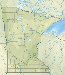
Fredenberg Township is a township in Saint Louis County, Minnesota, United States. The population was 1,337 at the 2010 census.
Grand Lake Township is a township in Saint Louis County, Minnesota, United States. The population was 2,779 at the 2010 census.
New Independence Township is a township in Saint Louis County, Minnesota, United States. The population was 299 at the 2010 census.
Solway Township is a township in Saint Louis County, Minnesota, United States. The population was 1,944 at the 2010 census. Solway Township was named after Solway Firth.

The Des Moines River is a tributary of the Mississippi River in the upper Midwestern United States that is approximately 525 miles (845 km) long from its farther headwaters. The largest river flowing across the state of Iowa, it rises in southern Minnesota and flows across Iowa from northwest to southeast, passing from the glaciated plains into the unglaciated hills near the capital city of Des Moines, named after the river, in the center of the state. The river continues to flow at a southeastern direction away from Des Moines, later flowing directly into the Mississippi River.

The term Iron Range refers collectively or individually to a number of elongated iron-ore mining districts around Lake Superior in the United States and Canada. Despite the word "range", the iron ranges are not mountain chains, but outcrops of Precambrian sedimentary formations containing high percentages of iron. These cherty iron ore deposits are Precambrian in age for the Vermilion Range and middle Precambrian in age for the Mesabi and Cuyuna ranges, all in Minnesota. The Gogebic Range in Wisconsin and the Marquette Iron Range and Menominee Range in Michigan have similar characteristics and are of similar age. Natural ores and concentrates were produced from 1848 until the mid 1950s, when taconites and jaspers were concentrated and pelletized, and started to become the major source of iron production.

The Arrowhead Region is located in the northeastern part of the U.S. state of Minnesota, so called because of its pointed shape. The predominantly rural region encompasses 10,635.26 square miles (27,545.2 km2) of land area and includes Carlton, Cook, Lake and Saint Louis counties. Its population at the 2000 census was 248,425 residents. The region is loosely defined, and Aitkin, Itasca, and Koochiching counties are sometimes considered as part of the region, increasing the land area to 18,221.97 square miles (47,194.7 km2) and the population to 322,073 residents. Primary industries in the region include tourism and iron mining.
Bachelor Lake is a lake in Brown County, Minnesota in the northeastern part of Stark township. Covering 79.80 acres, it is an officially protected water of the State of Minnesota. The lake is within the Cottonwood River Major Watershed. The lake’s elevation is 1,004 feet (306 m), and it is zoned as a shoreland area which is regulated as a shoreland management water.
Markham is an unincorporated community in Colvin Township, Saint Louis County, Minnesota, United States.
Twig is an unincorporated community in Grand Lake Township, Saint Louis County, Minnesota, United States.
Saginaw is an unincorporated area in Saint Louis County, Minnesota, United States. Although unincorporated, Saginaw has a post office with the ZIP code 55779.
Fairbanks is an unincorporated community in Fairbanks Township, Saint Louis County, Minnesota, United States; located within the Superior National Forest.
Kelly Lake is a neighborhood of the city of Hibbing in St. Louis County, Minnesota, United States. County Road 60 / Rainey Road / 1st Avenue serves as a main arterial route in the community. Previously, Kelly Lake was its own unincorporated community before it was annexed by the city of Hibbing. U.S. Route 169 is nearby.
Taft is an unincorporated community in Grand Lake Township, Saint Louis County, Minnesota, United States.
Four Corners is an unincorporated community in Saint Louis County, Minnesota, United States; located 10 miles northwest of the city of Duluth at the junction of U.S. Highway 53 and Saint Louis County Road 13.
The Jeanette State Forest is a state forest located in St. Louis County, Minnesota. The forest is within the limits of the Superior National Forest's Boundary Waters Canoe Area Wilderness, and thus falls under the federal jurisdiction and management of the United States Forest Service.
