
Derbyshire Dales is a local government district in Derbyshire, England. The district was created in 1974 as West Derbyshire; the name was changed to Derbyshire Dales in 1987. The council is based in the town of Matlock, and the district also includes the towns of Ashbourne, Bakewell, Darley Dale and Wirksworth, as well as numerous villages and extensive rural areas. Much of the district is within the Peak District National Park.

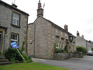
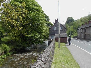
Wirksworth is a market, and former quarry town in the Derbyshire Dales district of Derbyshire, England. Its population of 4,904 in the 2021 census was estimated at 5,220 in 2023. Wirksworth contains the source of the River Ecclesbourne. The town was granted a market charter by Edward I in 1306 and still holds a market on Tuesdays in the Memorial Gardens. The parish church of St Mary's is thought to date from 653. The town developed as a centre for lead mining and stone quarrying. Many lead mines were owned by the Gell family of nearby Hopton Hall.

The White Peak, also known as the Low Peak, is a limestone plateau that forms the central and southern part of the Peak District in England. It is mostly between 270 metres (900 ft) and 430 metres (1,400 ft) above sea-level and is enclosed by the higher altitude Dark Peak to the west, north and east.

Peak Forest is a small village and civil parish on the main road the (A623) from Chapel-en-le-Frith to Chesterfield in Derbyshire. The population of the civil parish at the 2011 census was 335.

Beeley is a village and civil parish in northern Derbyshire, England. Located near Bakewell in the Derbyshire Dales, it is situated on the B6012 road, between Rowsley and Edensor. The civil parish population at the 2011 Census was 195.

The Limestone Way is a waymarked long-distance footpath in Derbyshire, England. It runs for 46 miles (74 km) through the White Peak of the Peak District National Park, from Castleton south to Rocester over the county boundary into Staffordshire. The trail is named for the limestone scenery along its route. It was devised by Brian Spencer of Matlock Rotary Club and developed and opened in 1986 by the West Derbyshire District Council. It originally ran to Matlock, but was extended to its current, longer route in 1992 to join up with the Staffordshire Way.
Great Longstone with Little Longstone is one of two villages in the local government district of Derbyshire Dales in Derbyshire, England. The population as taken at the 2011 Census was 843.
Waterhouses is a village in the south of the Staffordshire Peak District in England. It is around 8 miles from Leek and Ashbourne, being nearly the halfway point between the two towns on the A523 road, which roughly follows the southern boundary of the Peak District National Park. Waterhouses is also a civil parish, created in 1934 when the parishes of Calton, Cauldon, Waterfall and part of Ilam were merged; previously the village of Waterhouses was on the boundary of Waterfall and Cauldon parishes. The hamlet of Winkhill is also in the parish. The population of the civil parish at the 2011 census was 1,134.

Ballidon is a village and civil parish in the Derbyshire Dales district of Derbyshire, England, on the edge of the Peak District National Park. According to the 2001 census it had a population of 79. The population at the 2011 Census remained less than 100. Details are maintained in the civil Parish of Aldwark, Derbyshire.

Thorpe is a village and civil parish in the English county of Derbyshire; it is on the Derbyshire/Staffordshire border, on the east bank of the River Dove, about four miles north of Ashbourne. The population of the civil parish as at the 2011 census was 183.

Stanton Moor is a small upland area in the Derbyshire Peak District of central northern England, lying between Matlock and Bakewell near the villages of Birchover and Stanton-in-Peak. It is known for its megaliths – particularly the Nine Ladies stone circle – and for its natural, wind-eroded sandstone pillars. The Peak District Boundary Walk runs across the moor.

Eldon Hill is a hill in the Peak District National Park in the county of Derbyshire, England, 4 kilometres (2.5 mi) southwest of the village of Castleton. It is a 470-metre (1,540 ft) limestone hill whose pastureland is used for rough grazing, although a large proportion has been lost to limestone quarrying. It lies within the Castleton Site of Special Scientific Interest. Eldon Hill was formed when a bed of pure limestone was squeezed and upfolded by geological forces to form a dome; it is the highest limestone hill north of the River Wye.
Longcliffe is a crossroads hamlet in the English county of Derbyshire.

Great Rocks Dale is a dry valley in the Derbyshire Peak District, known for its extensive quarrying.

The Peak District Boundary Walk is a circular 190-mile (310 km) walking trail, starting and finishing at Buxton and broadly following the boundary of the Peak District, Britain's first national park. The route was developed by the Friends of the Peak District and was launched on 17 June 2017.

Harboro' Rocks is a dolomitic limestone hill near the village of Brassington in the Derbyshire Peak District. The summit is 379 metres (1,243 ft) above sea level with views across to Carsington Water.

Eaton and Alsop is a civil parish within the Derbyshire Dales district, in the county of Derbyshire, England. Largely rural, in 2021 Eaton and Alsop had a population of only 80 residents. It is 130 miles (210 km) north west of London, 17 miles (27 km) north west of the county city of Derby, and 6 miles (9.7 km) north of the market town of Ashbourne. Eaton and Alsop is wholly within the Peak District national park, and touches the parishes of Alstonefield, Hartington Nether Quarter, Newton Grange and Parwich. There are five listed buildings in Eaton and Alsop.
The geology of the Peak District National Park in England is dominated by a thick succession of faulted and folded sedimentary rocks of Carboniferous age. The Peak District is often divided into a southerly White Peak where Carboniferous Limestone outcrops and a northerly Dark Peak where the overlying succession of sandstones and mudstones dominate the landscape. The scarp and dip slope landscape which characterises the Dark Peak also extends along the eastern and western margins of the park. Although older rocks are present at depth, the oldest rocks which are to be found at the surface in the national park are dolomitic limestones of the Woo Dale Limestone Formation seen where Woo Dale enters Wye Dale east of Buxton.

Ivonbrook Grange is a civil parish within the Derbyshire Dales district, in the county of Derbyshire, England. Largely rural, Ivonbrook Grange's population is reported with the population of neighbouring parishes for a total of 180 residents in 2011. It is 130 miles (210 km) north west of London, 15 miles (24 km) north west of the county city of Derby, and 3+1⁄2 miles (5.6 km) south west of the nearest market town of Matlock. Ivonbrook Grange is wholly within the Peak District national park on its southern edge, and shares a border with the parishes of Aldwark, Bonsall, Brassington, Ible as well as Winster. There is one listed structure in Ivonbrook Grange.
Middleton and Smerrill is a civil parish within the Derbyshire Dales district, in the county of Derbyshire, England. Largely rural except for the village of Middleton-by-Youlgreave and isolated farms, Middleton and Smerrill's population is 137 residents in 2011. It is 130 miles (210 km) north west of London, 20 miles (32 km) north west of the county city of Derby, and 4+1⁄2 miles (7.2 km) south west of the nearest market town of Bakewell. Middleton and Smerrill is wholly within the Peak District national park, in the southern part of the area. It is one of the largest parishes but among the smallest by way of residents, and shares a border with the parishes of Gratton, Hartington Middle Quarter, Hartington Nether Quarter, Hartington Town Quarter, Monyash and Youlgreave. There are 31 listed structures in Middleton and Smerrill.
