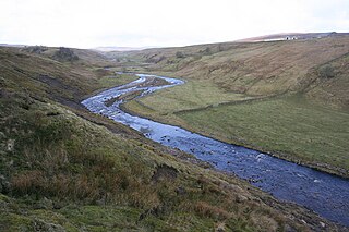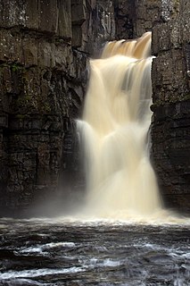
The River Tees is in northern England. It rises on the eastern slope of Cross Fell in the North Pennines, and flows eastwards for 85 miles (137 km) to reach the North Sea between Hartlepool and Redcar near Middlesbrough.

The Elan Valley Reservoirs are a chain of man-made lakes created from damming the Elan and Claerwen rivers within the Elan Valley in Mid Wales. The reservoirs, which were built by the Birmingham Corporation Water Department, provide clean drinking water for Birmingham in the West Midlands of England. The five lakes are known as the Claerwen, Craig-goch, Pen-y-garreg, Garreg-ddu, and Caban-coch.

The Quabbin Reservoir is the largest inland body of water in Massachusetts, and was built between 1930 and 1939. Today, along with the Wachusett Reservoir, it is the primary water supply for Boston, some 65 miles (105 km) to the east as well as 40 other communities in Greater Boston. It also supplies water to three towns west of the reservoir and acts as backup supply for three others. It has an aggregate capacity of 412 billion US gallons (1,560 GL) and an area of 38.6 square miles (99.9 km2).
Teesdale is a dale, or valley, of the east side of the Pennines in County Durham, England. Large parts of Teesdale fall within the North Pennines Area of Outstanding Natural Beauty (AONB) - the second largest AONB in England and Wales. The River Tees rises below Cross Fell, the highest hill in the Pennines at 2,930 feet (890 m), and its uppermost valley is remote and high. The local climate was scientifically classified as "Sub-Arctic" and snow has sometimes lain on Cross Fell into June.

Wearhead is a village in County Durham, in England. It is situated at the top of Weardale between Cowshill and Ireshopeburn. It is named after the nearby source of the River Wear which runs eastwards for approx 40 miles to Sunderland. In the 2001 census Wearhead had a population of 210.

A reservoir is, most commonly, an enlarged natural or artificial lake, pond or impoundment created using a dam or lock to store water.

The San Luis Reservoir is an artificial lake on San Luis Creek in the eastern slopes of the Diablo Range of Merced County, California, approximately 12 mi (19 km) west of Los Banos on State Route 152, which crosses Pacheco Pass and runs along its north shore. It is the fifth largest reservoir in California. The reservoir stores water taken from the San Joaquin-Sacramento River Delta. Water is pumped uphill into the reservoir from the O'Neill Forebay which is fed by the California Aqueduct and is released back into the forebay to continue downstream along the aqueduct as needed for farm irrigation and other uses. Depending on water levels, the reservoir is approximately nine miles long from north to south at its longest point, and five miles (8 km) wide. At the eastern end of the reservoir is the San Luis Dam, or the B.F. Sisk Dam, the fourth largest embankment dam in the United States, which allows for a total capacity of 2,041,000 acre feet (2,518,000 dam3).

Cow Green Reservoir is a 2 miles (3 km) long water reservoir built between 1967 and 1971 to supply the industries of Teesside in England.

The Teesdale Way is a long distance walk between the Cumbrian Pennines and the North Sea coast of North Yorkshire in England. The walk is 100 miles (160 km) in length; it links in with other long distance walks such as the Pennine Way and the E2 European Walk between Harwich and Stranraer.

Baldersdale is a dale, or valley, on the east side of the Pennines in County Durham, England, north of Barnard Castle. Its principal settlements are Hury and Briscoe. Baldersdale lies within the traditional boundaries of the North Riding of Yorkshire. Under provisions of the Local Government Act 1972, it was incorporated into County Durham for administrative purposes on 1 April 1974, along with the rest of the former Startforth Rural District.

The Balder is an English river that rises on the eastern slope of Stainmore Common in the Pennine Chain and flows eastwards for about 13 miles (21 km) to the River Tees at Cotherstone.
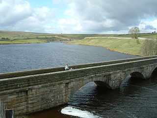
Lunedale is a dale, or valley, of the east side of the Pennines in England, west of Middleton-in-Teesdale. Its principal villages are Grassholme, Thringarth and West Pasture. There is also a civil parish covering the area with a population taken at the 2011 census of 187. Lunedale is part of County Durham.

The Tees Valley Railway was an 8 3⁄4-mile (14.1 km) branch railway line that ran between Barnard Castle on the South Durham & Lancashire Union Railway line between Bishop Auckland and Kirkby Stephen East, and Middleton-in-Teesdale via three intermediate stations Cotherstone, Romaldkirk and Mickleton.

Selset Reservoir is a reservoir in County Durham, England. It is situated in the Lune Valley which is a side valley of the River Tees, about 5 miles (8 km) west of Middleton-in-Teesdale. It supplies water for Teesdale and is owned by Northumbrian Water. It was built in 1960 and its main use is sailing.
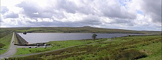
Balderhead Reservoir is a reservoir in Baldersdale, County Durham, England. It is one of a chain of three reservoirs on the River Balder, a tributary of the River Tees, which it joins at Cotherstone, about 5 miles to the east.
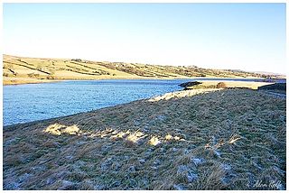
Hury Reservoir is a reservoir in County Durham, England situated in Baldersdale. The reservoir is located about four miles south of Middleton-in-Teesdale and about three miles west of Cotherstone. It supplies water for Teesdale and is owned by Northumbrian Water. It gets its name from the nearby village of Hury. It is almost adjoined to Blackton Reservoir to the immediate west. The dam 'bridges' the River Balder which flows in an easterly direction to meet the River Tees at Cotherstone,

Blackton Reservoir is a reservoir in County Durham, England. It is situated in Baldersdale, about 4 miles (7 km) west of Cotherstone, where the River Balder joins the River Tees.

Teesdale Business Park is a major business park on the former site of Head Wrightsons' Teesdale works in Thornaby-on-Tees in the borough of Stockton-on-Tees and Ceremonial County of North Yorkshire, England.
The park was redeveloped by the Teesside Development Corporation.
The area is immediately north of Thornaby railway station, bounded by the River Tees and the Tees Valley Line .
It is a short distance from Stockton-on-Tees town centre and is connected to Stockton via the Victoria Bridge, Teesquay Millennium Bridge footbridge, Princess of Wales Bridge and Infinity Bridge footbridge.

Foster's Hush is a Site of Special Scientific Interest in the Teesdale district of west County Durham, England. It is located in the valley of Lune Head Beck, immediately south of the B6276 road, 6 km upstream of the Selset Reservoir dam.
Northumbrian Water Limited is a water company in the United Kingdom, providing mains water and sewerage services in the English counties of Northumberland, Tyne and Wear, Durham and parts of North Yorkshire, and also supplying water as Essex and Suffolk Water. It is a wholly owned subsidiary of Northumbrian Water Group.


