Uttlesford is a local government district in Essex, England. Its council is based in the town of Saffron Walden. The district also includes the town of Great Dunmow and numerous villages, including Stansted Mountfitchet, Takeley, Elsenham, Thaxted, and Newport. The district covers a largely rural area in the north-west of Essex. London Stansted Airport lies within the district.
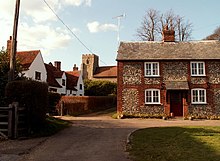
Takeley is a village and civil parish in the Uttlesford district of Essex, England.

Creaton is a village and civil parish in West Northamptonshire, England.

Felsted is a village and civil parish in the Uttlesford district of Essex, England. The civil parish includes the hamlets of Bannister Green, Bartholomew Green, Causeway End, Coblers Green, Cock Green, Frenches Green, Gransmore Green, Hartford End, Molehill Green, Milch Hill, Thistley Green, Watch House Green and Willows Green.
Kemble is a village in the civil parish of Kemble and Ewen, in the Cotswold district of Gloucestershire, England. Historically part of Wiltshire, it lies 4 miles (6.4 km) from Cirencester and is the settlement closest to Thames Head, the source of the River Thames. In 2020 it had an estimated population of 940. At the 2011 census the parish had a population of 1,036.
Braintree is a constituency in Essex represented in the House of Commons of the UK Parliament since 2015 by James Cleverly, a member of the Conservative Party.

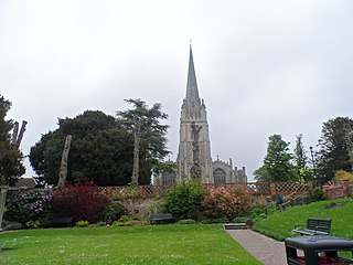
Saffron Walden was a constituency in Essex, represented in the House of Commons of the UK Parliament from 1922 to 2024 by members of the Conservative Party.

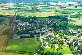
Sewards End is a village and civil parish in the Uttlesford district of Essex, England. Its area is 1211 acres. It is set in the rolling countryside of north west Essex. The village's village hall is two miles east of the centre of Saffron Walden and one and a third miles from Tesco's store. The population was 511 in 2011 with 124 children under the age of 18 and 87 people aged over 64. The median age was 47. There are about 210 houses in the village (2020). There are 23 listed buildings. The village became a civil parish on 1 April 2004.

Arkesden is a village and civil parish in the Uttlesford district of Essex, England.

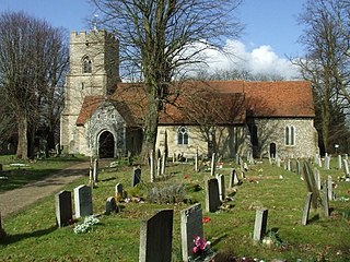
Ashdon, is a village and civil parish in Essex, England. It is about 4 miles (6 km) northeast of Saffron Walden and 23 miles (37 km) northwest from the county town of Chelmsford. The village is in the district of Uttlesford and the parliamentary constituency of Saffron Walden. The village has its own Parish Council.
Quendon and Rickling is a civil parish in the Uttlesford district of Essex, England with an area of 2,048 acres. The population of the civil parish at the 2011 was 587. It is a linear settlement on the B1383 between Saffron Walden and Bishops Stortford. Quendon & Rickling stand 300 feet above sea level on a watershed between two rivers: the Cam to the east, flowing north through Cambridge to the Ouse flowing on to the Wash.

Barnston is a village and civil parish in Essex, England. The village is on the B1008 road, about 1+3⁄4 miles (2.8 km) south-east of Great Dunmow and 9 miles (14 km) north-north-west from the county town of Chelmsford.

Bishop's Nympton is a village and civil parish in the North Devon district of Devon, England, about three miles east of South Molton. According to the 2001 census it had a population of 932. The electoral ward has the same name but covers the village and much of the land to the north-east. The ward population at the 2011 census was 1,911.

Elswick is a rural village and civil parish on the Fylde coast of Lancashire, England. At the 2011 Census, it had a population of 1,079.

Brawdy is a village, parish and community in Pembrokeshire, Wales.
Littlebury is a village and civil parish in the Uttlesford district, north-west Essex, England. The village is approximately a mile and a half from the market town of Saffron Walden, 12 miles (20 km) south from Cambridge, the nearest city, and 23 miles (37 km) north-east from the county town and city of Chelmsford.

Hempstead is a village and civil parish in the Uttlesford district of Essex, England.
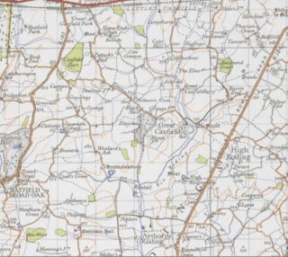
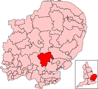
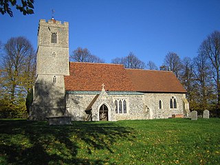
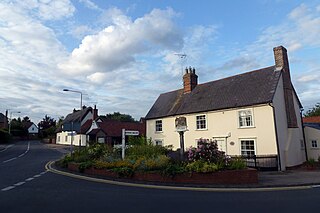
Great Canfield is a village and civil parish in the Uttlesford district of Essex, England. The village, which sits at the south-east edge of its civil parish, is approximately 3 miles (5 km) south-west from the small town of Great Dunmow, and 1 mile (1.6 km) north-west from High Roding. The civil parish contains the hamlets and small settlements of Hope End Green, Hellmans Cross, Bacon End, Baconend Green, and Puttocks End. The River Roding defines the parish border at the south-east, and for 1 mile cuts through the parish before providing part of the north-east border. In 2011 the parish had a population of 414.
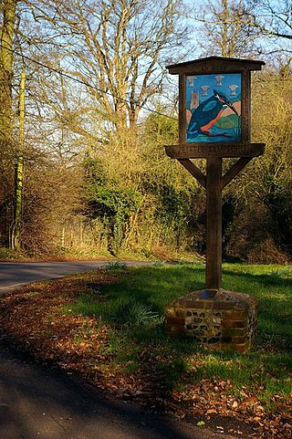
Little Sampford is a village and a civil parish on the B1053 road, in the Uttlesford district, in the county of Essex, England. The population of the civil parish at the 2011 Census was 251. Until the 18th century the ecclesiastical parish was known as St Mary the Virgin, Sampford Parva.

Great Munden is a village and civil parish in Hertfordshire, England. The parish, in the district of East Hertfordshire, spans 3,758 acres (5.872 sq mi), of which 1,895.75 acres (2.96211 sq mi) are arable land, 927.5 acres (1.4492 sq mi) are permanent grass and 97 acres (0.152 sq mi) are wood. It has a population of 477, reducing to 339 at the 2011 Census, and is situated 6 miles (9.7 km) north of the town of Ware. The village includes the church of St Nicholas, Munden Bury, and a rectory that includes the remains of a moat. Other settlements in the parish include Nasty and Levens Green. A detached portion of Little Munden was added to the parish in 1888.