
Handy Cross is a hamlet in the parish of Little Marlow, Buckinghamshire, England. It is located on Marlow Hill, on the old road between Marlow and High Wycombe. At the 2011 Census the population of the hamlet was included in the civil parish of Great Marlow. Today the hamlet consists of a farm, several households and a Harvester pub & restaurant.
Uttlesford is a local government district in Essex, England. Its council is based in the town of Saffron Walden. The district also includes the town of Great Dunmow and numerous villages, including Stansted Mountfitchet, Takeley, Elsenham, Thaxted, and Newport. The district covers a largely rural area in the north-west of Essex. London Stansted Airport lies within the district.
Saffron Walden Rural District was a rural district in the county of Essex, England. It was created in 1894 and later enlarged by the addition of the parishes of Berden, Birchanger, Elsenham, Farnham, Henham-on-the-Hill, Manuden, Stansted Mountfitchet and Ugley from the disbanded Stansted Rural District. It was named after and administered from Saffron Walden.
Coombe is a hamlet in the parish of Ellesborough in the English county of Buckinghamshire, situated between Coombe Hill and Chequers, the official country residence of the Prime Minister of the United Kingdom. At the 2011 Census the population of the hamlet was included in the civil parish of Wendover.

Hampden Row is a historic hamlet in the Chiltern Hills of Buckinghamshire, England. It is located in Great Hampden parish. At the 2011 Census the population of the hamlet was included in the civil parish of Great and Little Hampden.
Ash-cum-Ridley is a civil parish in the Sevenoaks district of Kent, England. According to the 2001 census the parish had a population of 7,070, reducing to 6,641 at the 2011 Census.

Ayot St Peter is a village and civil parish in the Welwyn Hatfield district of Hertfordshire, England, about two miles north-west of Welwyn Garden City. According to the 2001 census it had a population of 166. At the 2011 Census the population including the nearby Ayot Green and Ayot St Lawrence was 245.
Bengeo Rural is a civil parish in the East Hertfordshire district of Hertfordshire, England. According to the 2001 census it had a population of 601, increasing at the 2011 Census to 644. The parish includes the villages of Tonwell and Chapmore End.

Sampford Peverell is a village and civil parish in Mid-Devon, England. An old Saxon settlement, it was called Sanforda in the 1086 Domesday Book. Its current name reflects its inclusion in the Honour of Peverel, the lands of William Peverel and his family. His great-grandson, Hugh Peverell, is buried in the village church of St John the Baptist. The Grand Western Canal cuts through the village.
Pamber is a civil parish located in the north of Hampshire, England, near the border with Berkshire. The parish population at the 2011 Census was 2,613. It contains four settlements: Pamber Heath, Pamber Green, Pamber End and Little London.
Heath End is a hamlet in the parish of Great Missenden in Buckinghamshire, England. At the 2011 Census the population of the hamlet was included in the civil parish of Little Missenden. During the 20th century, it became attached to Great Kingshill to the south west. The old centre of the hamlet is where Spurlands End Road meets Heath End Road. Although Heath End is now attached to Great Kingshill there are still road signs indicating to the hamlet.
Mop End is a small hamlet in the parish of Little Missenden, in Buckinghamshire, England. At the 2011 Census, the population of the hamlet was included in the civil parish of Amersham.

Hunsdon is a village and civil parish in Hertfordshire, England. It is around 5.5 miles (9 km) east of Ware and 5 miles (8 km) north-west of Harlow. The population of the village taken at the 2011 Census was 1,080.

Hempstead is a village and civil parish in the Uttlesford district of Essex, England.

Saxtead is a village and civil parish in the East Suffolk district, in the county of Suffolk, England. Saxtead gives its name to the settlements of Saxtead Green and Saxtead Little Green and the windmill Saxtead Green Windmill. The population of the civil parish at the 2011 Census was 335. Saxtead is located on the A1120 road in between the town of Stowmarket and the village of Yoxford.

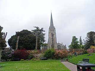
Great Sampford is a village and civil parish on the junction of the B1053 and B1051 roads in the Uttlesford district, in the north-west of the English county of Essex. The population of the civil parish at the 2011 Census was 586. The village includes a primary school, two places of worship and one public house. It is located three miles to the north-east of the town of Thaxted and eight miles to the south-east of Saffron Walden.

Great Munden is a village and civil parish in Hertfordshire, England. The parish, in the district of East Hertfordshire, spans 3,758 acres (5.872 sq mi), of which 1,895.75 acres (2.96211 sq mi) are arable land, 927.5 acres (1.4492 sq mi) are permanent grass and 97 acres (0.152 sq mi) are wood. It has a population of 477, reducing to 339 at the 2011 Census, and is situated 6 miles (9.7 km) north of the town of Ware. The village includes the church of St Nicholas, Munden Bury, and a rectory that includes the remains of a moat. Other settlements in the parish include Nasty and Levens Green. A detached portion of Little Munden was added to the parish in 1888.
Hormead is a civil parish in Hertfordshire, England. It comprises the villages of Great Hormead and Little Hormead and the hamlet of Hare Street and lies in the East Hertfordshire district. Hare Street House is located within Hare Street. In 2011 it had a population of 743.

West Wood is a 23.6 hectares biological Site of Special Scientific Interest in Little Sampford, north of Thaxted in northwestern Essex. It is owned and managed by the Essex Wildlife Trust.

Sampford Spiney is a village and civil parish in the Walkham valley, about 4 miles east south east of Tavistock, in the West Devon district, in the county of Devon, England. In 2011 the parish had a population of 117. The parish touches Walkhampton, Whitchurch and Horrabridge.
