Related Research Articles

San Mateo County, officially the County of San Mateo, is a county located in the U.S. state of California. As of the 2020 census, the population was 764,442. Redwood City is the county seat, the third-most populated city in the county after Daly City and San Mateo.

Colma is a small incorporated town in San Mateo County, California, United States, on the San Francisco Peninsula in the San Francisco Bay Area. The population was 1,507 at the 2020 census. The town was founded as a necropolis in 1924.

Daly City is the second most populous city in San Mateo County, California, United States. Located in the San Francisco Bay Area, and immediately south of San Francisco, it is named for businessman and landowner John Donald Daly.

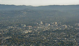
San Mateo is the most populous city in San Mateo County, California, United States, on the San Francisco Peninsula. About 20 miles (32 km) south of San Francisco, the city borders Burlingame to the north, Hillsborough to the west, San Francisco Bay and Foster City to the east and Belmont to the south. The population was 105,661 at the 2020 census. Some of the biggest economic drivers for the city include technology, health care and education.

Fener, also spelled Phanar, is a quarter midway up the Golden Horn in the district of Fatih in Istanbul, Turkey. The Turkish name is derived from the Greek word "phanarion", meaning lantern, streetlight or lamppost; the neighborhood was so called because of a column topped with a lantern which stood here in the Byzantine period and was used as a street light or lighthouse.

Greektown in Vancouver, British Columbia, Canada is an area in the Kitsilano neighborhood that was historically an enclave of Greek immigrants and their descendants. The term is an informal one, and Greektown's borders are not strictly defined; however, West Broadway around Trutch Street is generally considered the neighbourhood's heart, while Blenheim St to the west and MacDonald St to the east are approximately its outer limits. Vancouverites of Greek descent, who live in Kitsilano, nostalgically also call the area Ουέστ Μπροντουέι.

Greektown is a social and dining district, located on the Near West Side of Chicago. Today, Greektown consists mostly of restaurants and businesses, although a cultural museum and an annual parade and festival still remain in the neighborhood.

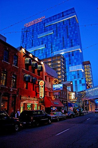
Greektown is a commercial and entertainment district in Detroit, Michigan, located just northeast of the heart of downtown, along Monroe Avenue between Brush and St. Antoine streets. It has a station by that name on the city's elevated downtown transit system known as the Detroit People Mover. Greektown is situated between the Renaissance Center, Comerica Park, and Ford Field.

Diamond Heights is a neighborhood in central San Francisco, California, roughly bordered by Diamond Heights Boulevard and Noe Valley to the north and east and Glen Canyon Park to the south and west. It is built on three hills: Red Rock Heights on the northwest, Gold Mine Hill in center, and Fairmount Heights on the southeast.

Bridesburg is the northernmost neighborhood in the River Wards section of Philadelphia, Pennsylvania, United States. A mostly working-class neighborhood, Bridgesburg is an historically German and Irish community, with a significant community of Polish immigrants who arrived mostly in the early- to mid-twentieth century. The community is home to two Catholic churches: All Saints Church, designed by Edwin Forrest Durang and built in 1889; and Saint John Cantius Church, built in 1898 in Polish cathedral style.

The Greek Orthodox Archdiocese of America, headquartered in New York City, is an eparchy of the Ecumenical Patriarchate of Constantinople. Its current primate is Archbishop Elpidophoros of America.

Greektown is a neighborhood located in Baltimore, Maryland, United States.

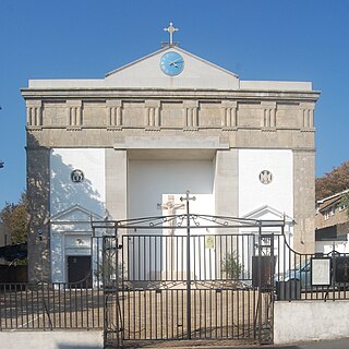
The Church of the Holy Trinity is a Greek Orthodox church in Brighton, part of the English city of Brighton and Hove. Built in 1838 in one of Brighton's most notorious slum districts, Carlton Hill, it was an Anglican church for most of its life: dedicated to St John the Evangelist, it was used by the Anglican community until it was declared redundant in 1980. After some uncertainty about its future, it was sold to Brighton's Greek Orthodox community in 1985 and has been used as their permanent place of worship since then. Reflecting its architectural and historical importance, it has been listed at Grade II since 1971.

Nation's Foodservice, Inc., doing business as Nation's Giant Hamburgers or simply Nation's, is a privately held El Cerrito, California-based regional fast food diner chain. Its menu includes hamburgers, hot dogs, sandwiches, breakfast items, and pies. The chain, founded in 1952, largely operates in the San Francisco Bay Area, especially the Greater East Bay, with some locations also in the Sacramento area and the Stockton area.

Holy Trinity Greek Orthodox Church is located in Sioux City, Iowa, United States. Designed by architect William L. Steele, the church building has been listed on the National Register of Historic Places since 1998.

Tongan Americans are Americans who can trace their ancestry to Tonga, officially known as the Kingdom of Tonga. There are approximately 57,000 Tongan Americans living in the United States, as of 2012. Tongans are considered to be Pacific Islanders in the United States census, and are the country's fourth largest Pacific Islander American group in terms of population, after Native Hawaiians, Samoan Americans, and Guamanian/Chamorro Americans.
The history of Greeks in Baltimore dates back to the late 19th and early 20th centuries. Baltimore is home to one of the largest Greek American communities in the United States. The community is centered in the Greektown and Highlandtown neighborhoods of East Baltimore.
Hispanic and Latino Americans in San Francisco form 15.1% of the population. The city's population includes 121,744 Hispanics or Latinos of any race. The principal Hispanic groups in the city were those of Mexican (7.4%), Salvadoran (2.0%), Nicaraguan (0.9%), Guatemalan (0.8%), and Puerto Rican (0.5%) ancestry. The Hispanic population is most heavily concentrated in the Mission District, Tenderloin District, and Excelsior District.
The Armenian community of the San Francisco Bay Area has an impact on some businesses, churches, and politics of San Francisco. An ABC7 News article from 2021 says the population of the Greater Bay Area is at around 50,000.