
McLean County is a county located in the U.S. state of Kentucky. As of the 2010 census, the population was 9,531. Its county seat is Calhoun. McLean is a prohibition or dry county.

Lincoln County is a county located in the U.S. state of Kentucky. As of the 2010 census, the population was 24,742. Its county seat is Stanford. Lincoln is a prohibition or "dry county."

Estill County is a county located in the U.S. state of Kentucky. As of the 2010 census, the population was 14,672. Its county seat is Irvine The county was formed in 1808 and named for Captain James Estill, a Kentucky militia officer who was killed in the Battle of Little Mountain during the American Revolutionary War. Estill County is a moist county meaning that the county seat, the city of Irvine, allows the sale of alcohol after the October 9, 2013 vote, but not the rest of Estill County outside the Irvine city limits.

Cave City is a home rule-class city in Barren County, Kentucky, in the United States. The population was 2,240 at the 2010 census. It is part of the Glasgow Micropolitan Statistical Area.
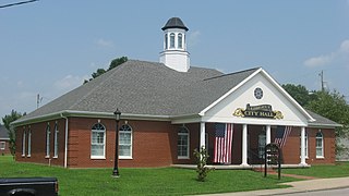
Liberty is a home rule-class city in Casey County, Kentucky, in the United States. It is the seat of its county. Its population was 2,168 at the 2010 U.S. census.
Muldraugh Hill is an escarpment in Bullitt, Hardin, Jefferson, and Nelson counties of central Kentucky separating the Bluegrass on the north and north-east from the Pennyrile on the south and south-west. This escarpment fades into the Pottsville Escarpment on the east, and terminates at the Ohio River in the west, although in truth it continues in Indiana as Floyds Knobs.
The Red River is a 97.2-mile-long (156.4 km) tributary of the Kentucky River in east-central Kentucky in the United States. Via the Kentucky and Ohio rivers, it is part of the Mississippi River watershed.

Boonesborough is an unincorporated community in Madison County, Kentucky, USA. It lies in the central part of the state along the Kentucky River and is the site of Fort Boonesborough State Park, which includes the Kentucky River Museum. The park site has been rebuilt to look like a working fort of the days when Boone resided there.
The Kentucky River Museum is located in Boonesborough, Kentucky, in Fort Boonesborough State Park.
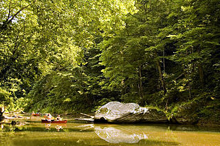
Cedar Creek, located in Lincoln County in south-central Kentucky, USA, is an 8-mile-long (13 km) tributary to the Dix River. Via the Dix, Kentucky and Ohio rivers, it is part of the Mississippi River watershed. In 2002, a section of Cedar Creek was impounded to form Cedar Creek Lake.

Abraham Lincoln Birthplace National Historical Park preserves two separate farm sites in LaRue County, Kentucky where Abraham Lincoln was born and lived early in his childhood. He was born at the Sinking Spring site south of Hodgenville and remained there until the family moved to the Knob Creek Farm northeast of Hodgenville when he was 2 years old, living there until he was 7 years old. The Sinking Spring site is the location of the park visitors center.
Parksville is a small unincorporated community on the Chaplin River in south central Boyle County, Kentucky, United States. It is located at the eastern end of Ky Route 300, where it intersects with Ky Route 34, near the US Post Office. The global position of Parksville is 37.597N latitude and -84.891W longitude. Elevation is 1,083 feet (330 m) above sea level. Current population is approximately 900 people.
Green River Lake is a 8,210-acre (33 km2) reservoir in Adair, Taylor, and Casey counties in Kentucky lying in the section of Kentucky known as the Highland Rim.

The Chaplin River is an 85.6-mile-long (137.8 km) tributary of the Beech Fork of the Salt River in the U.S. state of Kentucky.

The Barren River is a 135-mile-long (217 km) river in western Kentucky, United States. It is the largest tributary of the Green River, which drains more of Kentucky than any other river. The Barren River rises in Monroe County and flows into the Green in northeast Warren County.

Pilot Knob State Nature Preserve is located in Powell County, Kentucky, USA.

Tom Dorman State Nature Preserve is located in both Garrard and Jessamine county Kentucky and protects a section of the Kentucky River Palisades. The preserve is owned by the Office of Kentucky Nature Preserves, and encompasses 880 acres (3.6 km2) of cliffs, bluffs, and bottomland. In 2007, the Kentucky State Parks announced the purchase of 90 acres adjacent to Tom Dorman State Nature Preserve for the creation of the new Palisades State Park

Stuffley Knob is the tallest mountain in Johnson County, Kentucky, with a summit elevation of 1,496 feet above sea level. The summit is located about eight miles west of Paintsville at 37°46′59″N82°55′13″W, just off of U.S. Route 460.
The Rolling Fork is a 108-mile-long (174 km) river in central Kentucky. The river flows through Marion and Hardin counties, as well as being the border between LaRue and Nelson counties. The Rolling Fork drains much of the land in these counties, and is a key part of life in this area of the Knob Region. The Rolling Fork is a part of the Salt River Basin, and the larger Ohio River Basin.


