
Annandale is a strath in Dumfries and Galloway, Scotland, named after the River Annan. It runs north–south through the Southern Uplands from Annanhead to Annan on the Solway Firth, and in its higher reaches it separates the Moffat hills on the east from the Lowther hills to the west. A 53-mile (85 km) long-distance walking route called Annandale Way running through Annandale was opened in September 2009.

Millhousebridge is a village in Dumfries and Galloway, Scotland.

The A702 is a major road in Scotland, that runs from Edinburgh to St. John's Town of Dalry in Dumfries and Galloway. It is the last section of the route from London via the West Midlands and North West England to Edinburgh, which follows the M1, M6, A74(M) and finally the A702.
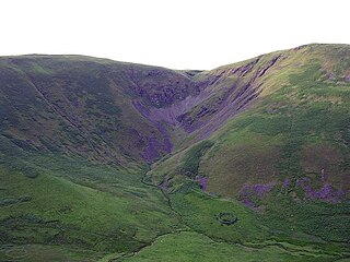
The Devil's Beef Tub, is a deep, dramatic hollow in the hills north of the Scottish town of Moffat. The 500-foot (150 m) deep hollow is formed by four hills, Great Hill, Peat Knowe, Annanhead Hill, and Ericstane Hill. It is one of the two main sources of the River Annan.
Ae Bridgend is a location in the Scottish council area of Dumfries and Galloway next to the River Ae.

The European route E 22 is one of the longest European routes. It has a length of about 5,320 km (3,310 mi). Many of the E-roads have been extended into Asia since the year 2000; the E 22 was extended on 24 June 2002.

The Meers Brook is a stream in Sheffield, England and one of the main tributaries of the River Sheaf. The Meers Brook originates in Gleadless and flows downhill through Gleadless Valley and Meersbrook then, tunnelled, continues underneath Meersbrook to pour into the River Sheaf near Saxon Road and Clyde Road in Lowfield.

Haslingden Grane is the glaciated upper portion of the valley of the River Ogden, lying to the west of Haslingden and in the north east of the West Pennine Moors. It is easily accessible via the B6232/A6077 Grane Road which links to the M65 motorway and the A56. It contains three reservoirs: Calf Hey Reservoir, 1860; Ogden Reservoir, 1912; and Holden Wood Reservoir, 1842.
Johnstonebridge is a village in Dumfries and Galloway, Scotland.

The A72 road is a major route in Scotland connecting Hamilton in South Lanarkshire, with Galashiels in the Scottish Borders. It travels for over 97 kilometres (60 mi) in a south-easterly direction, along the Clyde and Tweed valleys, passing the towns of Larkhall, Lanark, Biggar and Peebles.
The A701 is a major road in Scotland that runs from Dumfries to Edinburgh.

White Coomb is a hill in the Southern Uplands of Scotland. Its summit is the highest point of a network of ridges that lie north-east of the town of Moffat in the Moffat Hills. The ridges are broad, but are defended by steep valleys. The summit marks the highest point in the registration county of Dumfries.

The Moffat hills are a range of hills in the Southern Uplands of Scotland. They form a distinctly triangular shape with a west facing side, a north facing side, and a south-east facing side. It is 17 kilometres from east to west across this triangle and some 16 kilometres north to south. The highest point is White Coomb at 821 m (2694 ft). The town of Moffat lies just south of the Moffat hills and along with Tweedsmuir, at the northern extremity, is the only centre of population around these hills. In some older maps the northern part of the Moffat Hills is called the Tweedsmuir Hills.

Tantallon is a community in Saskatchewan. It is located in the Qu'Appelle Valley about 32 km east of Round Lake (Saskatchewan). The community celebrated its centennial in 2004. The communities school closed due to a lack of students, who are now bused to Esterhazy.
Croft Head is a hill in the Southern Uplands of Scotland 7 km due east of Moffat. Its summit height above sea level is just 637 metres but it offers unobstructed views to the Solway Firth, the fells and mountains of Cumbria and the Pennines to the south and east. To the north, the major Moffat Hills are close by and to the west, Queensberry, the Lowthers and many of the Galloway Hills can be seen.
Bowler is an unincorporated community located in Carbon County, Montana at 45.205°N 108.719°W.

Dryfe Water is a river in Scotland about 18 miles in length which flows into the River Annan at grid reference NY 107 820, near Lockerbie. It starts at NT 170 041 on the southern slopes of Loch Fell, near Moffat, and then flows along a narrow valley to the Annan.
Whaley's Hollow is a village in Coventry, Rhode Island.

Ledwyche Brook is a minor river in south Shropshire, England. It is sometimes referred to as the River Ledwyche and spelled variously, including "Ledwich" or "Ledwych". The brook is a tributary of the River Teme.
German submarine U-719 was a Type VIIC U-boat of Nazi Germany's Kriegsmarine during World War II. The submarine was laid down on 3 July 1942 at the H. C. Stülcken Sohn yard at Hamburg, launched on 28 April 1943, and commissioned on 27 July 1943 under the command of Oberleutnant zur See Klaus-Dietrich Steffens. Attached to 5th U-boat Flotilla based at Kiel, U-719 completed her training period on 30 April 1944 and was assigned to front-line service.


