
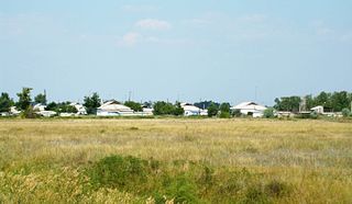
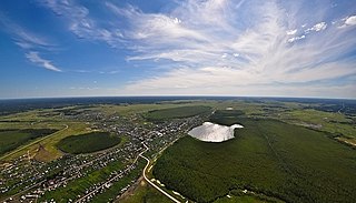
Bagansky District is an administrative and municipal district (raion), one of the thirty in Novosibirsk Oblast, Russia. It is located in the southwest of the oblast. The area of the district is 3,367.73 square kilometers (1,300.29 sq mi). Its administrative center is the rural locality of Bagan. Population: 16,627 ; 18,457 (2002 Census); 18,922 (1989 Soviet census). The population of Bagan accounts for 33.1% of the district's total population.
Karasuksky District is an administrative and municipal district (raion), one of the thirty in Novosibirsk Oblast, Russia. It is located in the southwest of the oblast. The area of the district is 4,321 square kilometers (1,668 sq mi). Its administrative center is the town of Karasuk. Population: 46,262 ; 48,548 (2002 Census); 50,374 (1989 Soviet census). The population of Karasuk accounts for 61.8% of the district's total population.

Kargatsky District is an administrative and municipal district (raion), one of the thirty in Novosibirsk Oblast, Russia. It is located in the center of the oblast. The area of the district is 5,396 square kilometers (2,083 sq mi). Its administrative center is the town of Kargat. Population: 18,207 ; 22,025 (2002 Census); 25,150 (1989 Soviet census). The population of Kargat accounts for 55.2% of the district's total population. Lake Ubinskoye extends into the district's northwest corner.
Kolyvansky District is an administrative and municipal district (raion), one of the thirty in Novosibirsk Oblast, Russia. It is located in the northeast of the oblast. The area of the district is 10,573 square kilometers (4,082 sq mi). Its administrative center is the urban locality of Kolyvan. Population: 24,049 ; 25,737 (2002 Census); 28,292 (1989 Soviet census). The population of Kolyvan accounts for 49.2% of the district's total population.

Suzunsky District is an administrative and municipal district (raion), one of the thirty in Novosibirsk Oblast, Russia. It is located in the southeast of the oblast. The area of the district is 4,746 square kilometers (1,832 sq mi). Its administrative center is the urban locality of Suzun. Population: 32,592 ; 34,917 (2002 Census); 35,677 (1989 Soviet census). The population of Suzun accounts for 47.1% of the district's total population.
Toguchinsky District is an administrative and municipal district (raion), one of the thirty in Novosibirsk Oblast, Russia. It is located in the east of the oblast. The area of the district is 3,925 square kilometers (1,515 sq mi). Its administrative center is the town of Toguchin. Population: 60,303 ; 65,515 (2002 Census); 66,912 (1989 Soviet census). The population of Toguchin accounts for 36.3% of the district's total population.
Dovolnoye is a rural locality and the administrative center of Dovolensky District, Novosibirsk Oblast, Russia. Population: 6,774 (2010 Census); 7,314 (2002 Census); 7,865 (1989 Soviet census).
Kochki is a rural locality and the administrative center of Kochkovsky District, Novosibirsk Oblast, Russia. Population: 4,055 (2010 Census); 4,154 (2002 Census); 4,363 (1989 Soviet census).

Kyshtovka is a rural locality and the administrative center of Kyshtovsky District, Novosibirsk Oblast, Russia. Population: 5,282 (2010 Census); 5,798 (2002 Census); 6,000 (1989 Soviet census).
Severnoye is a rural locality and the administrative center of Severny District, Novosibirsk Oblast, Russia. Population: 5,309 (2010 Census); 5,443 (2002 Census); 5,398 (1989 Soviet census).
Ubinskoye is a rural locality and the administrative center of Ubinsky District, Novosibirsk Oblast, Russia. Population: 5,841 (2010 Census); 5,958 (2002 Census); 6,586 (1989 Soviet census).
Terengul is a rural locality. It is part of the Andreyevsky Village Council of Bagansky District, Novosibirsk Oblast, Russia. Population: 445 (2010 Census); 453 (2002 Census);
Andreyevka is a rural locality. It is the administrative center of the Andreyevsky Village Council of Bagansky District, Novosibirsk Oblast, Russia. Population: 613 (2010 Census); 691 (2002 Census);
Ivanovka is a rural locality. It is the administrative center of the Ivanovsky Village Council of Bagansky District, Novosibirsk Oblast, Russia. Population: 526 (2010 Census); 480 (2002 Census);
Blagoveshchenka is a rural locality. It is the administrative center of the Blagoveshchensky Village Council of Kupinsky District, Novosibirsk Oblast, Russia. Population: 467 (2010 Census); 567 (2002 Census);

Petropavlovka is a rural locality. It is part of the Blagoveshchensky Village Council of Kupinsky District, Novosibirsk Oblast, Russia. Population: 112 (2010 Census); 196 (2002 Census);
Podolsk is a rural locality. It is part of the Ivanovsky Village Council of Bagansky District, Novosibirsk Oblast, Russia. Population: 110 (2010 Census); 140 (2002 Census);
Romanovka is a rural locality. It is part of the Andreyevsky Village Council of Bagansky District, Novosibirsk Oblast, Russia. Population: 120 (2010 Census); 145 (2002 Census);
Khorosheye is a rural locality. It is part of the Khoroshinsky village council of Karasuksky District, Novosibirsk Oblast, Russia.

Yudino is a village (selo). It is part of the urban settlement of the Chistoozyornoye workers' settlement, Chistoozyorny District, Novosibirsk Oblast, Russia. Population: 43 (2010 Census); 104 (2002 Census);

