Related Research Articles
Quiché is a department of Guatemala. It is in the heartland of the Kʼicheʼ (Quiché) people, one of the Maya peoples, to the north-west of Guatemala City. The capital is Santa Cruz del Quiché. The word Kʼicheʼ comes from the language of the same name, which means "many trees".

Cuautitlán Izcalli is a city and one of the 125 municipalities that make up the State of Mexico. Its municipal seat is Cuautitlán Izcalli. It is located in the Valley of Mexico area, and is part of the Metropolitan area of Mexico City. It borders to the north and northwest with Tepotzotlán, to the northeast and to the east with Cuautitlán, to the south with Tlalnepantla de Baz, to the southeast with Tultitlán, to the southwest with Atizapán de Zaragoza and to the west with the municipality of Nicolás Romero.

Guanajuato, officially the Free and Sovereign State of Guanajuato, is one of the 32 states that make up the Federal Entities of Mexico. It is divided into 46 municipalities and its capital city is Guanajuato.

The Lerma River is Mexico's second longest river.

The Río Grande de Santiago, or Santiago River, is a river in western Mexico. It flows westwards from Lake Chapala via Ocotlán through the states of Jalisco and Nayarit to empty into the Pacific Ocean. It is one of the longest rivers in Mexico, measuring up 433 km (269 mi) long.

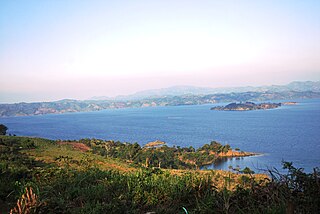
Lake Cuitzeo is a lake in the central part of Mexico, in the state of Michoacán. It has an area of 300–400 km2 (120–150 sq mi). The lake is astatic, meaning the volume and level of water in the lake fluctuates frequently. It is the second-largest freshwater lake in Mexico.
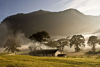
The Bajío is a cultural and geographical region within the central Mexican plateau which roughly spans from northwest of Mexico City to the main silver mines in the northern-central part of the country. This includes the states of Querétaro, Guanajuato, parts of Jalisco, Aguascalientes and parts of Zacatecas, San Luis Potosí and Michoacán.

The Necaxa River is one of the main rivers of the Mexican state of Puebla. It is a tributary of the Tecolutla River. Beginning south of Huauchinango with the name Totolapa, it runs through tall mountains and deep canyons of the Sierra Madre Oriental, forming the waterfalls known as Salto Chico y Salto Grande. Its flow is also used to generate hydroelectric power.
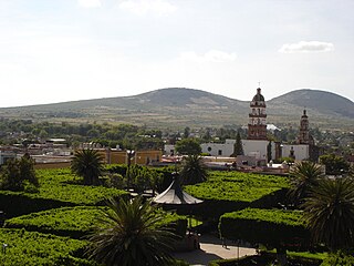
Salvatierra is a Mexican city located in the valley of Huatzindeo in the lowlands of the state of Guanajuato. It is rich in civil and religious architecture; haciendas, bridges, convents and large houses surrounded in tradition and history. With an area of 507.70 square kilometres, Salvatierra accounts for 1.66% the total area of the state. It is bordered to the north by Tarimoro and Cortazar, to the south by Acámbaro and the state of Michoacán, to the west by Yuriria and Santiago Maravatío, and to the northeast by Jaral del Progreso. The municipality had a total of 94,558 inhabitants of which 34,066 lived in the city of Salvatierra, according to the 2005 census. As of 2020 the municipality had a total of 94,126 inhabitants, compared to 2010, the population in Salvatierra decreased by -3.02%

Uriangato is a city and one of 46 municipalities of Guanajuato, located just north of the border between the states of Guanajuato and Michoacán in west central Mexico. Uriangato city is geographically united with Moroleon city and Yuriria city, these three cities form a metropolitan area. Since October 2010, this metropolitan area is the 75th biggest city of Mexico and the 5th biggest in Guanajuato. It is smallest of the 56 metropolitan areas in Mexico.

Irapuato is a Mexican city and municipality located at the foot of the Arandas Hill, in the central region of the state of Guanajuato. It lies between the Silao River and the Guanajuato River, a tributary of the Lerma River, at 1,724 m (5,656 ft) above sea level. It is located at 20°40′N101°21′W. The city is the second-largest in the state, with a population of 342,561 according to the 2005 census, while its municipality has a population of 529,440. The municipality has an area of 851 km2 (329 sq mi) and includes numerous smaller outlying communities. Although it is now an important center for regional trade and transportation center as well the site of several automotive and chemical manufacturing plants, the city's main industry has historically been agriculture and it has long been known for its strawberries and industry of refried beans, also the raising of pigs and cattle. The fruits and flowers of Irapuato's luxurious gardens are well known throughout Mexico.

Almolya del Río is a town and municipality located in the State of Mexico 26 km from the state capital of Toluca. It is located 2,600 meters above sea level. The name Almoloya comes from the Nahuatl phrase almoloyán which means place where water flows out. "del Rio" means "of the river" in Spanish and refers to the Lerma River, which originates here.

The Central Mexican matorral is an ecoregion of the deserts and xeric shrublands biome of central Mexico. It is the southernmost ecoregion of the Nearctic realm.
The Peñitas Dam, also known as Ángel Albino Corzo, is a dam with a hydro-electric power station on the river Rio Grijalva, 83 km south west of the city of Villahermosa, lying in the municipality of Ostuacán in the state of Chiapas in southern Mexico. The power station has an installed production effect of 420 MW from four turbines, and an annual production of 2.035 TWh.
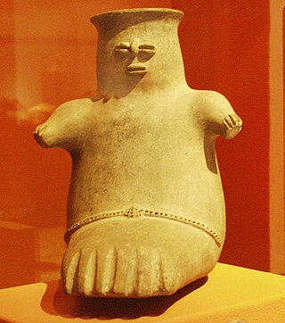
Chupícuaro is an important prehispanic archeological site from the late preclassical or formative period. The culture that takes its name from the site dates to 400 BC to 200 AD, or alternatively 500 BC to 300 AD., although some academics suggest an origin as early as 800 BC.
The Malpaso Dam, officially known as the Nezahualcóyotl Dam, is located in the Centro region of Chiapas, Mexico near the border with Tabasco and Veracruz. It was the first of several major dams built on the Grijalva River to generate hydroelectric energy and has the second largest reservoir in Mexico, after the Belisario Dominguez Dam. Construction of the dam occurred in the 1960s and flooded not only the riverbed but also hectares of rainforest and farmland, various towns and villages and archeological sites. These include the former town of Quechula, whose 16th century Dominican church will appear when water is at low levels, and the archeological site of San Isidro which contains one of only two known double Mesoamerican ball courts. Commissioning of the dam's 1,080 MW power station began in 1969 and ended in 1977. The reservoir and later construction of a federal highway has spurred ecotourism in the area.

Santillana reservoir, also known as Manzanares el Real reservoir, is a body of water along the Manzanares river located in the municipalities of Manzanares el Real and Soto del Real, in the Community of Madrid, in the centre of Spain. It has a maximum surface of 1052 ha, the longest distance between opposites shores reaches 30 kilometres (19 mi), and the total volume of the reservoir is 91 hm³. The first dam was built in 1907, but in 1969 a new and higher dam was built. This new construction was 5 m higher, which allowed the reservoir to have a volume twice as large as before.
Zona Protectora Forestal los terrenos constitutivos de las cuencas de los ríos Valle de Bravo, Malacatepec, Tilostoc y Temascaltepec is a protected area in central Mexico. It covers an area 1402.34 km2 in the mountains of the State of Mexico. It protects the headwaters of the Cutzamala and Temascaltepec rivers. The Cutzamala basin provides freshwater to Mexico City via the Cutzamala-Lerma System.
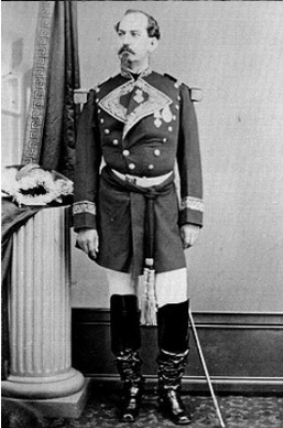
Francisco Florencio Antillón Moreno was a Mexican general and politician. He fought in the major Mexican wars of the 19th Century and served as governor of the state of Guanajuato between 1867 and 1876. During this period important civic developments took place in the city of Guanajuato.
References
- ↑ "Cuenca del Rio Guanajuato". guanajuato.gob.mex. Archived from the original on 2007-02-22. Retrieved 2007-03-21.
- ↑ "Treatment Plant Effects on Wastewater Irrigation Benefits: Revisiting a Case Study in the Guanajuato River Basin, Mexico". International Development Research Center. Archived from the original on 2011-06-09. Retrieved 2007-03-21.
- ↑ "Cuenca del Rio Guanjuato". guanajuato.gob.mex. Archived from the original on 2007-02-22. Retrieved 2007-03-21.
- ↑ "Guanajuato Hydrogeography". mexconnect.com. Retrieved 2007-03-21.
- ↑ "Guanajuato". DonQuijote.org. Retrieved 2007-03-21.
- ↑ "Presa La Olla". GuanajuatoCapital.com. Archived from the original on 2007-03-20. Retrieved 2007-03-21.
- ↑ "Guanajuato City". TourbyMexico.com. Retrieved 2007-03-21.
- ↑ "Opening of the Floodgates". GuanajuatoCapital.com. Archived from the original on 2006-10-21. Retrieved 2007-03-21.
| | This article related to a river in Mexico is a stub. You can help Wikipedia by expanding it. |