Related Research Articles

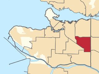
Burnaby is a city in the Lower Mainland region of British Columbia, Canada. Located in the centre of the Burrard Peninsula, it neighbours the City of Vancouver to the west, the District of North Vancouver across the confluence of the Burrard Inlet with its Indian Arm to the north, Port Moody and Coquitlam to the east, New Westminster and Surrey across the Fraser River to the southeast, and Richmond on Lulu Island to the southwest. It has a population of 249,125 as of the 2021 census.
The British Columbia Institute of Technology, is a public polytechnic institute in Burnaby, British Columbia, Canada. The technical institute has five campuses located in the Metro Vancouver region, with its main campus in Burnaby, British Columbia, Canada. There is also the Aerospace Technology Campus in Richmond, the Marine Campus in the City of North Vancouver, Downtown campus in Vancouver, and Annacis Island Campus in Delta. It is provincially chartered through legislation in the College and Institute Act. The school operates as a vocational and technical school, offering apprenticeships for the skilled trades and diplomas and degrees in vocational education for skilled technicians and workers in professions such as engineering, accountancy, business administration, broadcast/media communications, digital arts, nursing, computing, medicine, architecture, and law.

The Burrard Peninsula is a peninsula in the Lower Mainland region of British Columbia, Canada, bounded by the Burrard Inlet to the north, the Georgia Strait to the west, the North Arm of Fraser River to the south, and the Pitt River and Douglas Island to the east. The City of Vancouver occupies almost all of the western half of the peninsula, and the Cities of Burnaby and New Westminster occupy more than half of the eastern half. At its northeastern end, the peninsula is connected to the Eagle Mountain and Mount Burke of the Coast Mountains via a small isthmus at the center of the Tri-Cities.

Vancouver South is a federal electoral district in British Columbia, Canada, that has been represented in the House of Commons of Canada from 1917 to 1997, and since 2004. It covers the southern portion of the city of Vancouver, British Columbia. The district will be replaced by Vancouver Fraserview—South Burnaby for the 45th Canadian federal election.

The lieutenant governor of British Columbia is the representative of the monarch in the province of British Columbia, Canada. The office of lieutenant governor is an office of the Crown and serves as a representative of the monarchy in the province, rather than the governor general of Canada. The office was created in 1871 when the Colony of British Columbia joined Confederation. Since then the lieutenant governor has been the representative of the monarchy in British Columbia. Previously, between 1858 and 1863 under colonial administration the title of lieutenant governor of British Columbia was given to Richard Clement Moody as commander of the Royal Engineers, Columbia Detachment. This position coexisted with the office of governor of British Columbia served by James Douglas during that time.
Vancouver-Renfrew is a provincial electoral district of the Legislative Assembly of British Columbia in Canada.

Science World is a science centre run by a not-for-profit organization called ASTC Science World Society in Vancouver, British Columbia, Canada. It is located at the end of False Creek and features many permanent interactive exhibits and displays, as well as areas with varying topics throughout the years.

CFML-FM is the campus radio station of the British Columbia Institute of Technology in Burnaby, British Columbia, Canada.
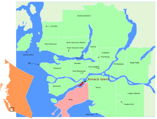
Annacis Island is a narrow island under the jurisdiction of City of Delta in Lower Mainland, British Columbia, located just downstream of the south arm of the Fraser River bifurcation between Lulu Island to the north and the Delta peninsula to the south. The island is now mostly an industrial zone, and contains one of Metro Vancouver's secondary wastewater treatment plants, the Annacis Island Wastewater Treatment Plant. The island is also home to the British Columbia Institute of Technology's Annacis Island campus.

Burnaby Heights, often referred to as The Heights, is a residential neighbourhood in North Burnaby. British Columbia, Canada. It is bounded by Boundary Road to the west, Gamma Avenue to the east and Hastings Street to the south. Its northern edge facing the North Shore Mountains comes down rather steeply to the shores of Burrard Inlet.

Deer Lake is a lake in central Burnaby, British Columbia, Canada. It is home to a wide variety of flora and fauna and features a number of walking trails. These trails connect the lake and its surrounding forests and fields to a number of amenities, including a boat launch, picnic sites, a playground, washrooms, the Burnaby Art Gallery, Shadbolt Centre for the Arts, Burnaby Village Museum, and Century Gardens, as well as the surrounding community and long trails for walking.
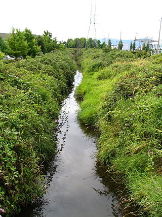
Still Creek is a long stream flowing across Central Burnaby, British Columbia and into Burnaby Lake. Still Creek's path lies mainly through the industrial area which contributes to its high level of pollution, although through dedicated work of local volunteers the creek is slowly recovering.
The Brunette River runs through East Burnaby, New Westminster and Coquitlam, flowing out of Burnaby Lake and to the Fraser River. It is the final outflow of the Central Valley Watershed, which consists of most streams between the Ulksen and Burnaby Heights. According to a map and materials by Heritage Advisory Committee and Environment and Waste Management Committee of the City of Burnaby (1993), the number of native campsites discovered on the shores of the Fraser River, Burrard Inlet and Deer Lake and some petroglyphs suggest that the area was used extensively by local aboriginal peoples such as the Squamish, Musqueam and Kwantlen for hunting and fishing before the arrival of European settlers.
Annacis Island is a narrow island under the jurisdiction of City of Delta in Lower Mainland, British Columbia, located just downstream of the south arm of the Fraser River bifurcation between Lulu Island to the north and the Delta peninsula to the south. The island is now mostly an industrial zone, and contains one of Metro Vancouver's secondary wastewater treatment plants, the Annacis Island Wastewater Treatment Plant. The island is also home to the British Columbia Institute of Technology's Annacis Island campus.
Spring Brook is one of many tributaries of Still Creek, an important stream in Burnaby, British Columbia, Canada. It runs north just east of Boundary Road and joins Still Creek just west of Gilmore Station.
Burnaby Public Library or BPL is a public library that serves Burnaby, British Columbia and the surrounding Lower Mainland. According to its 2019–2022 strategic plan, BPL aims to "empower the community to engage with and share stories, ideas and information." BPL provides access to information services and library collections through its four branches as well as online and through community outreach.

Victoria Harbour is a harbour, seaport, and seaplane airport in the Canadian city of Victoria, British Columbia. It serves as a cruise ship and ferry destination for tourists and visitors to the city and Vancouver Island. It is both a port of entry and an airport of entry for general aviation. Historically it was a shipbuilding and commercial fishing centre. While the Inner Harbour is fully within the City of Victoria, separating the city's downtown on its east side from the Victoria West neighbourhood, the Upper Harbour serves as the boundary between the City of Victoria and the district municipality of Esquimalt. The inner reaches are also bordered by the district of Saanich and the town of View Royal. Victoria is a federal "public harbour" as defined by Transport Canada. Several port facilities in the harbour are overseen and developed by the Greater Victoria Harbour Authority, however the harbour master's position is with Transport Canada.

Mark Angelo, is a Canadian river conservationist, writer, speaker, teacher and paddler. He founded and is the chair of BC Rivers Day and World Rivers Day. In 2009, Angelo was appointed as the inaugural chair of the Rivers Institute at the British Columbia Institute of Technology (BCIT). Prior to that, he was the long-time head of the Fish, Wildlife and Recreation Program at BCIT. Angelo has received the Order of British Columbia and the Order of Canada in recognition of his river conservation efforts. In 2009, he was awarded an honorary doctorate from Simon Fraser University for his river conservation work both locally and globally and in 2019, was the recipient of an honorary doctorate from Trent University for his contributions to protecting global waterways. Angelo's river conservation efforts have been the subject of several feature length films, including the 2016 documentary, RiverBlue and the 2021 film, Last Paddle; 1000 Rivers, 1 Life.
The Thornton Tunnel is a freight railway tunnel in Burnaby, British Columbia, running under the Willingdon Heights and Vancouver Heights neighbourhoods. It was built in 1969 by Canadian National to connect Second Narrows Bridge to the main line in Willingdon, and is 3.4 km long.

Big Bend is the southernmost neighbourhood in Burnaby, British Columbia, Canada, located on the watershed of the Fraser River. The neighbourhood owes its name to the large bend that the river forms on its North Arm. Big Bend comprises all of Burnaby south of Marine Drive.
References
- 1 2 3 "Guichon Creek". British Columbia Institute of Technology. Retrieved 26 November 2021.
- ↑ Community Heritage Commission (6 February 1995). Burnaby Heritage Creek Name Project (PDF) (Report). City of Burnaby Archives. p. 78. Retrieved 26 November 2021.
- ↑ "Waterways of Burnaby" (PDF). p. 2. Retrieved 26 November 2021.
- ↑ Damer (2013 , p. 6)