Related Research Articles

Surrey is a ceremonial county in South East England and one of the home counties. It is bordered by Greater London to the northeast, Kent to the east, East and West Sussex to the south, and Hampshire and Berkshire to the west. The largest settlement is Woking.

Guildford is a town in west Surrey, England, around 27 mi (43 km) south-west of central London. As of the 2011 census, the town has a population of about 77,000 and is the seat of the wider Borough of Guildford, which had around 145,673 inhabitants in 2022. The name "Guildford" is thought to derive from a crossing of the River Wey, a tributary of the River Thames that flows through the town centre.

The Borough of Runnymede is a local government district with borough status in Surrey, England. Its council is based in Addlestone and the borough also includes the towns of Chertsey and Egham. The borough is named after Runnymede, a water meadow on the banks of the River Thames near Egham, which is connected with the sealing of Magna Carta by King John in 1215.

The University of Surrey is a public research university in Guildford, Surrey, England. The university received its royal charter in 1966, along with a number of other institutions following recommendations in the Robbins Report. The institution was previously known as Battersea College of Technology and was located in Battersea Park, London. Its roots however, go back to Battersea Polytechnic Institute, founded in 1891 to provide further and higher education in London, including its poorer inhabitants.

Cranleigh is a village and civil parish, about 8 miles (13 km) southeast of Guildford in Surrey, England. It lies on a minor road east of the A281, which links Guildford with Horsham. It is in the north-west corner of the Weald, a large remnant forest, the main local remnant being Winterfold Forest directly north-west on the northern Greensand Ridge. In 2011 it had a population of just over 11,000.

The Borough of Waverley is a local government district with borough status in Surrey, England. The council is based in the town of Godalming. The borough also contains the towns of Farnham and Haslemere and numerous villages, including the large village of Cranleigh, and surrounding rural areas. At the 2021 Census, the population of the borough was 128,200. The borough is named after Waverley Abbey, near Farnham. Large parts of the borough are within the Surrey Hills Area of Outstanding Natural Beauty.
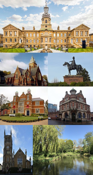
Aldershot is a town in the Rushmoor district, Hampshire, England. It lies on heathland in the extreme north-east corner of the county, 31 mi (50 km) south-west of London. The town has a population of 37,131, while the Aldershot Urban Area – a loose conurbation, which also includes other towns such as Camberley and Farnborough– has a population of 243,344; it the thirtieth-largest urban area in the UK.

Surrey Heath is a local government district with borough status in Surrey, England. Its council is based in Camberley. Much of the area is within the Metropolitan Green Belt.
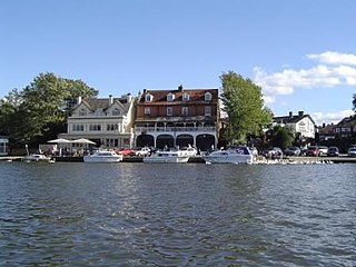
Elmbridge is a local government district with borough status in Surrey, England. Its council is based in Esher, and other notable towns and villages include Cobham, Walton-on-Thames, Weybridge and Molesey. The borough lies just outside the administrative boundary of Greater London, but is mostly within the M25 motorway which encircles London. Many of the borough's urban areas form part of the wider Greater London Built-up Area.

Mole Valley is a local government district in Surrey, England. Its council is based in Dorking, and the district's other town is Leatherhead. The largest villages are Ashtead, Fetcham and Great Bookham, in the northern third of the district.

The Borough of Guildford is a local government district with borough status in Surrey, England. With around half of the borough's population, Guildford is its largest settlement and only town, and is where the council is based.
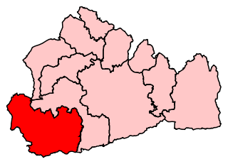
South West Surrey was a constituency in the House of Commons of the UK Parliament. Since its 1983 creation, South West Surrey has been represented only by members of the Conservative Party. From 2005, the seat's MP was Jeremy Hunt, the current chancellor of the Exchequer and the former Culture Secretary, Health Secretary and Foreign Secretary.
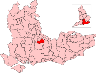
Guildford is a constituency in Surrey represented in the House of Commons of the UK Parliament since 2019 by Angela Richardson, a Conservative.

Surrey Heath is a constituency represented in the House of Commons of the UK Parliament since 2005 by Michael Gove, a Conservative who has also been the Secretary of State for Levelling Up, Housing and Communities since October 2022. The Home counties suburban constituency is in the London commuter belt, on the outskirts of Greater London. Surrey Heath is in the north west of Surrey and borders the counties of Berkshire and Hampshire.

Mole Valley is a former constituency in Surrey represented in the House of Commons of the UK Parliament since 1997 by Sir Paul Beresford, a Conservative, until it was abolished in 2024, primarily replaced by Dorking and Horley.

Anne Frances Milton is a former British politician and lobbyist who served as Minister of State for Skills and Apprenticeships from 2017 to 2019. She was Member of Parliament (MP) for Guildford from 2005 to 2019. Elected as a Conservative, she had the whip removed in September 2019 and subsequently sat as an independent politician.

Compton is a village and civil parish in the Guildford district of Surrey, England. It is between Godalming and Guildford. It has a medieval church and a close connection to fine art and pottery, being the later life home of artist George Frederic Watts. The parish has considerable woodland and agricultural land, and the undeveloped portions are in the Metropolitan Green Belt. The village is traversed by the North Downs Way and has a large western conservation area. Central to the village are the Watts Gallery, the cemetery chapel commissioned by his wife for him, two inns and the parish church.
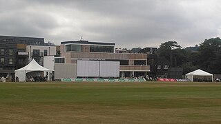
The Sports Ground, Woodbridge Road is a cricket ground in Guildford, Surrey. The ground was given to the town in trust in 1911 by Sir Harry Waechter, Bart. Guildford Cricket Club play their home matches on the ground. Surrey County Cricket Club usually play at least one County Championship match there each season, as well as some second XI and Surrey Stars fixtures. Until comparatively recently, hockey was played on the ground in winter. The ground was also used for football until at least 1921. It was the home ground of the amateur team Guildford F.C. who existed until 1953 and was also used as the venue for some Surrey Senior Cup finals.

G Live is an arts centre in Guildford, Surrey, England. It was officially opened by Prince Edward, Duke of Kent in February 2012.
References
- 1 2 "Nights to remember at the Guildford Civic Hall", Get Surrey , 30 January 2004.
- ↑ "Live in Guildford, 1972", Elephant Talk Wiki, 19 June 2007.
- ↑ "In pictures: Artists' plans of Civic Hall's replacement", BBC, 1 July 2010. Archived July 5, 2010, at the Wayback Machine
- ↑ Luke Jacobs, "Neighbours see how new civic hall is progressing", Get Surrey , 5 March 2010. Archived March 10, 2010, at the Wayback Machine
- ↑ "Guildford Antiques Fair at G Live". Surreylife.co.uk. Archived from the original on 15 June 2016. Retrieved 16 November 2018.
- ↑ "G Live". Hqtheatres.com. Retrieved 10 January 2021.
G Live opened in September 2011 on the site of Guildford's former Civic Hall.
- ↑ "BBC: Election 92 (Part 1) - YouTube". YouTube . Retrieved 10 January 2021.
51°14′19″N0°33′59″W / 51.2386°N 0.5663°W