The Northern line is a London Underground line that runs from south-west to north-west London, with two branches through central London and three in the north. It runs northwards from its southern terminus at Morden in the borough of Merton to Kennington in Southwark, where it divides into two central branches, one via Charing Cross in the West End and the other via Bank in the City. The central branches re-join at Camden Town where the line again divides into two branches, one to High Barnet and the other to Edgware in the borough of Barnet. On the High Barnet branch there is a short single-track branch to Mill Hill East only.

The Golders Green Hippodrome was built in 1913 by Bertie Crewe as a 3,000-seat music hall, to serve North London and the new London Underground Northern line expansion into Golders Green in the London Borough of Barnet, London, England. Taken over by the BBC in the 1960s as a television studio, it has been put to more recent use as a radio studio and multi-purpose concert venue. In 2007, it became an evangelical church building. Since 2017, it is an Islamic centre.

Camden Passage off Upper Street in the London Borough of Islington, minutes from Angel tube station is a picturesque car free London street. The passage is known for its antique shops, markets and its array of independent shops, cafes and restaurants.

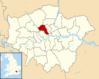
The London Borough of Camden is a borough in north west London, and forms part of Inner London. Historically in Middlesex, some southern areas of the borough, such as Holborn, are sometimes described as part of the West End of London.

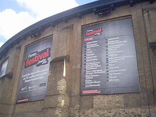
The Apple Music Festival was a music concert series held by Apple, Inc. inaugurated in 2007. Free tickets were given to Apple Music, iTunes and DICE users who lived in the United Kingdom, through localized prize draws. Performances were streamed live and available to view afterwards, free of charge, for Apple Music members on their Apple TV, iPhone, iPad, iPod touch, Mac, PC, and Android phones. In London, the Apple Music Festival had become an annual music festival which takes place in September at The Roundhouse art centre in Camden Town. The series made its United States debut with five days of free performances at the Moody Theater in March 2014, alongside the South by Southwest (SXSW) music showcase in Austin, Texas.

The Lord High Admiral is a Grade II* listed former public house at 43 Vauxhall Bridge Road, Pimlico, London.

ArtsLav was an arts venue located at Kennington Cross in Kennington, London, England. It started life as an underground Victorian gentlemen's public lavatory. It is now a listed and restored Kennington landmark used as a community arts facility, Artslav. Engineered by B. Finch and Co. in 1898. It went out of commission in 1988 during a period of public convenience closures in Lambeth.

The Sun and 13 Cantons is a Grade II listed public house at 20 Great Pulteney Street, Soho, London W1.

The Harp is a public house at 47 Chandos Place, Covent Garden, London, WC2N 4HS.

St John the Baptist, now the Christ Apostolic Church, is a grade II listed building at 23 Highgate Road, Kentish Town, London.

The Ship and Shovell is a Victorian pub in Craven Passage, Charing Cross, London. It may be unique for consisting of two separate buildings on either side of a street, connected underground by a shared cellar.

The Guilford Place drinking fountain is a Grade II listed drinking fountain at Guilford Place, London WC1, built in about 1870, and designed by the architect Henry Darbishire, for the Misses Whiting to commemorate their mother.

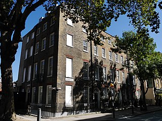
Guilford Place is a Grade II listed Georgian terrace of four houses in Guilford Place, London WC1, built in about 1791 to 1793 by J. Tomes and W. Harrison.

The Denbigh Arms is a former pub at 3 Denbigh Place, Pimlico, London SW1.

The Knave of Clubs is a former pub at 25 Bethnal Green Road, Shoreditch, London E1. It closed in July 1994, and since 2001 has been Les Trois Garçons, a restaurant.

The Rose and Crown, Bow is a former pub at 8 Stroudley Walk, Bow, London E3.
The Markham Arms is a former pub at 138 King's Road, London SW3. It closed as a pub in the early 1990s, and is now a branch of the Santander bank.

The Park Hotel is a pub, restaurant and hotel at 19 Park Road, Teddington, London TW11.

St Paul's Tavern is a former pub at 56 Chiswell Street, London EC1. It is now a restaurant, the Chiswell Street Dining Rooms.


