
Adambakkam is a neighbourhood of Chennai, India. It is a thickly populated area close to St. Thomas Mount railway station. Adambakkam area comes under Velachery taluk and Alandur taluk, Chennai District of Chennai Corporation. Adambakkam is surrounded by areas namely, Alandur, Palavanthangal, Nanganallur, Thalakanancheri, Vanuvampet, Puzhuthivakkam, Velachery and Guindy. Earlier, one part of Adambakkam was under the direct governance of Chennai Corporation. From October 2011 onwards, the entire area was merged with the Chennai Corporation. Upon completion of the MRTS extension line, the neighbourhood will be served by Adambakkam railway station.

Kotturpuram, also known as Kottur, is a neighbourhood in Chennai (Madras), Tamil Nadu, India. The neighbourhood is served by Kotturpuram MRTS railway station.

Chennai district, formerly known as Madras district, is one of the 38 districts in the state of Tamil Nadu in India. It is the smallest and densest of all the districts in the state. Most of the Greater Chennai City comes under this district, erstwhile under Tiruvallur, Kanchipuram and Chengalpattu districts. As of 2011, the district had a population of 7,100,000 with a sex-ratio of 989 females for every 1,000 males.

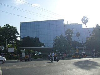
Guindy is one of the important neighborhoods of Chennai (Madras), Tamil Nadu, India. The Kathipara junction where Anna Salai, Mount-Poonamallee Road, Inner Ring Road, 100 Feet Road or Jawaharlal Nehru Road, and GST Road meet here. It is one of the important nodal points of road traffic in the metropolitan area. This junction serves as the entry point to the city limits from the suburbs. It is surrounded by Saidapet in the north, Kotturpuram and Adyar towards the east, Velachery in the south and Adambakkam and St. Thomas Mount in the west. Guindy is home to many important landmarks in the city, the most famous amongst them being the Guindy National Park — the only National Park in the country within city limits. It also serves as a main hub for several small and medium scale industries. Transportation to/from the neighborhood is catered by Guindy railway station and Guindy metro station.

Velachery is a residential area in southern Chennai, Tamil Nadu, India. The growth of the neighbourhood during the last decade can be cited due to the growth of the IT sector in south Chennai. It acts as an important hub connecting the rapidly growing business-class information technology corridor popularly called the OMR; the more mature and well-connected GST road and the central business districts of the city, which has more relevance to the history of Chennai. Velachery as a whole draws a perfect balance between old and new Chennai and is a phenomenon in terms of growth and development.
Ramapuram is a neighbourhood in the western part of Chennai, India. It is situated on the Mount-Poonamallee Road at a distance of 3 kilometres from Guindy. Ramapuram forms a part of Maduravoyal taluk, Chennai district.

West Mambalam is a residential and commercial area in Chennai (Madras), India. It is known for its shops, bazaars and Hindu temples. It is bounded by Kodambakkam to the north and Saidapet to the south. T. Nagar and Nandanam stretch all along its eastern frontiers while Ashok Nagar lies to its west. The Ayodhya Mandapam is an important landmark.
Sardar Patel Road is an arterial road in Chennai which runs from Mount Road eastwards through Guindy and Adyar for 3.2-kilometre (2.0 mi) up to the sea coast where it turns north and crosses the Adyar River to Raja Annamalaipuram.
Pattabiram, which is pronounced as 'Pattaabhiraam', is a neighbourhood situated on the western part of Chennai, Tamil Nadu, in India. The town, which falls under the local administrative limits of Avadi City Municipal Corporation, is about 25 km from the Chennai Central railway station.
Mambalam taluk is a taluk of the city district of Chennai in the Indian state of Tamil Nadu. It was formed in December 2013 from parts of the former Egmore-Nungambakkam taluk and the Mambalam-Guindy taluk. It comprises the neighbourhoods of K. K. Nagar, Kodambakkam, Mambalam, Saligramam, Saidapet and Virugambakkam.
Ekkattuthangal, also known as Ekkaduthangal or Ekkatuthangal, is a neighborhood in Chennai city, Tamil Nadu, India. It is surrounded by Jafferkhanpet, Guindy and Ramapuram. Area pincode is 600032, and previously it was 600097.
Gerugambakkam is a residential-industrial neighborhood in the South-Western part of Chennai, a metropolitan city in Tamil Nadu, India.It belongs to the Alandur taluk of Chennai District, Tamil Nadu, India. The Alandur taluk, earlier a part of Kanchipuram district has now been annexed to the Chennai District. It forms a suburb of Chennai city.

Guindy railway station is one of the railway stations of the Chennai Beach–Chengalpattu section of the Chennai Suburban Railway Network. It serves the neighbourhood of Guindy, a suburb of Chennai. It is located at about 14 km from Chennai Beach terminus and is situated at NH 45 in Anna Salai, with an elevation of 12 m above sea level.
Alandur taluk is a taluk of the district of Chennai in the Indian state of Tamil Nadu. The centre of the taluk is the neighbourhood of Alandur. The headquarters of the taluk is Guindy division. On 4 January 2018, Chennai district was expanded by annexing Alandur taluk.
Sholinganallur taluk is a taluk of the city district of Chennai in the Indian state of Tamil Nadu. It was created in 2009 by the trifurcation of Tambaram taluk in Kanchipuram district. The centre of the taluk is the neighbourhood of Sholinganallur. The headquarters of the taluk is Guindy division. On 4 January 2018, Chennai district was expanded by annexing Sholinganallur taluk.
Guindy metro station is a Metro railway station on the Blue Line of the Chennai Metro, which opened on 21 September 2016 along with the elevated section on the Blue Line. The station is among the elevated stations coming up along corridor I of the Chennai Metro, Washermanpet–Chennai International Airport stretch. The station will serve the neighbourhoods of Guindy and Velachery.
South Chennai is the new southern neighbourhoods of Chennai city, India. It is roughly the neighbourhoods and suburbs that lie south of the Adyar River. None of these places were part of Chennai Corporation before 1947 and became part of Chennai before 1990 when they existed as separate local bodies.
Guindy taluk is a taluk of the city district of Chennai in the Indian state of Tamil Nadu. It was formed in December 2013 from parts of the erstwhile Mambalam-Guindy taluk and the Mylapore-Triplicane taluk. It comprises the neighbourhoods of Adyar, Alandur, T. Nagar, Ekkaduthangal, Guindy and Kotturpuram.
Velachery taluk is a taluk of the city district of Chennai in the Indian state of Tamil Nadu. It was formed in December 2013 from parts of the erstwhile Mambalam-Guindy and Mylapore-Triplicane taluks. It comprises the neighbourhoods of Besant Nagar, Tharamani, Thiruvanmiyur and Velachery.
Guindy division is a revenue division in the Chennai district of Tamil Nadu, India. It comprises the taluks of Alandur, Guindy, Mylapore, Sholinganallur and Velachery.