Guryevsky District is the name of several administrative and municipal districts in Russia.
Russia, officially the Russian Federation, is a transcontinental country in Eastern Europe and North Asia. At 17,125,200 square kilometres (6,612,100 sq mi), Russia is by far or by a considerable margin the largest country in the world by area, covering more than one-eighth of the Earth's inhabited land area, and the ninth most populous, with about 146.77 million people as of 2019, including Crimea. About 77% of the population live in the western, European part of the country. Russia's capital, Moscow, is one of the largest cities in the world and the second largest city in Europe; other major cities include Saint Petersburg, Novosibirsk, Yekaterinburg and Nizhny Novgorod. Extending across the entirety of Northern Asia and much of Eastern Europe, Russia spans eleven time zones and incorporates a wide range of environments and landforms. From northwest to southeast, Russia shares land borders with Norway, Finland, Estonia, Latvia, Lithuania and Poland, Belarus, Ukraine, Georgia, Azerbaijan, Kazakhstan, China, Mongolia and North Korea. It shares maritime borders with Japan by the Sea of Okhotsk and the U.S. state of Alaska across the Bering Strait. However, Russia recognises two more countries that border it, Abkhazia and South Ossetia, both of which are internationally recognized as parts of Georgia.
Guryevsky District is an administrative district (raion), one of the fifteen in Kaliningrad Oblast, Russia. As a municipal division, it is incorporated as Guryevsky Urban Okrug. It is located in the west of the oblast. The area of the district is 1,284 square kilometers (496 sq mi). Its administrative center is the town of Guryevsk. Population: 52,988 (2010 Census); 47,330 ; 39,148 (1989 Census). The population of Guryevsk accounts for 23.5% of the district's total population.
Kaliningrad Oblast, often referred to as the Kaliningrad Region in English, or simply Kaliningrad, is a federal subject of the Russian Federation that is located on the coast of the Baltic Sea. As an oblast, its constitutional status is equal to each of the other 84 federal subjects. Its administrative center is the city of Kaliningrad, formerly known as Königsberg. It is the only Baltic port in the Russian Federation that remains ice-free in winter. According to the 2010 census, it had a population of 941,873.
Guryevsky District is an administrative district (raion), one of the nineteen in Kemerovo Oblast, Russia. As a municipal division, it is incorporated as Guryevsky Municipal District. It is located in the west of the oblast and borders with Prokopyevsky, Belovsky, and Leninsk-Kuznetsky Districts of Kemerovo Oblast and with Altai Krai and Novosibirsk Oblast in the west. The area of the district is 2,180 square kilometers (840 sq mi). Its administrative center is the town of Guryevsk. Population: 10,617 (2010 Census); 12,057 ; 20,816 (1989 Census).
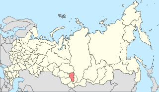
Belovsky District is the name of several administrative and municipal districts in Russia.
Mezhdurechensky District is the name of several administrative and municipal districts in Russia:
Yurginsky District is the name of several administrative and municipal districts in Russia:
Anzhero-Sudzhensk is a town in the Kuznetsk Basin in Kemerovo Oblast, Russia, located to the north of the oblast's administrative center of Kemerovo and to the east of the Tom River, on the route of the Trans-Siberian Railway. Population: 76,646 (2010 Census); 86,480 (2002 Census); 107,951 (1989 Census).
Salair is a town administratively subordinated to Guryevsk Town Under Oblast Jurisdiction in Kemerovo Oblast, Russia, located 210 kilometers (130 mi) south of Kemerovo, the administrative center of the oblast. Population: 8,262 (2010 Census); 9,472 (2002 Census); 11,452 (1989 Census).
Guryevsk is a town in Kemerovo Oblast, Russia, located 195 kilometers (121 mi) southeast of Kemerovo, the administrative center of the oblast. Population: 24,817 (2010 Census); 27,381 (2002 Census); 28,152 (1989 Census).
Ozyorsky District is the name of several administrative and municipal districts in Russia.
Kuznetsky District is the name of several administrative and municipal districts in Russia.
Rudnichny City District is the name of several city divisions in Russia:
Beryozovsky is a town in Kemerovo Oblast, Russia, located between the Barzas and Shurap Rivers, 27 kilometers (17 mi) north of Kemerovo, the administrative center of the oblast. Population: 47,279 (2010 Census); 48,299 (2002 Census); 51,250 (1989 Census).
Kaltan is a town in Kemerovo Oblast, Russia, located on the Kondoma River, 338 kilometers (210 mi) south of Kemerovo, the administrative center of the oblast. Population: 21,892 (2010 Census); 25,591 (2002 Census); 25,369 (1989 Census).
Zavodsky City District is the name of several city divisions in Russia.
Mezhdurechensky District is an administrative district (raion), one of the nineteen in Kemerovo Oblast, Russia. It is located in the southeast of the oblast. Its administrative center is the city of Mezhdurechensk. Population: 2,268 (2010 Census); 2,658.
Novokuznetsky District is an administrative district (raion), one of the nineteen in Kemerovo Oblast, Russia. As a municipal division, it is incorporated as Novokuznetsky Municipal District. It is located in the center of the oblast and spans it from border to border in the southwest-northeast direction. The area of the district is 13,039.5989 square kilometers (5,034.6173 sq mi). Its administrative center is the city of Novokuznetsk. As of the 2010 Census, the total population of the district was 50,681.
Tashtagolsky District is an administrative district (raion), one of the nineteen in Kemerovo Oblast, Russia. As a municipal division, it is incorporated as Tashtagolsky Municipal District. It is located in the south of the oblast. The area of the district is 11,383 square kilometers (4,395 sq mi). Its administrative center is the town of Tashtagol. Population: 31,895 (2010 Census); 34,545 ; 37,816 (1989 Census).
Yurginsky District is an administrative district (raion), one of the nineteen in Kemerovo Oblast, Russia. As a municipal division, it is incorporated as Yurginsky Municipal District. It is located in the northwest of the oblast. The area of the district is 2,510 square kilometers (970 sq mi). Its administrative center is the town of Yurga. Population: 22,448 (2010 Census); 22,779 ; 22,994 (1989 Census).
Mezhdurechensky Urban Okrug is a municipal formation in Kemerovo Oblast, Russia, one of the sixteen urban okrugs in the oblast. Its territory consists of the territories of two administrative divisions of Kemerovo Oblast—Mezhdurechensky District and Mezhdurechensk City Under Oblast Jurisdiction.
Komsomolskoye Urban Settlement is the name of several municipal formations in Russia.
Guryevskoye Urban Settlement is the name of several municipal formations in Russia.

Polysayevo is a town in Kemerovo Oblast, Russia, located on the right bank of the Inya River 139 kilometers (86 mi) south of Kemerovo. Population: 27,624 (2010 Census); 28,151 (2002 Census).
| This article includes a list of related items that share the same name (or similar names). If an internal link incorrectly led you here, you may wish to change the link to point directly to the intended article. |