This article needs additional citations for verification . (July 2017) (Learn how and when to remove this template message) |
The Bora Bora Group. | |
Geography | |
---|---|
Location | Pacific Ocean |
Coordinates | Coordinates: 16°27′36″S151°46′12″W / 16.460°S 151.770°W |
Archipelago | Society Islands |
Area | 0.02 km2 (0.0077 sq mi) |
Highest elevation | 0 m (0 ft) |
Administration | |
France | |
Commune | Bora Bora Commune |
Island Group | Bora Bora |
Largest settlement | Haapiti Rahi(pop. 0) |
Demographics | |
Population | 0 (2016) |
Pop. density | 0 /km2 (0 /sq mi) |
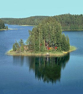
Haapiti Rahi, also known as Motu Haapiti Rahi, is a 3.5-acre (0.014 km2) private island in the lagoon of Bora Bora in French Polynesia. It is the located between Krisu, and Tevairoa, near Haapiti Iti.
A private island is a disconnected body of land wholly owned by a single private citizen or corporation. Although this exclusivity gives the owner substantial control over the property, private islands remain under the jurisdiction of national and sometimes local governments.
A lagoon is a shallow body of water separated from a larger body of water by barrier islands or reefs. Lagoons are commonly divided into coastal lagoons and atoll lagoons. They have also been identified as occurring on mixed-sand and gravel coastlines. There is an overlap between bodies of water classified as coastal lagoons and bodies of water classified as estuaries. Lagoons are common coastal features around many parts of the world.
Bora Bora is a 30.55 km2 (12 sq mi) island group in the Leeward group in the western part of the Society Islands of French Polynesia, an overseas collectivity of France in the Pacific Ocean. The main island, located about 230 kilometres northwest of Papeete, is surrounded by a lagoon and a barrier reef. In the center of the island are the remnants of an extinct volcano rising to two peaks, Mount Pahia and Mount Otemanu, the highest point at 727 metres. It is part of the commune of Bora-Bora, which also includes the atoll of Tūpai.
The island is part of Bora Bora Commune.
The island is up for sale [1]
After arriving in Fa'a'ā International Airport, an Air Tahiti inter-island flight (50 minutes) will bring you to Bora Bora Airport.
Fa'a'ā International Airport, also known as Tahiti International Airport, is the international airport of French Polynesia, located in the commune of Fa'a'ā, on the island of Tahiti. It is situated 5 km (3.1 mi) southwest of Papeete, the capital city of the overseas collectivity. It opened in 1960. Regional air carrier Air Tahiti and international air carrier Air Tahiti Nui are both based at the airport.
Air Tahiti is a French airline company which operates in French Polynesia, France. Its principal base is Faa'a International Airport.
Bora Bora Airport, also known as Motu Mute Airport, is an airport serving the island of Bora Bora in French Polynesia. It is located on the islet of Motu Mute.
There, you will need to hire a boat at the Rent-a-boat Office.
The Society Islands are an archipelago located in the South Pacific Ocean. Politically, they are part of French Polynesia, an overseas collectivity of France. Geographically, they form part of Polynesia.
Transports Aériens Intercontinentaux was a private French airline, based at Orly Airport, Paris. In 1963, it was merged with Union Aéromaritime de Transport on 1 October 1963 to form UTA French Airlines.
This page list topics related to French Polynesia.
Vaitape is the largest city of Bora Bora Island in French Polynesia. It has a population of 4,927, about half of the island's population which is about 9,000. It is located about 130 mi (210 km) northwest of Papeete, the capital of French Polynesia. The main language of Vaitape is French, although 20 percent of the population speaks Tahitian.
Motu Mute is a 1.2 km2 (0 sq mi) island in the Bora Bora Islands Group, within the Society Islands of French Polynesia. It is the located between Havae, and Tooparopae.
Ome, is a 1.087 km2 (0.420 sq mi) public island in the lagoon of Bora Bora in French Polynesia. It is the located between Mute, and Temahu. Former island of Tooparopae is now adjoined to Ome in its western point.
Motu Paahi is a 0.19 km2 (0.1 sq mi) island in the Bora Bora Islands Group, within the Society Islands of French Polynesia. It is the located between Vananui, and Tane.
Motu Moute is a 0.115 km2 (0.0 sq mi) island in the Bora Bora Islands Group, within the Society Islands of French Polynesia. It is the located between Vananui, and Moute Iti.
Motu Toopua is a 1.45 km2 (0.6 sq mi) island in the Bora Bora Islands Group, within the Society Islands of French Polynesia. It is the located between Toopua Iti, and Tapu.
Motu Tapu, is a 0.026 km2 (0.010 sq mi) private island in the lagoon of Bora Bora in French Polynesia. It is the located between Toopua, and Ahuna. Motu Tapu is located just outside the Teavanui Passage, and has the Teavanui front automated lighthouse installed, in Paparoto point on the north of the island.
Motu Piti Aau is a 2.25 km2 (0.9 sq mi) island in the Bora Bora Islands Group, within the Society Islands of French Polynesia. It is the located between Pitiuu Tai, and Tape.
Motu Tane, is a 9.6-acre (0.039 km2) private island in the lagoon of Bora Bora in French Polynesia. It is the located between Paahi, and Pitoraverahi.
Motu Tupe is a 14-acre (0.057 km2) private island in the lagoon of Bora Bora in French Polynesia. It is the located between Tape and Taufarii.
Motu Tofari is a 1.132 km2 (0.4 sq mi) island in the Bora Bora Islands Group, within the Society Islands of French Polynesia. It is the located between Taufarii, and Ome.
Motu Tevairoa is a 2.363 km2 (0.9 sq mi) island in the Bora Bora Islands Group, within the Society Islands of French Polynesia. It is the located between Haapiti Rahi, and Ahuna.
![]() | This French Polynesia-related geography article is a stub. You can help Wikipedia by expanding it. |