Related Research Articles

Oakland County is a county in the U.S. state of Michigan. It is part of the metropolitan Detroit area, located northwest of the city. As of the 2010 census, its population was 1,202,362, making it the second-most populous county in Michigan, behind neighboring Wayne County. The county seat is Pontiac. The county was founded in 1819 and organized in 1820.
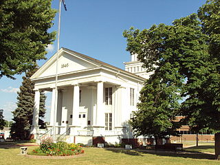
Lapeer County is a county located in the U.S. state of Michigan. As of the 2010 census, the population was 88,319. The county seat is Lapeer. The county was created on September 18, 1822, and was fully organized on February 2, 1835. The name is a corruption of the French la pierre, which means "the stone". Lapeer County is included in the Detroit-Warren-Dearborn, MI Metropolitan Statistical Area.

Genesee County is a county in the U.S. state of Michigan. As of the 2010 census, the population was 425,790, making it the fifth-most populous county in Michigan. The county seat and population center is Flint. Genesee County is considered to be a part of the greater Mid Michigan area.

Hadley Township is a civil township of Lapeer County in the U.S. state of Michigan. The population was 4,528 at the 2010 Census.
Lapeer Township is a civil township of Lapeer County in the U.S. state of Michigan. The population was 5,056 at the 2010 Census. The name is an Americanization of the French La pierre, which means "flint" or "flint stone".
Metamora Township is a civil township of Lapeer County in the U.S. state of Michigan. The population was 4,249 at the 2010 Census.

Holly Township is a civil township of Oakland County in the U.S. state of Michigan. The population was 11,362 at the 2010 census.

Independence Township is a charter township of Oakland County, in the U.S. state of Michigan.
Oxford Township, officially the Charter Township of Oxford, is a charter township in Oakland County in the U.S. state of Michigan. The population was 20,526 at the 2010 census.

Rochester Hills is a city in Oakland County in the U.S. state of Michigan. As of the 2010 census, the city had a total population of 70,995.

White Lake Charter Township is a charter township of Oakland County in the U.S. state of Michigan. Together with its two unincorporated communities, the township makes up part of the Detroit metropolitan area outskirts. As of the 2010 census, the township population was 30,019.
The Thumb is a region and a peninsula of the U.S. state of Michigan, so named because the Lower Peninsula is shaped like a mitten. The Thumb area is generally considered to be in the Central Michigan region, east of the Tri-Cities and north of Metro Detroit. The region is also branded as the Blue Water Area.
M-24 is a north–south state trunkline highway in the U.S. state of Michigan that extends 75.691 miles (121.813 km) through Southeast Michigan and The Thumb, from northeast Auburn Hills to Unionville. It starts at an interchange with Interstate 75 (I-75) and ends where it merges with M-25. While the M-24 designation is similar to that of US Highway 24 (US 24) which has a northern terminus located only a few miles from the southern terminus of M-24, M-24 was never part of US 24.

The Shiawassee River in the U.S. state of Michigan drains an area of 1,201 square miles (3,110 km2) within Oakland, Genesee, Livingston, Shiawassee, Midland and Saginaw counties. It flows in a generally northerly direction for about 110 miles (180 km) from its source to its confluence with the Tittabawassee River creating the Saginaw River, which drains into the Saginaw Bay of Lake Huron.

Louis Convers Cramton was a politician and jurist from the U.S. state of Michigan.

The Goodrich Area School District is a public school district in Genesee County in the U.S. state of Michigan and in the Genesee Intermediate School District.
Metamora-Hadley State Recreation Area is a state-managed protected area in the U.S. state of Michigan, located in Hadley Township in Lapeer County, northwest of Detroit. It is located eight miles south of the city of Lapeer. The closest urban community is the village of Metamora, Michigan, which lies to its east and is used in its postal address.

Highland State Recreation Area is a 5,900-acre (2,400 ha) state recreation area in the southeast part of the U.S. state of Michigan. It is located in north Oakland County, 14 miles (23 km) west of Pontiac.

Paint Creek Trail is an 8.9-mile (14.3 km) rail trail linear park in northeast Oakland County, Michigan. The course of the park generally follows Paint Creek, a stream that flows southeast towards the Clinton River.
References
- ↑ History of Lapeer County, Michigan: with illustrations and biographical sketches of some of its prominent men and pioneers. H.R. Page & Co. 1884. pp. 1–.
- ↑ Western Association of State Game and Fish Commissioners (U.S.). (1971). Proceedings of the Annual Conference of Western Association of State Game and Fish Commissioners. Western Association of State Game & Fish Commissioners.
- ↑ Michigan. Dept. of Natural Resources; Shirley Walter Allen; George Charles Sumner Benson (1942). They Need Not Vanish: A Discussion of the Natural Resources of Michigan. Michigan Department of Conservation.
- ↑ Kent L. Copeman; Laura Strauss; Reta Copeman (1977). A Historical Scrapbook of Hadley Township. Hadley Friends of the Library.
- ↑ "Hadley Hills Coon Hunters Association tradition continues" [ permanent dead link ]. The Citizen
- ↑ T. Huggler (1 June 1985). Hunt Michigan!: How To, Where To, When To. Michigan United Conservation Clubs. ISBN 978-0-933112-12-4.
- ↑ It's Playtime All the Time in Eastern and Central Michigan. East Michigan Tourist Association.
- ↑ "HORSIN' AROUND: Equestrian work bee seeks participants to clean, improve area". Oakland Press News. By SHARON GREENE