
Hagåtña is the capital village of the United States territory of Guam. From the 18th through mid-20th century, it was Guam's population center, but today it is the second smallest of the island's 19 villages in both area and population. However, it remains one of the island's major commercial districts in addition to being the seat of government.

The Seal of Guam appears in the middle of the Flag of the United States territory of Guam. It depicts Agaña Bay near Hagåtña, a local proa and a coconut tree. Charles Alan Pownall approved the seal in 1946. It depicts a coconut palm on the shore with a sailboat nearby on the water. The name "Guam" appears in red across the center of the seal.

The Roman Catholic Archdiocese of Agaña is an ecclesiastical territory or diocese of the Catholic Church in the United States. It comprises the United States dependency of Guam. The prelate is an archbishop whose cathedral is the Dulce Nombre de Maria Cathedral-Basilica.

Agana Heights is one of the nineteen villages in the United States territory of Guam. It is located in the hills south of Hagåtña, in the central part of the island. United States Naval Hospital Guam is located in this largely residential village.

KEQI-LD is a low-power television station in Dededo, Guam, serving the U.S. territory as an affiliate of the Fox network. It is owned by Sorensen Media Group as its sole television property. Both stations share studios on 111 Chalan Santo Papa in Hagåtña (Agana), while KEQI-LD's transmitter is located in the heights of Barigåda (Barrigada).

Sinajana is the smallest of the nineteen villages in the United States territory of Guam by area. It is located in the hills south of Hagåtña. The village's name may have come from the word "china-jan," cookware used to cook wild yams that once grew in the area.

Mongmong-Toto-Maite is a municipality in the United States territory of Guam composed of three separate villages east of Hagåtña that experienced development after the Second World War.

Guam Highway 1 (GH-1), also known as Marine Corps Drive, is one of the primary automobile routes in the United States territory of Guam. It runs in a southwest-to-northeast direction, from the main gate of Naval Base Guam in the southwestern village of Santa Rita in a northeasterly direction to the main gate of Andersen Air Force Base in the village of Yigo. It passes through Guam's capital, Hagåtña, as well as intersecting other territorial highways. The highway runs through tropical forest, urbanized commercial areas, and residential neighborhoods. The US military upgraded and extended the road starting in 1941. Construction ceased with the Japanese invasion in December 1941 and resumed after the Second Battle of Guam in 1944. The highway was formally dedicated to the U.S. Marine Corps by the governor in 2004.

The Plaza de España located in central Hagåtña, the capital of the United States territory of Guam, was the location of the Governors Palace during the island's long period of Spanish occupation. Most of the palace was destroyed during the shelling of Hagåtña during the reconquest of Guam in World War II. There are three structures still standing including the three-arch gate to Almacen (Arsenal), the azotea or back porch, and the Chocolate House. The plaza was listed on the National Register of Historic Places in 1974.

The Agana Spanish Bridge is a stone arch bridge built in 1800 in Hagåtña, Guam, during the administration of Spanish governor Manuel Muro. It is the only surviving Spanish bridge in Hagåtña, which is the capital of the United States territory of Guam. Also known as Sagon I Tolai Acho, it is located at the southwest corner of Aspenall St. and Rte. 1 and was listed on the U.S. National Register of Historic Places in 1974.

The Fonte River Dam is a historic dam on the Fonte River on the island of Guam. It is located in the upper third of the river's main valley, which is located between Nimitz Hill Annex and Agana Heights, and lies below and west of the Libugon scenic overlook on Nimitz Hill. The dam, built in 1910, was part of the first organized effort by the United States Navy to provide a reliable water supply to the island's major settlement, Hagåtña. It is a concrete structure 150 feet (46 m) long, 24 feet (7.3 m) high, and has a 17 feet (5.2 m) base. It is almost complete obscured by jungle overgrowth.
Theodore "Ted" Sgambelluri Nelson is a Guamanian retired politician. A member of the Democratic Party of Guam, Nelson served as Vice Speaker of Guam Legislature and senator in the Guam Legislature for 6 terms.
Felix Flores Ungacta was a Guamanian politician and businessman. He served as the Mayor of Hagåtña, the capital city and seat of government of Guam, from January 5, 1981 to January 3, 2005, becoming one of the territory's longest-serving mayors in history. The village's name was changed from Agana to Hagåtña in 1998, while the office he held was renamed from Commissioner to Mayor during his tenure. He was a member of the Republican Party of Guam.
Elizabeth Pangelinan Perez "Belle" Arriola was a Guamanian educator and a Democratic Party of Guam politician in Guam. Arriola served as Senator in the Guam Legislature for 6 consecutive terms, from 1983 to 1995, and was the wife of former Speaker in the Guam Legislature Joaquin C. Arriola.
Joaquin Camacho Arriola was an American attorney and Democratic Party of Guam politician in Guam. Arriola served as a senator in the Guam Legislature from 1955 to 1959 and as a senator in and Speaker of the Guam Legislature from 1967 to 1971, ran for Governor of Guam in 1974, and was the husband of former senator in the Guam Legislature Elizabeth P. Arriola.

United States Naval Hospital Guam is a U.S. Navy medical facility on the U.S. territory of Guam. It provides a broad range of medical services to active-duty U.S. military personnel under Joint Region Marianas. Besides the main hospital, the hospital runs a medical clinic and a dental clinic on Naval Base Guam.

Latte Stone Park, officially Senator Angel Leon Guerrero Santos Latte Stone Memorial Park, is an urban park in Hagåtña, Guam. Established in the 1950s and operated by the Guam Department of Parks and Recreation, it is best known for its set of eight historical latte stones, which were transferred from their original site in Fena. The Park is located along the cliffline below the Governor's residence in Agana Heights and south of the Plaza de España. It is often visited by sightseers visiting central Hagåtña. The park also includes the entrances to two sets of caves that were constructed during the Japanese occupation (1941–1944) by forced laborers and that were listed in the National Register of Historic Places in 1991 as the Agana/Hagåtña Cliffline Fortifications.
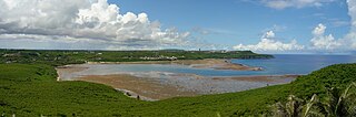
Pago Bay is the largest bay on the U.S. territory of Guam, located at the mouth of Pago River on the island's eastern coast. There is extensive evidence of CHamoru settlement before Spanish colonization during the late seventeenth century. During the Spanish-Chamorro Wars, the Spanish transferred the populations of Tinian and Aguigan to the village of Pago. However, a smallpox epidemic in 1856 killed much of the village's population and the Spanish moved survivors to other villages, leaving the bay shoreline largely uninhabited. The bay is popular with fishermen and recreationalists, and was the site of new housing development in the 2000s.

