Related Research Articles

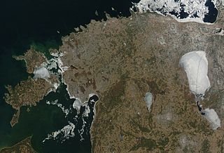
Between 57.3 and 59.5 latitude and 21.5 and 28.1 longitude, Estonia lies on the eastern coast of the Baltic Sea on the level northwestern part of the rising East European Platform. Estonia's continental mainland is bordered to the north by the Gulf of Finland across from Finland, to the east by Lake Peipus and Russia, and to the south by Latvia. Besides the part of the European continent, Estonian territory also includes the larger islands of Saaremaa and Hiiumaa, and over 2,200 other islands and islets in the Baltic Sea, off the western and northern shores of the country's mainland.

Saaremaa is the largest island in Estonia, measuring 2,673 km2 (1,032 sq mi). The main island of Saare County, it is located in the Baltic Sea, south of Hiiumaa island and west of Muhu island, and belongs to the West Estonian Archipelago. The capital of the island is Kuressaare, which in January 2018 had 13,276 inhabitants. The whole island had a recorded population in January 2020 of 31,435.

Hiiumaa is the second largest island in Estonia and is part of the West Estonian archipelago, in the Baltic Sea. It has an area of 989 km2 and is 22 km from the Estonian mainland. Its largest town is Kärdla. It is located within Hiiu County.

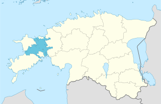
Hiiu County is one of 15 counties of Estonia, being the smallest county both in terms of area and population. It consists of Hiiumaa, the second largest island of Estonia, and several smaller islands near it. The county borders Lääne County to the east and Saare County to the south.

Kõpu Lighthouse is one of the best known symbols and tourist sights on the Estonian island of Hiiumaa. It is one of the oldest lighthouses in the world, having been in continuous use since its completion in 1531. The lighthouse is quite unique with its shape and an exception among lighthouses because it has gone through all the stages from a medieval landmark up to a modern electrified lighthouse.

West Estonian archipelago is a group of Estonian islands located in the Baltic Sea around Väinameri. The total area is about 4,000 km2 (1,500 sq mi). The archipelago is composed of the islands Saaremaa, Hiiumaa, Muhu, Vormsi and about 900 other smaller islands.

As of 2020, Estonia has a wind power installed capacity of about 320 MW. All operational wind farms in the country are on land. Offshore wind farms are planned on Lake Peipus and in the Baltic Sea near the island of Hiiumaa.
The Estonian Open Air Museum is a life-sized reconstruction of an 18th-19th century rural/fishing village, which includes church, tavern, schoolhouse, several mills, a fire station, twelve farmyards and net sheds. Furthermore, it includes a recently opened 20th century Soviet kolkhoz apartment building, and a prefabricated modern wooden house from 2019. The site spans 72 hectares of land and along with the farmyards, old public buildings are arranged singularly and in groups in a way that represents an overview of Estonian vernacular architecture of the past two centuries from across Estonia.

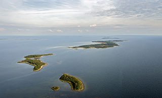
Kõverlaid is a small, moraine-based Baltic Sea island belonging to the country of Estonia. Its coordinates are 58°49′01″N23°04′46″E.

Käina is a small borough in Hiiu County on the island of Hiiumaa in Estonia, located near the north shore of Käina Bay. Prior to the administrative reform of Estonian municipalities in 2017, Käina was the administrative center of Käina Parish.
Hüti is a village in Hiiumaa Parish, Hiiu County, Estonia, on the island of Hiiumaa. As of 2011 Census, the settlement's population was 0.

The Väinameri or Väinameri Sea is a strait and sub-bay of the Baltic Sea, located between the West Estonian Archipelago and the Estonian mainland, within western Estonia.

Öakse is an island in the Baltic Sea belonging to the country of Estonia.

Rukkirahu is a small, uninhabited island in the Baltic Sea belonging to the country of Estonia.

Kõpu Nature Reserve is a nature reserve situated on Hiiumaa in western Estonia, in Hiiu County.
Võrkrahu is a small islet belonging to the country of Estonia off the west coast of the larger island of Saaremaa in the Kuusnõmme Gulf of the Baltic Sea. It is administered by Lääne-Saare Parish. Võrkrahu lies in an oblong North-South direction and is covered in pine and junipers. It covers an area of 6.07618 hectares and a circumference of 1.32628 kilometers and is part of Vilsandi National Park.
Hiiu Shoal or Nekmangrund is a shoal located in the Baltic Sea, off the northwestern shores of Hiiumaa Island. It is known as Neckmansgrund in Swedish, as Nekmangrund in Russian and as Neckmangrund in German, the loan translation in Estonian being Näkimadalad.
Enefit Green AS is a publicly traded renewable energy company located in Tallinn, Estonia. It went public on Nasdaq Tallinn in October 2021 with 23 % of shares, the rest being owned by the state-owned energy company Eesti Energia. CEO of the company is Aavo Kärmas.

Käina seamud deposit is a national mineral resource deposit in Estonia, Hiiu County, located in the western part of Käina Bay, Hiiumaa Island. In accordance to the Earth's Crust Act sea mud is a mineral resource in Estonia. Käina seamud deposit is one of 3 national seamud deposits in Estonia. The active reserve of the Käina seamud deposit in December, 2018 was 273,8 thousand tons and passive reserve 1 546,0 thousand tons.

Ruserahu is an uninhabited 31.1 hectares island belonging to Estonia. It is located in Õunaku Bay, 1.5 kilometers southwest of the Õunaku Peninsula, off the southeast coast of the larger island of Hiiumaa. The terrain on Ruserahu is very flat. The island's highest point is 2 meters above sea level. It stretches 0.4 kilometers in a north-south direction, and 0.45 kilometers in an east-west direction. Administratively, it belongs to the village of Esiküla on the island of Kassari, Hiiu Parish, Hiiu County. Ruserahu is part of the Käina Bay-Kassari Landscape Conservation Area.
References
- 1 2 OpenLibrary.org. "Haide-Ene Rebassoo". Open Library. Retrieved 2022-02-06.