There is a medieval settlement at the current site of the Burgruine Hals at the narrowest point of the Halser Ilzschleifen. The town was the seat of the Lord of Hals, which was his earldom in 1280. In 1376 the Holy Roman Emperor Charles IV granted the a charter to the town and also provided it with coining rights (Münzrecht) until 1497.
In the background of the later decline of the earldom, municipal rights began to be exercised more strongly. In 1517 the earldom passed to Bavaria and the town was the sea of a Pfleger (caregiver). In 1587 Duke William V reinstated the town's status as a market. Due to its cramped conditions the market town could not expand, on the other hand, the Bishops of Passau never succeeded in integrated the town into the prince bishop's territories.
19th Century
In 1803 the area was part of the royal district court of Passau. 1810 the town was devastated, as it was many times before, by a fire. Most of the remaining houses in the town, including the parish, were built shortly after the fire. In 1825, Hals received the status of a III Class town.
Since the Middle Ages timber rafting was an important economic factor for Hals. The powerful levees (Tiftsperre) were developed and the existing 115 m long tunnel was construction from 1827 to 1831. In Hals, the storage yards were expanded and the timer industry began to grow, with the corporation Salomon Forcheimer employing hundreds of seasoner workers. However, this site had to be abandoned in 1926 due to a missing rail link.
In 1890, the Passauer photographer Ducrue built a Bavaria-Bad cure and hydrotherapy spa in Siegelberg. Hals was then temporarily named "Bad Hals" Under the new owner, Dr. Mayerhaused the bathhouse was further expanded. It utilized every kind of Hydrotherapy as well as Electrotherapy. During World War I, its therapeutic centers were taken apart.
Twentieth century
In 1902, Hals renounced its town privileges and returned to its previous status as a market. On August 9, 1922, it came under the jurisdiction of the area of Ries.[1]
A Weir has stood in the Ilz at the Halser Reservoir to support a hydroelectric power plant. However, the plant is not located on the foot of the dam but rather lies about 2.5km downriver. A canal drives the water right through the town to the power station.
On April 30, 1945 the parish, town hall and additional houses were destroyed by artillery fire. Reconstruction then began in 1946. In 1954, new streets were around Christdobl to improve Hals's connections to Passau.
As a result of the Gemeindegebietsreform (territorial reform), which came into effect on July 1, 1972, the former market of Hals became a neighborhood of Passau,[2] although there would be a plebiscite, only 13 of the 113 electors supported incorporation into Passau, while the larger share supported a merger with Grubweg. The current neighborhood has a population of 1,695 residents (12/31/2005)
Pranger at the Halser Marketplace
Sights
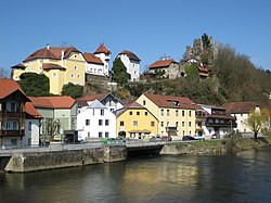
Above the village there is a hill which is home to the Burgruine Hals
↑ Wilhelm Volkert (Hrsg.) (1983), Handbuch der bayerischen Ämter, Gemeinden und Gerichte 1799–1980 (in German), München: C.H.Beck’sche Verlagsbuchhandlung, p.548, ISBN3-406-09669-7
↑ Wilhelm Volkert (Hrsg.) (1983), Handbuch der bayerischen Ämter, Gemeinden und Gerichte 1799–1980 (in German), München: C.H.Beck’sche Verlagsbuchhandlung, p.602, ISBN3-406-09669-7
This page is based on this Wikipedia article Text is available under the CC BY-SA 4.0 license; additional terms may apply. Images, videos and audio are available under their respective licenses.