Hambleton Peninsula

Last updated

Rutland UK location map.svg
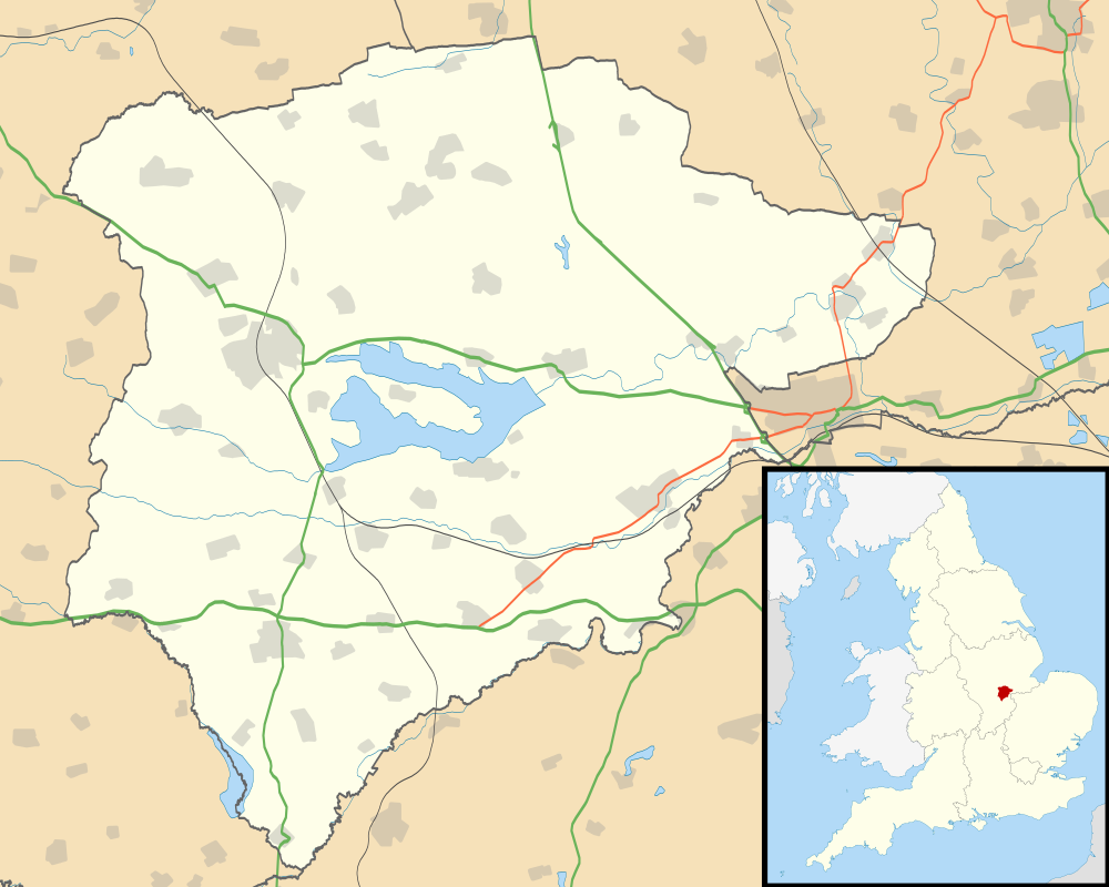
Map of Rutland Water and the peninsula
The deconsecrated St Matthew's Church, Normanton, Rutland viewed from Hambleton Peninsula. Cmglee Normanton Church from Hambleton Peninsula.jpg
The deconsecrated St Matthew's Church, Normanton, Rutland viewed from Hambleton Peninsula.

The Hambleton Peninsula lies within the reservoir Rutland Water, in Rutland, England. [1] When the Gwash Valley was dammed in 1975, the area surrounding what was then a ridge was submerged, including a small number of properties in the hamlets of Nether Hambleton and Middle Hambleton. [2] The village of Upper Hambleton survived, and now sits on the peninsula, which is some 3500 metres in length and 1000 metres in width.

The area of the peninsula lies in the parish of Hambleton with the exception of a small detached area of Exton parish on the north shore.

The Hambleton Peninsula and its surroundings feature heavily in British author Robert Goddard´s fictional mystery thriller Set in Stone (1999).

Rutland Water aerial.jpg
Aerial view of Rutland Water with Hambleton Peninsula in the middle

Related Research Articles

<span class="mw-page-title-main">River Tamar</span> River in southwest England

The Tamar is a river in south west England that forms most of the border between Devon and Cornwall. A large part of the valley of the Tamar is protected as the Tamar Valley National Landscape, and some is included in the Cornwall and West Devon Mining Landscape due to its historic mining activities.

<span class="mw-page-title-main">Rutland Water</span> Reservoir in Rutland, England

Rutland Water is a reservoir in Rutland, England, east of Rutland's county town, Oakham. It is filled by pumping from the River Nene and River Welland, and provides water to the East Midlands. By surface area it is the largest reservoir in England, but its capacity is exceeded by that of Kielder Water in Northumberland. Its maximum depth is 33m.

<span class="mw-page-title-main">Petermann Island</span> Island of Antarctica

Petermann Island is an island 1 nautical mile long, lying 1 nautical mile southwest of Hovgaard Island in the Wilhelm Archipelago, Antarctica.

<span class="mw-page-title-main">Booth Island</span> Island in Antarctica

Booth Island is a Y-shaped island, 5 nautical miles long and rising to 980 metres (3,220 ft) in the northeast part of the Wilhelm Archipelago, Antarctica.

<span class="mw-page-title-main">A151 road</span> Road in Lincolnshire, England

The A151 road is relatively minor part of the British road system. It lies entirely in the county of Lincolnshire, England. Its western end lies at coordinates 52°48.1892′N0°36.5179′W otherwise, grid reference SK938238.

<span class="mw-page-title-main">Hambleton, Rutland</span> Human settlement in England

Hambleton is a village and civil parish in Rutland, England. It is about two miles (3 km) east of Oakham.

<span class="mw-page-title-main">Vale of Catmose</span>

The Vale of Catmose is an area of relatively low-lying land, much of which is flooded by Rutland Water, in western Rutland, England. Oakham, the county town, lies within its bounds. It is drained by the River Gwash and the Langham Brook.

<span class="mw-page-title-main">Doora, County Clare</span> Village in County Clare, Ireland

Doora is a village and civil parish in County Clare, Ireland, just to the east of the town of Ennis.

<span class="mw-page-title-main">Oakham Rural District</span>

Oakham was a rural district in Rutland, England from 1894 to 1974, covering the north of the county.

Broughton and Old Dalby is a civil parish in the Melton district of Leicestershire, England. According to the 2001 census it had a population of 1,400, rising marginally to 1,405 at the 2011 census. It includes Nether Broughton and Old Dalby. However, Upper Broughton also has an LE14 postcode but lies entirely within Nottinghamshire and is not part of the civil parish of Broughton and Old Dalby. The parish was created on 1 April 1936 from the former area of Nether Broughton and Old Dalby civil parishes. 21 acres of the parish were transferred to Upper Broughton, Nottinghamshire, on 1 April 1965.

<span class="mw-page-title-main">Easby, Hambleton</span> Village and civil parish in North Yorkshire, England

Easby is a village and civil parish in Hambleton District of North Yorkshire, England. It lies approximately 2 miles (3.2 km) south-east of Great Ayton. The larger village of Low Easby lies 0.3 miles (480 m) down the road, but neither have any amenities, only a postbox.

<span class="mw-page-title-main">Mullion, Cornwall</span> Human settlement in England

Mullion is a civil parish and village on the Lizard Peninsula in south Cornwall, England, United Kingdom. The nearest town is Helston approximately 5 miles (8 km) to the north.

<span class="mw-page-title-main">St Anthony-in-Meneage</span>

St Anthony-in-Meneage is a coastal civil parish and village in Cornwall, England, United Kingdom. The parish is in the Meneage district of the Lizard peninsula. In the 2001 census the parish had a population of 171, decreasing to 168 at the 2011 census.

<span class="mw-page-title-main">Furzton</span> Area of Milton Keynes in Buckinghamshire, England

Furzton is a district in south-west Milton Keynes, Buckinghamshire, England and in the civil parish of Shenley Brook End The man-made Furzton Lake is a balancing lake that covers approximately half of the district. The district lies just north of Bletchley, and roughly 2 miles (3.2 km) south of Central Milton Keynes.

<span class="mw-page-title-main">River Dysynni</span> River in Gwynedd, Wales flowing from Tal-y-llyn Lake to Cardigan Bay north of Tywyn

The River Dysynni is a river in mid Wales. Its source is the Tal-y-llyn Lake just south of the Cadair Idris massif and its mouth is in the Cardigan Bay area of the Irish Sea to the north of Tywyn. It measures about 16 mi (26 km) in length.

<span class="mw-page-title-main">Careby Aunby and Holywell</span> Civil parish in South Kesteven, England

Careby Aunby and Holywell is a civil parish in the district of South Kesteven, south-west Lincolnshire, in England. It stretches from the county border with Rutland in the west to the River West Glen in the east. The B1176 road from Corby Glen passes through Careby and on past Aunby toward Stamford. The main London to Scotland railway line passes through the parish, the line upon which Mallard took the speed record for the LNER.

<span class="mw-page-title-main">Duirinish, Skye</span>

Duirinish is a peninsula and civil parish on the island of Skye in Scotland. It is situated in the north west between Loch Dunvegan and Loch Bracadale.

<span class="mw-page-title-main">Pencaer</span>

Pencaer is a community which covers an area of dispersed settlement in Pembrokeshire, Wales, on the peninsula of Pen Caer and comprises the village of Llanwnda and the smaller settlements of Granston, Llangloffan, St Nicholas (Tremarchog) and Trefasser. The population of the community taken at the 2011 census was 474.

<span class="mw-page-title-main">Paradise Harbour</span> Bay in Antarctica

Paradise Harbour is a wide embayment behind Lemaire Island and Bryde Island, indenting the west coast of Graham Land, Antarctica, between Duthiers Point and Leniz Point. The name was first applied by whalers operating in the vicinity and was in use by 1920.

<span class="mw-page-title-main">Hambleton, Ryedale</span> Hamlet in North Yorkshire, England

Hambleton is a hamlet on the A170 road between Thirsk and Pickering in North Yorkshire, England. It lies on the Hambleton Hills 1 mile east of Sutton Bank.

References

  1. Ordnance Survey: Landranger map sheet 141 Kettering & Corby (Market Harborough & Stamford) (Map). Ordnance Survey. 2014. ISBN   9780319229866.
  2. Ovens, Robert; Sleath, Sheila. "Rutland History: Rutland Waters". www.rutlandhistory.org. p. 325. Retrieved 18 March 2016.

52°39′N0°38′W / 52.65°N 0.64°W / 52.65; -0.64