
Belsize Park Gardens is a street in the Belsize Park area of Hampstead in London. Located in the London Borough of Camden, it is residential street featuring white stucco Victorian era buildings. It runs roughly southeastwards from Belsize Avenue in Belsize Village before terminating at a junction with Eton Avenue, England's Lane and Primrose Hill Road. The Grade II listed pub The Washington, dating from around 1865, is located at its eastern end.
Well Walk is a street in Hampstead, England in the London Borough of Camden. It runs southwestwards from Hampstead Heath to Flask Walk which then continues on towards the centre of Hampstead Village around the Hampstead tube station. It takes its name from the historic Hampstead Wells.

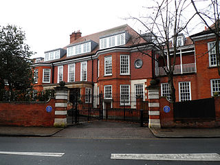
Eton Avenue is a street in the Belsize Park area of Hampstead in North London. Located in the London Borough of Camden, it runs eastward from Swiss Cottage tube station to a junction with England's Lane, Primrose Hill Road and Belsize Park Gardens by The Washington pub. Fellows Road and Adelaide Road run parallel to the south of Eton Avenue.

Belsize Lane is a street in the Belsize Park area of Hampstead in London. Located in the London Borough of Camden, it runs east to west from Haverstock Hill to Fitzjohns Avenue. While residential for much of the route, it also features a group of commercial properties that form the centre of Belsize Village. The Tavistock Clinic is located at its western end.

Well Road is a street in Hampstead, England in the London Borough of Camden. It runs westwards from Hampstead Heath to New End Square. Well Walk runs parallel to its south and the two are linked by Wells Passage. When the Hampstead Wells were in existence, a large pump room and assembly room were located on Well Walk, with the water supplied from the headspring on Well Road.

New End Square is a square in Hampstead, in the London Borough of Camden. It dates back to the early eighteenth century when it was located close to the Hampstead Wells spa on the adjacent Well Walk. Despite its name it is not rectangular. At its northern end is the Old White Bear pub dating back to 1704, on the corner with Well Road. Its southern end is at the junction between Flask Walk and Well Walk. New End street curls off from one corner of the square, eventually heading west to Heath Street.

Flask Walk is a street in Hampstead in the London Borough of Camden. It runs eastwards from Hampstead High Street to a junction with Well Walk and New End Square. It is primarily residential but the western end of the street is a pedestrianised alley featuring commercial properties. Hampstead tube station is located close to the junction with the High Street.

Pond Street is located in Hampstead in the London Borough of Camden. It runs eastwards from Rosslyn Hill to South End Green, located in the old "South End" of the settlement. The street takes its name from an ancient pond at South End Green, a source of the River Fleet, and has been known by this name since at least 1678. The pond survived into the Victorian era.
North End Way is a street in Hampstead in the London Borough of Camden, today a stretch of the A502 road. At the boundary with the London Borough of Barnet it becomes North End Road running northwards into Golders Green where it terminates at the junction with Finchley Road, by the tube station. North End Way passes through Hampstead Heath.
Hampstead Way is a street at the northern edge of Hampstead. It is located primarily in the London Borough of Barnet although its southern end forms a border with the London Borough of Camden in which the rest of Hampstead is located. In the south it is part of the old hamlet of North End, which marked the northern boundary of Hampstead, but then curves northwards and follows the edge of Hampstead Heath into Golders Green and Hampstead Garden Suburb. The southern end leads off North End Way.

Heath Street is in Hampstead in the London Borough of Camden, part of the A502 road for much of its route. It runs from the centre of Hampstead Village northwards towards Hampstead Heath. By Jack Straw's Castle it divides into North End Way heading towards North End and Spaniards Road heading towards Hampstead Garden Suburb and Highgate via Hampstead Lane. Streets running off it include Church Row, New End, Holly Hill, Hampstead Grove and Hampstead Square.

Hampstead Grove is a street in Hampstead in the London Borough of Camden. It heads northwards from Holly Hill running towards Hampstead Heath, but curving back towards Lower Terrace which connects it to the Heath. It runs roughly parallel to Heath Street to its east. It takes its name from the groves of trees that marked the landscape.

Hampstead High Street is located in the London Borough of Camden. It is the main high street for Hampstead Village and is part of the A502. Heading southeastwards from a junction with Heath Street and Holly Hill by Hampstead tube station it runs downhill and features a number of pubs, restaurants and shops before becoming Rosslyn Hill which connects it further on to Haverstock Hill, the whole stretch of which was one called Hampstead Road. Streets and alleys running off it include Flask Walk, Perrin Court and Prince Arthur Road.
Holly Hill is a street in Hampstead in the London Borough of Camden. It runs northwards from a junction with Hampstead High Street and Heath Street, Hampstead heading uphill to a grassy triangle named Holly Bush Hill where it meets Windmill Hill and Hampstead Grove by the entrance to Fenton House. It takes its name from a grove of holly bushes which stood on the hill until the 1940s. In the eighteenth century it was known as Cloth Hill, likely because local laundresses using Hampstead Wells hung their clothes out on the Holly Bushes to dry. Holly Mount turns eastwards off the street and forms a cul-de-sac, although there are steps linking it to Heath Street below. Holly Mount contains The Holly Bush pub, which was once linked to the nearby assembly rooms. Notable residents of Holly Hill have included the artists George Romney and Derek Hill, both commemorated with blue plaques. A number of properties are now Grade II listed. Romney's House at 5 Holly Bush Hill is Grade I listed. Running uphill to the west is Mount Vernon which also features notable historic properties and Holly Walk.

Hampstead Hill Gardens is a street in Hampstead in the London Borough of Camden. It runs eastwards off the Rosslyn Hill stretch of the A502 road before looping round to join Pond Street to the south. The land was considered as a potential location for Hampstead Town Hall before a nearby site on Haverstock Hill was selected. The Hampstead Heath Tunnel of the North London Line passes under the street.

Priory Road is a street in Kilburn. Located in the London Borough of Camden it runs northwards from Belsize Road through South Hampstead crossing several streets including Abbey Road before finishing at a junction with Broadhurst Gardens, not far from West Hampstead tube station. It takes its name from the old Kilburn Priory located in the area until the dissolution of the monasteries under Henry VIII.

Broadhurst Gardens is a street in the London Borough of Camden running eastwards from West End Lane in West Hampstead and ending near to the Finchley Road. It forms the northern border of South Hampstead, and runs parallel to the Midland Main Line. It meets or is crossed by Priory Road, Fairhazel Gardens and Canfield Gardens.

Branch Hill is a street in Hampstead. Located in the London Borough of Camden it is named after a hill on Hampstead Heath and runs adjacent to the heath between Frognal Rise and West Heath Road. Branch Hill, then largely open countryside, was a favourite landscape of the artist John Constable and he painted it on a number of occasions. Branch Hill Pond is located close to the junction with West Heath Road, while it dried up in the early twentieth century recent efforts have been made to restore it.

Belsize Road is a street in the London Borough of Camden. It runs west to east from Kilburn High Road to close to Finchley Road in the Swiss Cottage area of Hampstead. It is part of the B509 route which continues eastwards as Adelaide Road to Chalk Farm tube station. Despite its name it is located to the west of Belsize Park in the South Hampstead area. Much of its route runs parallel to the Midland Main Line and Kilburn High Road station is at its eastern end. It meets a number of streets including Loudoun Road, Abbey Road and Priory Road.

Highgate High Street is located in Highgate in London. A high street, it provides the main shopping thoroughfare for the settlement at the top of Highgate Hill. It runs downhill from the western end and forms of the longer B519 that includes Highgate Hill towards Archway. At its western end is a crossroads by The Gatehouse pub where it meets Hampstead Lane, Highgate West Hill and North Road. Pond Square, the village green of Highgate, is located nearby. Other roads running off the High Street include Southwood Lane and South Grove. The High Street forms the border between the London Borough of Camden to the south and Haringey to the north, reflecting the historic parish boundaries between Hornsey and St Pancras.


