Hanhowuz Reservoir

Last updated
Hanhowuz Reservoir
Hanhowuz reservoir 2014.jpg
Hanhowuz reservoir, 2014 Landsat 8
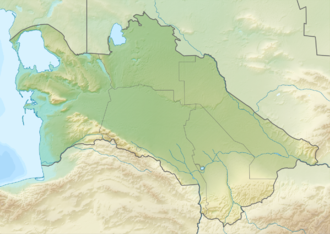
Relief Map of Turkmenistan.png
Red pog.svg
Hanhowuz Reservoir
Location Ahal Province
Coordinates 37°13′56″N61°14′37″E / 37.23222°N 61.24361°E / 37.23222; 61.24361 Coordinates: 37°13′56″N61°14′37″E / 37.23222°N 61.24361°E / 37.23222; 61.24361
Type Reservoir
Basin  countriesTurkmenistan

Hanhowuz, also known as Khauz-Khan, is a reservoir in Ahal Province of southeastern Turkmenistan. The M37 highway passes nearby and the village of Hanhowuz stands on the northwestern shore, with the city of Tejen not too far away in that direction.

Hanhowuz Reservoir is a component of the Kara Kum Canal system and it was created to attempt to control the erratic Tejen River. It plays an important role in agriculture in the region. [1] The reservoir is named after the legendary khan Oguz Han.

Hanhowuz (Khauzkhan) Reservoir was constructed in a natural depression to capture winter runoff and overflow from the canal for use later during the driest periods of summer. Phytoplankton thrive in the warm waters, as do many commercial fish—including Aral barbel, asp and catfish.

In the satellite image, Garagum Canal is the brown ribbon dropping down from the upper right corner and heading south and east from the reservoir. A portion of the canal is diverted, and can be seen the brown sediment-laden water entering the reservoir from the east and dropping its load of suspended sediments. The water that leaves is turquoise and travels west to irrigate the Tedjen Oasis. Roughly rectilinear farmlands appear on either side of that section of the canal. [2]
See also

Related Research Articles

Geography of Turkmenistan Overview of the geography of Turkmenistan

Turkmenistan is a landlocked country in Central Asia, bordering the Caspian Sea to the west, Iran and Afghanistan to the south, Uzbekistan to the north-east, and Kazakhstan to the north-west. It is the southernmost republic of the Commonwealth of Independent States (CIS), the loose federation created at the end of 1991 by most of the Post-Soviet states.

Transport in Turkmenistan includes roadways, railways, airways, seaways, and waterways, as well as oil-, gas-, and water pipelines. Road-, rail-, and waterway transport fall under the jurisdiction of the Ministry of Industry and Communications.

Hari (Afghanistan) River flowing from Afghanistan to Turkmenistan

The Hari River or Herat River is a river flowing 1,100 kilometres (680 mi) from the mountains of central Afghanistan to Turkmenistan, where it forms the Tejend oasis and disappears in the Karakum Desert.

Karakum Desert Desert in Central Asia

The Karakum Desert, also spelled Kara-Kum and Gara-Gum, is a desert in Central Asia. Its name in Turkic languages means "black sand": "kum" means sand; "kara" is a contraction of garaňky: "dark" or may pre-date that in this language family. This refers to the shale-rich sand generally beneath the sand of much of the desert. It occupies about 70 percent, 350,000 km2, of Turkmenistan.

Turkmenistan Country in Central Asia

Turkmenistan, also known as Turkmenia, is a landlocked country in Central Asia, bordered by Kazakhstan to the northwest, Uzbekistan to the north, east and northeast, Afghanistan to the southeast, Iran to the south and southwest and the Caspian Sea to the west. Ashgabat is the capital and largest city of the country. The population of the country is about 6 million, the lowest of the Central Asian republics. Turkmenistan is one of the most sparsely populated nations in Asia. Citizens of Turkmenistan are known as Turkmenistanis, Turkmenians or Turkmens.

Ahal Region Region of Turkmenistan

Ahal Region is one of five provinces of Turkmenistan. It is in the south-center of the country, bordering Iran and Afghanistan along the Kopet Dag Range. Its area is 97,160 km2 (37,510 sq mi) and population 939,700.

Mary Region Region of Turkmenistan

Mary Region is one of five provinces in Turkmenistan. It is located in the south-east of the country, bordering Afghanistan. Its capital is the city of Mary. Its area is 87,150 km2 (33,650 sq mi) and population 1,480,400. The average population density is about 15 persons per square kilometer, but it reaches 150–200 per square kilometer in the most developed oases.

Tejen Place in Ahal Province, Turkmenistan

Tejen is an oasis city with district status in the Karakum Desert, in Ahal Province of Turkmenistan. It lies along the M37 highway, between Dushak and Mary, 223 kilometres (139 mi) by road southeast of Ashgabat. It has a population of approximately 52,000. To the east is the larger oasis of Mary.

Sarakhs City in Razavi Khorasan, Iran

Sarakhs is a city in Sarakhs County, Razavi Khorasan Province, Iran. Sarakhs was once a stopping point along the Silk Road, and in its 11th century heyday had many libraries. Much of the original city site is now just across the border at Serakhs in Turkmenistan. According to the most recent national census, in 2006, the city's population was 33,571 in 8,066 families.

The Trans-Karakum Railway is a 540 km (336 mi) long railway in the central Asian republic of Turkmenistan. The railway was officially completed on 19 February 2006.

Betsiboka River

Betsiboka River is a 525-kilometre (326 mi) long river in central-north Madagascar. It flows northwestward and empties to Bombetoka Bay, forming a large delta. It originates to the east of Antananarivo. The river is surrounded in mangroves. The river is distinctive for its red-coloured water, which is caused by river sediments. The river carries an enormous amount of reddish-orange silt to the sea. Much of this silt is deposited at the mouth of the river or in the bay.

Sarahs Place in Ahal Province, Turkmenistan

Sarahs is an oasis city in Ahal Province, Turkmenistan, and the administrative center of Sarahs district. It is located at latitude 36°31' North; longitude 61°12' East and an elevation of 285m above sea level. It is one of the oases of the ancient Silk Road lying between Merv to the east and Mashhad to the west. In 1989 the city had a population of 9,585.

Tanbi Wetland Complex

Tanbi Wetland Complex is a wetland reserve in the Gambia outside of Banjul which was established in 2001.

Ahsikent is a site of ancient settlement and ancient capital of Farghona (Fergana). It is located on the right branch of the Sirdarya River in the Turakurgan district of the Namangan region of Uzbekistan. It is currently under consideration for designation as a UNESCO World Heritage Site.

Boldumsaz Place in Daşoguz Province, Turkmenistan

Boldumsaz, formerly Kalinin and Voro’silovabad, is a city and capital of Boldumsaz District in the Daşoguz Province of Turkmenistan.

M37 highway (Turkmenistan) Highway in Turkmenistan

The M37 highway is a highway in Turkmenistan. It is the Turkmenistan section of the European route E60 and Asian Highway AH5, which connects Brest, France to Irkeshtam, Kyrgyzstan on the border with the People's Republic of China. It connects most of the major cities in the country from Turkmenbashy on the Caspian Sea on the west coast to Bukhara, Uzbekistan.

Sherkala Mountain in Kazakhstan

Sherkala is a mountain in Mangystau Province, western Kazakhstan, close to the town of Shetpe. It has been described as looking like a piala, yurt or Sphinx with steep south and east sides and a more eroded northern side.

Tuyamuyun Hydro Complex Dam in Urgench, Xazorasp District, Xorazm Region/Dasoguz, Lebap Region

The Tuyamuyun Hydro Complex (THC) is a system of four interconnected reservoirs and a series of canals on the lower Amu Darya River, bordering Uzbekistan and Turkmenistan. Its primary purpose is to provide water for irrigation in Xorazm, Karakalpakstan and Daşoguz regions of Uzbekistan, Turkmenistan and as far north as Kazakhstan. The complex is located about 74 km (46 mi) southeast of Urgench in Xorazm Region, Uzbekistan and about 2 km (1.2 mi) north of Gazojak in Lebap Region, Turkmenistan. It was constructed between 1969 and 1983. Aside from irrigation, the complex also provides water for industrial and municipal uses. A 150 MW power station on the main dam contains six 25 MW hydroelectric turbine-generators.

References

  1. Brummell, Paul (2006). Bradt Travel Guide Turkmenistan. Bradt Travel Guides. p. 220. ISBN   1-84162-144-7.
  2. Hanhowuz Reservoir at NASA Earth Observatory