Magam is a tehsil in central Kashmir's Beerwah sub-district. It is also a town, notified area committee, and a block in Budgam district in the Indian administered union territory of Jammu and Kashmir. It is 11 km (6.8 mi) away from sub-district headquarter Beerwah and 20 km (12 mi) away from Srinagar, the summer capital of Jammu and Kashmir. Magam is top business hub in this locality, which comes before on the way to gulmarg. Magam comes both in baramulla district and budgam which makes this famous across these districts for business.

Beerwah also pronounced as Beeru is a subdistrict, tourist destination and one of the oldest town of Jammu and Kashmir and a municipal committee in Budgam district in the Indian administered union territory of Jammu and Kashmir. It is also one of the oldest tehsil of Jammu and Kashmir with one of the largest towns in Budgam district. Beerwah is 27 km (17 mi) away from the summer capital Srinagar via Bemina, 31 km (19 mi) via Magam, 33 km (21 mi) via Soibugh and 35 km (22 mi) via Budgam. Beerwah subdistrict has 4 tehsils namely Beerwah, Magam, Narbal and Khag. Beerwah is located along the banks of River Sukhnaag.

Budgam district is a district in the Indian union territory of Jammu and Kashmir. Created in 1979 with its headquarters at the town of Budgam, it is the district with the largest population of Shia Muslims in the Kashmir valley.

Rathsun or Rathsoon is a village and block located in the Jammu and Kashmir's Budgam district. It is situated at the base of the Pir Panjal Range of the Himalayas. It falls under the administrative division of tehsil Beerwah one of the nine tehsils of district Budgam. It is about 23.7 km via Beerwah-Budgam Road from district headquarters Budgam, 7 km (4.3 mi) from sub-district headquarters Beerwah, known as the Gateway of Doodhpathri and Gateway of Tosamaidan, and 29 km away from Srinagar, the summer capital of Jammu and Kashmir. Magam, known as the Business Hub of Budgam district and the Gateway of Gulmarg, is nearest town to Rathsun which is approximately 4 kilometres (2.5 mi) away.
Mazhom a village located in Budgam district of the union territory of Jammu and Kashmir. It has a railway station Mazhom railway station, which along with being in proximity (3 km) with Magam, the biggest financial hub of the district, has a crucial role in the economy communication in the area. Also there is railway flyover there on Gulmarag Road. The surrounding villages are Kawoosa Khalisa (east) and Kanihama (west). Mazhama is located on both sides of Gulmarg Highway. Schools in the Mazhama village are Hanfia English Medium School and Government High School. A well-facilitated dispensary is also present in this village, which is also home to two masjids. River Sukhnag, which is a tributary of the Jhelum, also flows along the boundary of the village.
Nussu is a village in the district Budgam, tehsil Beerwah in the Indian administered union territory of Jammu and Kashmir. It is located about 29 km (18 mi) west of the district headquarters, Budgam, and about 34 km (21 mi) west of union territory capital Srinagar.

Pethmakhama is a village in Budgam district, in the Indian administrative union territory of Jammu and Kashmir. It falls under the administrative division of tehsil Magam. It is famous for the shrine of Mir Sayyid Ali Hamadani who stayed at various places in and around Kashmir and one example is Pethmakhama where he prayed for around two months. The stone on which he prayed there, has the marks of praying on it miraculously and is preserved at Aasar-i-Shareef Pethmakhama. The shrine also hosts beard hair as one of the holy Relics of Muhammad which is displayed to the devotees every year on the auspicious occasion of Mehraj ul Alam and other festivals. Pethmakhama is irrigated throughout the year by River Sukhnag which is a tributary of Jhelum River and various springs in the village.
Wahabpora is a village in district Budgam in Indian administered union territory of Jammu and Kashmir, India. Situated on the banks of Aihaji River, Wahabpora is about 10 kilometres (6.2 mi) away from the district headquarters Budgam and 21 kilometres (13 mi) from Srinagar, the summer capital of Jammu and Kashmir. The village Wahabpora consists of about six mohallahs— Peer Mohallah, Taingapora, Watipora, Ganaiepora, New Colony and Chinar colony.
It is necessary to describe that Chinar colony was a part of Mosviabad and Al-Mehdi Chowk is the famous region of Chinar colony, the colony which is the central part of the village where five big chinars, about the age five hundred years old are present. The brother in law of Mughal King Jahangir and that time Governor of Kashmir Asif Khan had planted these five chinars. Chinar Garden of Wahabpora is also known as “Asif Ali Khan Bagh”. Gariend is the neighbouring village to Wahabpora. Famous plane crushing event occurred near this place is also known as Gariend-Wahabpora plane crashing event-2019.

Khag is a tehsil in and block in the Beerwah sub-district of the Budgam district in the Indian union territory of Jammu and Kashmir. It is 8.8 km (5.5 mi) away from sub-district headquarter Beerwah and 35 km (22 mi) away from Srinagar, the summer capital of Jammu and Kashmir.
Aripanthan is a village and panchayat halqa in Beerwah tehsil of Budgam district in the Indian union territory of Jammu and Kashmir. It is situated at the centre of tehsil Beerwah and tehsil Magam. It is located about 27 km (17 mi) west from summer capital of Jammu and Kashmir, Srinagar and about 28 km (17 mi) north from district headquarters in Budgam.

Doodhpathri is a tourist destination and a hill station in Jammu and Kashmir. India It is located in the Khan Sahib area of Budgam district in Jammu and Kashmir. Situated at an altitude of 2,730 metres (8,960 ft) from sea level, it is located at a distance of 42 km (26 mi) from Jammu and Kashmir's summer capital, Srinagar, and 30 km (19 mi) from district headquarters, Budgam.
Badran is a village located in district Budgam in the Indian administered union territory of Jammu and Kashmir.

Purni Suder Shah, also known as The Dwelling Place Of Sufi Saint Suder Shah, is a village in the Budgam district in the Indian union territory of Jammu and Kashmir. It lies in the Narbal tehsil of district Budgam, on the eastern side of Mazhom railway station. It is a small village and only a few generations have lived here. It is recognised for its vegetation and agriculture.
Gariend Kallan is a village in Budgam district situated in Jammu and Kashmir, India. It is only 8 km (5.0 mi) from Budgam and 13 km (8.1 mi) from Srinagar. It is bordered by Wahabpora, Garandkhurd, Chattabug, Soibug and Wadwan.
Transclusion error: {{En}} is only for use in File namespace. Use {{lang-en}} or {{in lang|en}} instead.
Narbal is a tehsil in central Kashmir's Beerwah sub-district. It is also a block in Budgam district in the Indian administered union territory of Jammu and Kashmir. It is 18 km (11 mi) away from sub-district headquarter Beerwah and 13 km (8.1 mi) away from Srinagar, the summer capital of Jammu and Kashmir.

Ichgam, also known as Ichigam, is a census town located in the Indian administered union territory of Jammu and Kashmir's Budgam district. It falls under the administrative division of tehsil Budgam, one of the nine tehsils of district Budgam. It is one of the most populated area of Budgam district. It is roughly 5 km (3.1 mi) away from district Budgam and nearly 19 km (12 mi) away from Srinagar, the summer capital of union territory of Jammu and Kashmir. Ichgam village consists of four blocks — Ichgam-A, Ichgam-B, Ichgam-C and Ichgam-D. The village consists of both major sects of Islam, Shias (85-90%) and Sunnis(10-15%). There is also a Hindu minority.

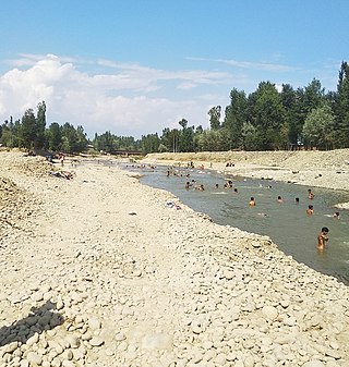
The Sukhnag River is one of the major tributaries of the River Jhelum located in Budgam District in the Kashmir Valley in the union territory of Jammu and Kashmir, India. It originates in the Tosa Maidan locale of Pir Panjal Range and has a length of 54 km (34 mi).

Kondur or Kandoora is the largest village in the Sukhnag River valley, located on the eastern banks of the Sukhnag River. It lies on the Beerwah-to-Doodhpathri road and is 26 kilometres (16 mi) from Srinagar, the largest city and summer capital of the union territory of Jammu and Kashmir, which is the southern portion of the wider Indian-administered Kashmir region.


