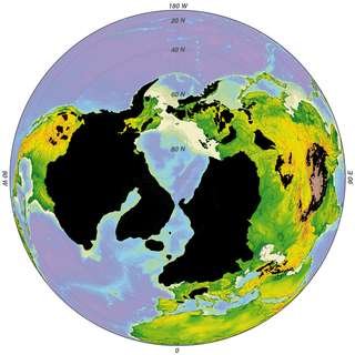
The Last Glacial Period (LGP), also known as the Last glacial cycle, occurred from the end of the Last Interglacial to the beginning of the Holocene, c. 115,000 – c. 11,700 years ago, and thus corresponds to most of the timespan of the Late Pleistocene.
The Holocene Climate Optimum (HCO) was a warm period in the first half of the Holocene epoch, that occurred in the interval roughly 9,500 to 5,500 years BP, with a thermal maximum around 8000 years BP. It has also been known by many other names, such as Altithermal, Climatic Optimum, Holocene Megathermal, Holocene Optimum, Holocene Thermal Maximum, Holocene global thermal maximum, Hypsithermal, and Mid-Holocene Warm Period.

The Greenland Ice Core Project (GRIP) was a research project organized through the European Science Foundation (ESF). The project ran from 1989 to 1995, with drilling seasons from 1990 to 1992. In 1988, the project was accepted as an ESF-associated program, and the fieldwork was started in Greenland in the summer of 1989.

Peary Land is a peninsula in northern Greenland, extending into the Arctic Ocean. It reaches from Victoria Fjord in the west to Independence Fjord in the south and southeast, and to the Arctic Ocean in the north, with Cape Morris Jesup, the northernmost point of Greenland's mainland, and Cape Bridgman in the northeast.

The Quaternary glaciation, also known as the Pleistocene glaciation, is an alternating series of glacial and interglacial periods during the Quaternary period that began 2.58 Ma and is ongoing. Although geologists describe this entire period up to the present as an "ice age", in popular culture this term usually refers to the most recent glacial period, or to the Pleistocene epoch in general. Since Earth still has polar ice sheets, geologists consider the Quaternary glaciation to be ongoing, though currently in an interglacial period.

Dye 3 is an ice core site and previously part of the DYE section of the Distant Early Warning (DEW) line, located at in Greenland. As a DEW line base, it was disbanded in years 1990/1991.

Frederick E. Hyde Fjord is a fjord in Peary Land, far northern Greenland.
J.P. Koch Fjord is a fjord in Peary Land, northern Greenland. To the west, the fjord opens into the Lincoln Sea of the Arctic Ocean.

Odin Fjord is a fjord in Peary Land, far northern Greenland.
De Long Fjord is a fjord system in Peary Land, northern Greenland. To the northwest, the fjord opens into the Lincoln Sea of the Arctic Ocean. It is part of the Northeast Greenland National Park.
Henson Glacier, is one of the major glaciers in northern Greenland.

Melville Glacier, is a glacier in northwestern Greenland. Administratively it belongs to the Avannaata municipality.

Hart Glacier is a glacier in northwestern Greenland. Administratively it belongs to the Avannaata municipality.

Sharp Glacier, is a glacier in northwestern Greenland. Administratively it belongs to the Avannaata municipality.

Hubbard Glacier, is a glacier in northwestern Greenland. Administratively it belongs to the Avannaata municipality.

Bliss Bay is a bay in the Wandel Sea, Northern Greenland. The area of the bay is uninhabited. Administratively Bliss Bay and its surroundings belong to the Northeast Greenland National Park.

Sif Glacier, is a glacier in northern Greenland. Administratively it belongs to the Northeast Greenland National Park.

Amundsen Land or Amundsenland, is a peninsula in central North Greenland. It is a part of the Northeast Greenland National Park.

The Nordpasset, meaning "North Pass" in Danish, is a glacial valley in Peary Land, Greenland. Administratively, it is part of the Northeast Greenland National Park.

O.B. Bøggild Fjord is a fjord in Peary Land, far northern Greenland.


