
Harrisburg is the capital city of the Commonwealth of Pennsylvania, United States, and the seat of Dauphin County. With a population of 50,135 as of 2021, Harrisburg is the ninth-largest city and 15th-largest municipality in Pennsylvania. Harrisburg is situated on the east bank of the Susquehanna River. It is the larger principal city of the Harrisburg–Carlisle metropolitan statistical area, also known as the Susquehanna Valley, which had a population of 591,712 as of 2020, making it the fourth-most populous metropolitan area in Pennsylvania after the Philadelphia, Pittsburgh, and Lehigh Valley metropolitan areas.

Columbia, formerly Wright's Ferry, is a borough (town) in Lancaster County, Pennsylvania, United States. As of the 2020 census, it had a population of 10,222. It is 28 miles (45 km) southeast of Harrisburg, on the east (left) bank of the Susquehanna River, across from Wrightsville and York County and just south of U.S. Route 30.
Middletown is a borough in Dauphin County, Pennsylvania, on the Susquehanna River, 10 miles (16 km) southeast of Harrisburg. As of the 2020 census, it had a population of 9,550. It is part of the Harrisburg–Carlisle Metropolitan Statistical Area.
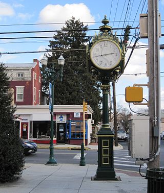
Paxtang is a borough in Dauphin County, Pennsylvania, United States. As of the 2020 census it had a population of 1,640. The borough is a suburb of Harrisburg and is one of the earliest colonial settlements in South Central Pennsylvania.

Lewisburg is a borough in Union County, Pennsylvania, United States, 30 miles (48 km) south by southeast of Williamsport and 60 miles (97 km) north of Harrisburg. In the past, it was the commercial center for a fertile grain and general farming region. The population was 5,158 as of the 2020 census. It is the county seat of Union County. Located in central Pennsylvania's Susquehanna River Valley, on the West Branch Susquehanna River, Lewisburg is northwest of Sunbury. It is home to Bucknell University and is near the Lewisburg Federal Penitentiary. Its 19th-century downtown is on the National Register of Historic Places. Lewisburg is the principal city of the Lewisburg, PA Micropolitan Statistical Area, and is also part of the larger Bloomsburg-Berwick-Sunbury, PA Combined Statistical Area.
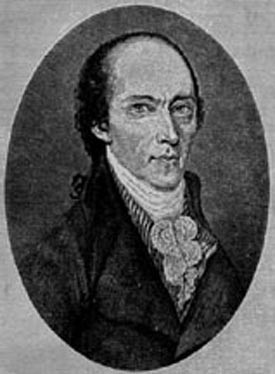
William Maclay was a politician from Pennsylvania during the eighteenth century. Maclay, along with Robert Morris, was a member of Pennsylvania's first two-member delegation to the United States Senate. He assisted John Harris, Sr. with the planning the layout of Harrisburg, Pennsylvania in 1785, where Maclay Street is named for him. Following his tenure in the Senate, he served in the Pennsylvania House of Representatives on two occasions, as a county judge, and as a presidential elector. He is known for his journal providing historical information on the 1st United States Congress.

The West Branch Susquehanna River is one of the two principal branches, along with the North Branch, of the Susquehanna River in the Northeastern United States. The North Branch, which rises in upstate New York, is generally regarded as the extension of the main branch, with the shorter West Branch being its principal tributary.

City Island is a mile-long island in the Susquehanna River between Harrisburg and Wormleysburg, Pennsylvania in the United States. It is used mainly for leisure and sports activities. Its previous names have included Turkey Island, Maclay's Island, Forster's Island and Hargast Island. The island can be reached from either side of the Susquehanna River by Market Street Bridge or, from the Harrisburg side and by pedestrians and cyclists only, by Walnut Street Bridge.

The Walnut Street Bridge also known as The People's Bridge, is a truss bridge that spanned the Susquehanna River in Harrisburg, Pennsylvania until 1996. Built by the Phoenix Bridge Company in 1890, it is the oldest remaining bridge connecting Harrisburg's downtown and Riverfront Park with City Island. Since flooding in 1996 collapsed sections of the western span, it no longer connects to the West Shore. The bridge was added to the National Register of Historic Places in 1971. A 2014 Cross-River Connections Study notes that the bridge currently serves as an "important bicycle and pedestrian link between City Island and downtown Harrisburg, connecting the city and the Capital Area Greenbelt to special events on City Island."

The West Branch Susquehanna Valley of central Pennsylvania, United States, in the Ridge-and-valley Appalachians, is the low-lying area draining into the West Branch Susquehanna River southeast of the Allegheny Front, northeast of the Bald Eagle Valley, southwest of the Wyoming Valley and north of the water gap formed between Shamokin Mountain and Montour Ridge.

The history of Harrisburg, the state capital of the Commonwealth of Pennsylvania, United States, has played a key role in the development of the nation's industrial history from its origins as a trading outpost to the present. Harrisburg has played a critical role in American history during the Westward Migration, the American Civil War, and the Industrial Revolution. For part of the 19th century, the building of the Pennsylvania Canal and later the Pennsylvania Railroad allowed Harrisburg to become one of the most industrialized cities in the Northeast.
The Susquehanna Boom was a system of cribs and chained logs in the West Branch Susquehanna River, designed to catch and hold floating timber until it could be processed at one of the nearly 60 sawmills along the river between Lycoming and Loyalsock Creeks in Lycoming County, Pennsylvania in the United States. The Susquehanna Boom was originally built under the supervision of James H. Perkins, and operated from 1851 to 1909, when it shut down for lack of timber.

The Dauphin County Veteran's Memorial Obelisk, sometimes called the Harrisburg Obelisk, is an Egyptian-style obelisk that was erected in Harrisburg, Pennsylvania as a tribute to Dauphin County’s Civil War soldiers. Designed by civil engineer E. Hudson Worrall, its planning, development and dedication phases were supervised by the Dauphin County Soldiers' Monument Association, which was formed by an act of the Pennsylvania General Assembly on January 30, 1867.

Riverfront Park is a public park in Harrisburg, Pennsylvania that spans beside the Susquehanna River.
This is a timeline of the major events in the history of Harrisburg, Pennsylvania and vicinity.

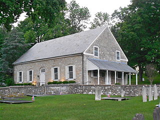
Camp Curtin Memorial Methodist Episcopal Church, also known as Curtin Heights Church and Camp Curtin Memorial-Mitchell United Methodist Church, is a historic Methodist Episcopal church located in Harrisburg, Dauphin County, Pennsylvania.

Pride of the Susquehanna is a diesel-powered paddle-wheel riverboat owned and operated by the Harrisburg Area Riverboat Society non-profit, moored at City Island, Harrisburg, Pennsylvania on the Susquehanna River during its annual operational period.
Riverside is a suburban neighborhood within the Uptown section of Harrisburg, Pennsylvania. It is bordered by Front Street and the Susquehanna River to the west, Vaughn Street to the north, 7th Street and Railroad tracks to the east, and Division Street to the south. Riverside is known for its diversity of housing stock in price, size, and style which typically contain yards, driveways, and proximity to both the Susquehanna River and Italian Lake.

Kipona is an annual festival held each Labor Day weekend in Harrisburg, Pennsylvania celebrating the Susquehanna River. Its name means "on sparkling water" to some Native Americans, of which "sparkling water" was thought to be what the river was traditionally called by the Susquehannock and Shawanese tribes.

